18 June 2012

ACTION MyBus Infogram

| imagineteamsol
Join the conversation
8

Hey all,

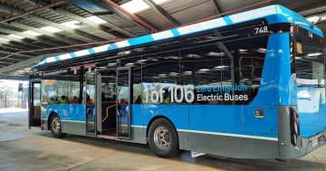
In the spirit of the recent ACT government budget proposal, and some of the costs surrounding the ACTION bus service, we thought it would be cool to share some anonymised statistics we’ve found from users of our MyBus app- it gives you a pretty accurate inside into the bus services in Canberra.

Check it out here. Feel free to share your thoughts or suggestions!

bus statistics

Join the conversation

8
All Comments
  • All Comments
  • Website Comments
LatestOldest

imagineteamsol said :

Skidbladnir said :

Pie charts should only be used against entire sets, and then for only part-whole comparisons.
Triangles should not be used for comparison presentation, as the diminishing width to the apex gives a false impression, flatter triangles give different impressions to thin wedges…
[/quote>

Speaking of terrible presentation, layout, and overall style, what is your DP supposed to be? I can’t help but feel you don’t really have too much of a leg to stand on, seeing that you seem to state your opinion as fact…

You just had an opportunity to learn something. Instead, you got all defensive.

Your graphic should be a bar graph.
OR, you should include an additional wedge in your pie representing “all other routes”.

I just downloaded your app – looks quite nice. Seems quite good. I think I will use it.

It would be good to see the MyWay stats. It should indicate where there are overloads and where people are choosing odd or roundabout ways to get somewhere because there is no direct service or services don’t connect properly. However, it should be noted that the stats are limited to what services are out there at present. Eg, weekend patronage is never going to improve while there are practically no services and it takes 2 hrs to connect to other buses.

while the intentions are good, this is clearly a case of misusing statistics – as was stated above, it’s not appropriate to put this kind of info in a pie chart, which is meant to represent percentages of a whole, not just a few top categories. You also just can’t infer from the number of bus related inquiries the popularity of particular routes or stops or total distance walked – huge leaps of logic. These bus stops or routes could just be difficult to find or near to where App-savvy people live or want to go.

Yes, some data is better than none but it should be represented properly or it risks being misunderstood by the public and/or further distorted by the media – the Canberra Times, illiterate when it comes to statistics (or anything local for that matter) being a prime example, often running disinformative or factually wrong stories based on some out-of-context numbers reported improperly in a press release.

I guess ACTION probably fears releasing myway data not because it has something to hide but because it fears people will misuse or misreport it before ACTION get a chance to analyse it thoroughly (and put official spin on it).

imagineteamsol9:43 pm 18 Jun 12

Our sentiment in showing this is a matter of an interesting curiosity, not to state it as fact (as is clearly stated in the infographic).

Skidbladnir said :

That is a terrible infographic in terms of content, presentation, layout, and overall style.

Pie charts should only be used against entire sets, and then for only part-whole comparisons.
Triangles should not be used for comparison presentation, as the diminishing width to the apex gives a false impression, flatter triangles give different impressions to thin wedges…

Also, are you actually tracking people with your app (distance actually walked, bus data query vs actual bus usage…)?

Speaking of terrible presentation, layout, and overall style, what is your DP supposed to be? I can’t help but feel you don’t really have too much of a leg to stand on, seeing that you seem to state your opinion as fact…

To answer the only rational thing your comment had, no we do not track our users. If you actually read the infogram, you’d be able to see that we calculate distances walked from the closest bus stop feature, and the popular buses/bus stops from people’s timetable queries.

damien haas said :

Before we all criticise the presentation, consider this: at least someone has provided some useful and accurate data on ACTION use.

Unlike the MyWay data, which has been collected for over a year and is guarded like some state secret.

There is no reason why the data collected by MyWay cannot be released to the public. Its not like there is a competitor that can use the data to run their own bus service more efficiently.

We’d love to see something like that from the government. Its great to hear all the numbers and costs surrounding ACTION, but unless you correlate it against hard statistics that MyWay could *potentially* provide (I say potentially because they probably dont even keep the raw data), its too much of a one sided story.

+1 that we should be getting a lot more data by now.

Good try but I’m surprised that somewhere like Ngunnawal Primary would be in the top 6 stops compared to other stops like the various hospitals, Dickson, Macquarie, Kippax, Manuka, Albert Hall.

I would like to know also how you assessed pedestrian distances. Without having used the app, I imagine many use various means to get to their bus stops (eg bicycle, drive and park or beg lifts from others).

Before we all criticise the presentation, consider this: at least someone has provided some useful and accurate data on ACTION use.

Unlike the MyWay data, which has been collected for over a year and is guarded like some state secret.

There is no reason why the data collected by MyWay cannot be released to the public. Its not like there is a competitor that can use the data to run their own bus service more efficiently.

That is a terrible infographic in terms of content, presentation, layout, and overall style.

Pie charts should only be used against entire sets, and then for only part-whole comparisons.
Triangles should not be used for comparison presentation, as the diminishing width to the apex gives a false impression, flatter triangles give different impressions to thin wedges…

Also, are you actually tracking people with your app (distance actually walked, bus data query vs actual bus usage…)?

A good example of why infographics have clearly jumped the shark.

Daily Digest

Want the best Canberra news delivered daily? Every day we package the most popular Riotact stories and send them straight to your inbox. Sign-up now for trusted local news that will never be behind a paywall.

By submitting your email address you are agreeing to Region Group's terms and conditions and privacy policy.