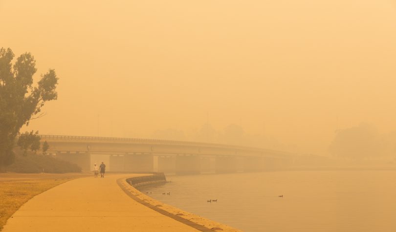
Canberra’s air quality in December and January was often the worst in the world. Photo: Region Media.
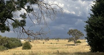
While some would say Canberra’s summer was one to forget, it will take its place in the record books.
It rewrote records with the highest-ever temperature of 44.0 degrees Celsius recorded at Canberra Airport (4 January) and the hottest night of 26.7 degrees (2 February).
Record high temperatures were also set in December and February.
There were the impacts of bushfires in the ACT and those in surrounding areas of New South Wales which caused severe smoke pollution for much of December and January.
And the weather wasn’t done yet.
Then there was one of the most severe hailstorms recorded in the ACT on 20 January, when hail of 4 to 6 cm in diameter fell across a region extending from the southern half of Belconnen through Acton to the inner southern suburbs. Extensive damage was reported to buildings and motor vehicles, with some motorists still waiting on repairs or new vehicles.
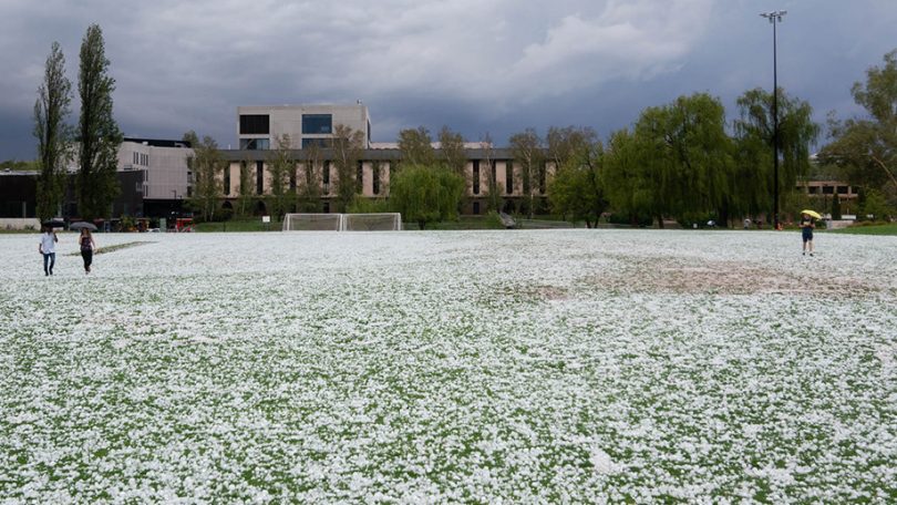
As the smoke cleared the hail came. Photo: ANU.
The Bureau of Meteorology says while the extremes may have passed, the average summer maximum and minimum temperatures at Canberra Airport were only the third-warmest on record. Summer 2018-19 holds the record in both cases.
Overnight minimum temperatures were above average in all three months.
Daytime maximum temperatures were at record high levels in December and above average in January, but near average in February.
Rainfall was generally below average, despite a wet February. Charnwood recorded the highest rainfall of any Canberra suburb, with 77.2 mm of rain falling on 10 February. The total rainfall for summer at the Canberra Airport was 97.2 mm, just 57 per cent of the long-term average of 171.7 mm.
Meteorologists say that while the rain has eased the dry, more is needed to break the drought.
Senior climatologist Dr Andrew Watkins said after an extremely dry start to summer, more of the same is forecast for autumn.
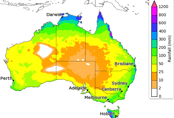
The rainfall outlook for March to May. Image: BOM.
“Autumn is likely to be warmer and possibly drier than average in the north of Australia, while some areas will be wetter in the south,” he said.
With the monsoon season arriving three weeks later than the previous latest since records began in 1957, four tropical cyclones have since helped to bring rainfall across northern Australia.
The island of Dum In Mirrie off Darwin had 562 mm of rain in a 24-hour period on 10 January, which was a new daily record for the Northern Territory.
In NSW, Dr Watkins said most of the rain fell east of the Great Dividing Range, which helped lift soil moisture levels and provide much-needed green pastures for farmers.
“Any further rainfall in these areas now has a better chance of contributing to increased water storages,” he said.
While Sydney’s water storage has risen to 81 per cent capacity, there has been only a modest two per cent increase in Canberra. The northern Murray-Darling catchment is still precarious at 12 per cent, having only risen by six per cent in the past month.
Dr Watkins said 90 per cent of NSW still has what is described as “serious rainfall deficiencies”.
“Our major climate drivers are currently neutral and look to stay that way during autumn. However, warm ocean temperatures around northern Australia, which typically help increase rain, are being offset by warm temperatures in the tropical Pacific that would normally draw moisture away from Australia.
“As a result, autumn rainfall could be below average for the tropical north, but above average for areas of western and south Australia,” he said.
Autumn temperatures are likely to remain warmer than average in most states.
The BOM’s senior hydrologist, Dr Paul Feikema, said now that the climate drivers have returned to neutral, our weather is more likely to be influenced by more local effects.
“While the dry signal has eased considerably, parts of the country may still see below-average rainfall during the next three months,” Dr Feikema said.
“Australia’s temperature and rainfall variability are also influenced by global warming caused by human activities. Australia’s climate has warmed by about 1.4 degrees Celsius since 1910, while southern Australia has seen a reduction of 10-20 per cent in April–October rainfall as a result.”
The new records may not last long.