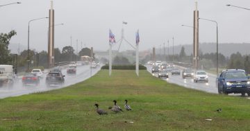
Canberrans make their way home as the smoke haze hovers over Kingston this week. Photo: Michelle Kroll, Region Media.
Canberra could record its highest ever temperature next week as a band of heat makes its way across the country.
The Bureau of Meteorology is already forecasting temperatures in Canberra to exceed 40 degrees by the middle of next week, as record temperatures are currently being recorded in parts of Western Australia.
Weatherzone is reporting that a high-pressure system currently passing over the Great Australian Bight is causing hot air to lie over northern and western Australia.
“This strong and near-stationary upper-level high will deflect cold fronts away from Australia until at least next weekend, allowing a ‘dome of heat’ to sit over the continent for days on end,” Weatherzone’s Ben Domensino said on Friday (13 December).
BOM forecaster Jiwon Park told Region Media there is a chance of seeing record temperatures in Canberra in the coming week.
“Significant heat is forecast to affect large parts of Australia from this weekend until at least the end of next week,” he said.
Mr Park said the forecast for Canberra begins at 34 degrees on Monday before steadily warming to 35 on Tuesday and jumping to 38 on Wednesday.
He said the hottest days will be Thursday (42 degrees) and Friday (41 degrees).
On Thursday, winds are expected to remain light from the northwest during the day, with a light easterly sea breeze coming in late afternoon. Relative humidity on Thursday (19 December) is expected to be only 8 per cent.
Temperatures are forecast to reach 45 degrees in every mainland state and territory except the ACT next week.
Since temperature records began in 1939, Canberra’s highest December maximum temperature of 39.2 degrees was recorded at Canberra Airport on 21 December 1994.
The highest temperature ever recorded in Canberra was 42.2 degrees on 1 February 1968.
The December average temperature is 27.5 degrees.
The BOM is not forecasting any rain next week.
The BOM says the smoke haze is set to continue until at least Tuesday next week.
There is also a strong chance that Canberra could see more total fire bans.
An Emergency Services Agency spokesperson said Canberra had five total fire bans during the last bushfire season. There have already been five so far this season, with three of those occurring before summer started.
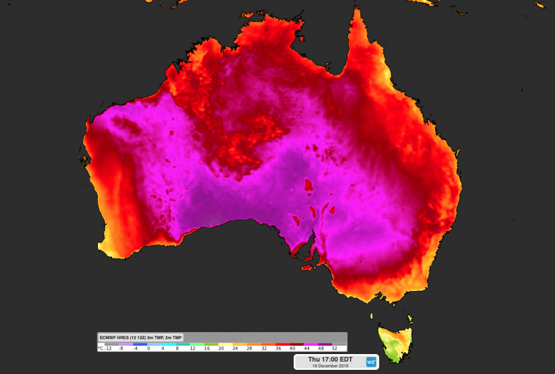
The forecast surface temperature on Thursday, 19 December. Image: Weatherzone.
Mr Park said heat records may also be broken as the high-pressure weather system moves across Australia and picks up intensity as it goes.
“This heat will move into South Australia and NSW next week. We expect from Monday and Tuesday, some parts of NSW will see the temperatures exceeding 40 degrees.
“Temperatures in the mid to high-40s are likely in the areas of southern and central Australia throughout next week.”
Mr Park said the heatwave is likely to break December records throughout these parts of Australia.
The highest recorded temperature in Australia was 50.7 degrees at Oodnadatta in South Australia on 2 January 1960.
The highest December temperature was 49.5 degrees at Birdsville in Queensland on 24 December 1972.
“For this heatwave, whether we see those records break is something that we will have to wait and see,” Mr Park said.
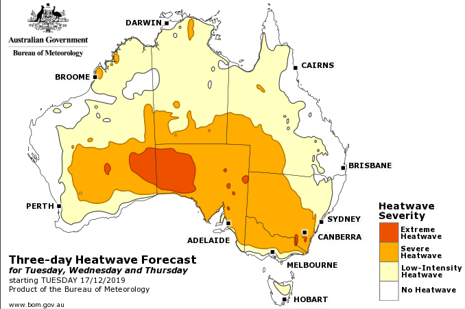
The BOM’s heatwave forecast for Tuesday, Wednesday and Thursday of next week. Image: BOM.