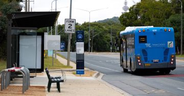
We’ve made a new feature available in a MyBus 2.0 Market update, and is what we hope is the beginning of the future of MyBus 2.0. Through a giant community effort on Open Street Map, members of the community have mapped out the bus stops around Canberra.
MyBus 2.0 can now show you a map with all bus stops nearest to you! Your current location is found via GPS, or wireless network, marked on the map by a red pin. You can drag this pin to any location on the map to see bus stops close to that location also.
Also to help you navigate on foot from your location to the nearest bus stop, a path is plotted on the map.
While we can certainly tell you the nearest bus stops to your location, to tell you which buses pass them, and at what times, we still need the GPS data from the government. We’ve recently been told again that the data will be available in a few weeks.
If you would like to give feedback on these new features, please don’t hesitate to contact us through our website here or send us a tweet and follow us on Twitter. Once again, thank you for your ongoing support.
Regards,
– Imagine Team