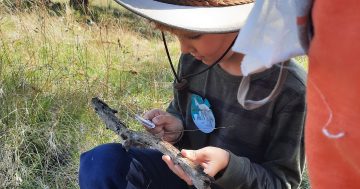
LandCare ACT CEO Karissa Preuss (left) with Umbagong Landcare Group members Dr Caroline Wenger and Bruno Ferronato taking one of his regular water samples. Photo: Michael Weaver.
Following one of the driest years on record, the 2020 report card for the region’s waterways has found signs of improvement due to above-average rainfall after the previous summer’s devastating bushfires.
The 2020 Catchment Health Indicator Program (CHIP) report, released last week, highlighted the health of the ACT region’s waterways across 229 surveyed sites across the upper Murrumbidgee catchment in Cooma, Yass and Canberra.
This involved more than 200 volunteers taking a record 1872 water quality surveys, 184 water bug surveys and 219 riverbank vegetation assessments.
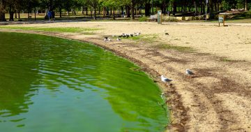
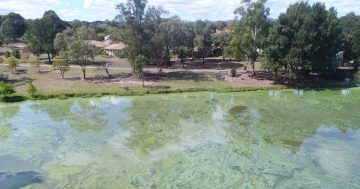
From almost 100 report cards, 40 waterways received an excellent or a good mark, 55 were marked as fair and three received a poor result. None were rated as degraded.
The three catchments in the area classed as poor or worse included Kippax Creek, Tuggeranong Creek upstream of Isabella Pond and parts of the Yass River.
Overall, 59 per cent of waterways fell into the fair/poor range which is about the same as in 2019 and a rise from 55 per cent in 2018.
Waterways in the upland reserves such as Gibraltar Creek and the Cotter River were found to have the best health.
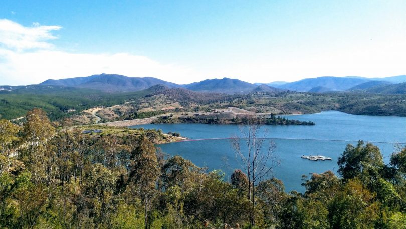
A very full Cotter Dam at capacity at the beginning of October last year. Photo: Michael Weaver.
Minister for Water Shane Rattenbury said the more-than 200 volunteer citizen-scientists played a major role in gauging the health of the waterways, water bugs and vegetation.
“The 2020 report, which is the sixth annual report of its kind, is based on 1872 water quality surveys, 184 water bug surveys and 219 riparian condition surveys conducted by more than 200 volunteers.
“I want to thank these dedicated volunteers for the thousands of hours of work that went into this important report despite bushfires, severe rain events and the COVID-19 public health emergency,” Mr Rattenbury said.
The report found that the upper Murrumbidgee catchment was impacted by bushfires in 2019/20 summer, as the timing of the rain following the fires had a devastating impact on the waterways with sand, soil and ash from the fresh fire grounds being washed into the systems.
The report also found that 2019 was the driest year on record so when the rains came in 2020, much of the organic matter built up in the landscape was washed into the waterways leading to high nutrient concentrations.
“While the range of scores did not change markedly from 2019, conditions influencing the scores most certainly did,” Minister Rattenbury said.
“Extended dry conditions could be attributed to many of the results in 2019, but in 2020, either a lack of rain, too much rain or, of course, bushfires, played a role.
“Thankfully, many waterways started to improve as the high flows continued throughout the rest of the year and hopefully we will see continued improvements in 2021.”
Ginninderra Catchment Group Waterwatch Coordinator Bruno Ferronato said volunteers saw massive changes during their surveys across more than 11,400 square kilometres from dry conditions and bushfires, which were followed by heavy rainfall and the COVID lockdown which prevented samples being taken.
“After volunteers were allowed to sample again following the COVID lockdown last year, every single volunteer returned to sample the waterways,” Mr Ferronato said.
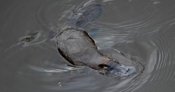
“Across the catchments an impressive 300 volunteers – young and old – also took part in the Platypus Month surveys, discovering 31 individual platypuses over eight ‘river reach’ sites across the ACT region.”
This number is much higher than the 11 individuals spotted in 2019 which may also be attributed to three additional sites being added to the survey in 2020.
More information, including the 2020 Catchment Health Indicator Program report, is on the ACT Waterwatch website.