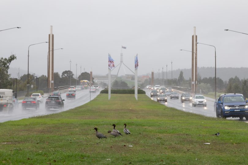
Ducks and motorists negotiate rain on Commonwealth Avenue this morning (23 March). Up to 90 millimetres of rain is predicted to fall on Tuesday. Photo: Michelle Kroll.
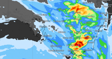
Updated – 3:00 pm: The Bureau of Meteorology says that rain is beginning to clear and the end of the prolonged wet weather may be in sight, but conditions remain dangerous.
Two motorists have been rescued from the roof of a car at Gudgenby during a wet and wild day. We've got the latest on road closures and the forecast.
Posted by The RiotACT on Monday, March 22, 2021
Two motorists have been rescued from the roof of a vehicle at Gudgenby this morning after their vehicle was swept off a bridge around 11am. Passers-by raised the alarm, prompting the rescue effort.
A helicopter was deployed to reach them and police have criticised what they call “an unnecessary attempt” to cross a bridge that was already well underwater.
“We are seeing the back edge of the rain coming into the area in a line from Wagga, to Goulburn and Yass”, a duty forecaster at the Bureau said. “It looks like there will still be significant rain to come throughout the south east, but the end is in sight”.
Falls of up to 30mm have been recorded around the ACT since 9am, although rainfall remains heavy further south. The BOM has recorded 88mm at Bodalla and 68mm at Mt Darragh near Bega.
“Tomorrow rain will begin to clear although there will still be some heavy falls on the far south coast, depending where the trough situates itself off the coast”, the duty forecaster said.
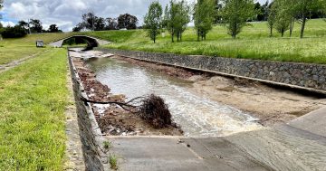
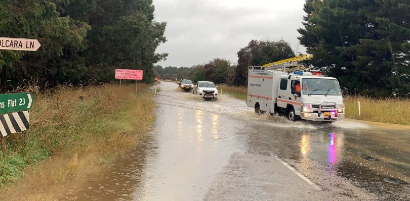
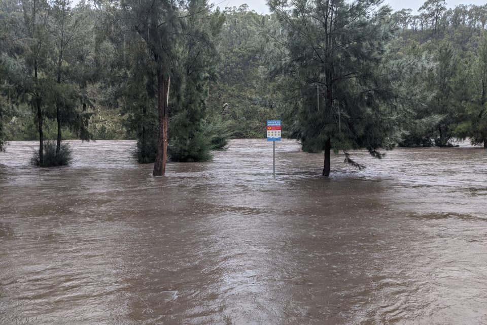
Updated – 12:30 pm: Today’s torrential rain has washed away a bridge in the Namadgi National Park, while school teachers at Captains Flat have been evacuated before the road into the town becomes completely flooded.
South of Tharwa, the Naas Bridge over the Gudgenby River was washed away by floodwaters early on Tuesday morning (23 March).
Roadworks had been underway to widen the bridge to two lanes (see photo gallery below for images).
Meanwhile, school teachers who live outside of Captains Flat have been evacuated from the town before the flooded road becomes unsafe and impassable.
Water across Captains Flat Road had been steadily rising during the morning before a call was made to evacuate teachers who don’t reside in the town.
Members of the SES Queanbeyan Unit evacuate teachers from Captains Flat this morning. Photo: Queanbeyan SES Facebook.
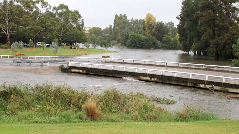
The heavy rain is also causing concerns for residents in Queanbeyan where a minor flood watch is still in place for the Queanbeyan and Molonglo River.
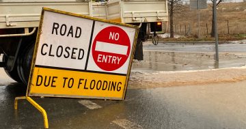
The low-level bridge on Morisset Street is now closed as water flows from Googong Dam into catchment areas and downstream towards Queanbeyan.
However, a spokesperson for the Queanbeyan SES Unit said they did not expect homes or business in the Queanbeyan area to be impacted by floodwaters.
“Rain is set to increase towards lunchtime before fading out by late afternoon,” the spokesperson said. “Water levels will still increase after the rain as large volumes of water continue downstream from Googong Dam. Please remember to avoid floodwater.”
The low-level crossing at Morisset Street in Queanbeyan is now closed. Photo: QPRC Facebook.
The Queanbeyan River at Queens Bridge is expected to exceed the minor flood level of 4.2 m at 1:00 pm on Tuesday. The river level may reach around 6.3 metres midnight Tuesday into Wednesday, with minor flooding.
The Molonglo River at Oaks Estate is also expected to exceed the minor flood level of 4.5 m at 1:00 pm. The river level may reach around 7.2 metres early Wednesday morning, with minor flooding.
Further rises are also possible.
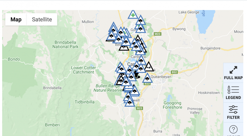
In the ACT, multiple parks and reserves in Namadgi National Park and Tidbinbilla Nature Reserve have been closed until at least Wednesday (24 March), including:
- All of Namadgi National Park south of Tharwa, including the Visitor Information Centre
- Tidbinbilla Nature Reserve, including the Visitor Information Centre
- Googong Dam and all areas of Googong Foreshores are closed to all recreation. No access is available at the southern end of Googong Foreshores.
- All swimming areas along the Murrumbidgee River Corridor
- Caves Crossing and Murrays Corner Crossing on Paddys River
- Molonglo River Reserve
- The Lower Cotter Catchment including the Cotter, Blue Range and Woods Reserve campgrounds
- Murrumbidgee River Corridor including Cotter, Pine Island, Kambah Pool, Casuarina Sands and Uriarra Crossing.
ACT Conservator of Flora and Fauna Ian Walker said further closures may occur today and during the coming days due to the weather conditions in our parks and reserves.
“We are advising all Canberrans to avoid these areas as we see heavy rain and extreme weather continue over the coming days,” Mr Walker said.
“Floodwaters can occur suddenly and without much warning, leaving you trapped or stranded if you are unprepared. Steer clear of low-lying areas such as creeks, stormwater drains or other causeways.
“With high winds forecast tomorrow, take additional care in the coming days around trees and other debris in parks and reserves. Strong winds are dangerous and will move fallen trees unpredictably and can even topple or uproot standing trees.”


Motorists are urged to remember that floodwater moves quickly and can be very dangerous. Pedestrians are also urged to be responsible and to avoid taking children near flooded rivers.
In the ACT, Coppins Crossing, Uriarra Crossing, Point Hut Crossing and Oaks Estate Crossing have all been closed to motorists due to the rising water levels.
The ACT SES is responding to multiple calls regarding storm damage including fallen trees.
The ESA is currently attending multiple incidents across Canberra. Image: ACT ESA.