While housesitting for a friend in Bungendore recently, I did a quick Google search to see what hikes I could find nearby.
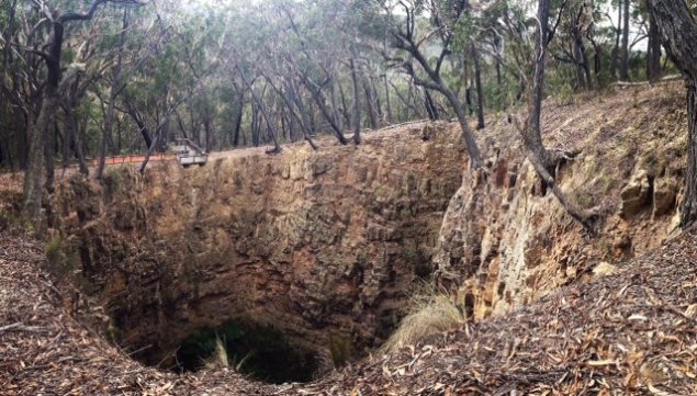
I was intrigued when I came across “The Big Hole” hike not far from Braidwood, which is the site of a large sinkhole within the Deua National Park. I’d never heard of it before and thought I’d take a look.
The trail to The Big Hole is part of a larger hike called the Marble Arch. It’s 1.8km to the sinkhole, and another 4km to the Marble Arch caves.
The sinkhole is 100 metres deep and 50 metres wide and has a lookout platform on one side overlooking the hole.
To get to the start of this walk, head into Braidwood and follow the signs to Cooma. Instead of turning left to go to Bateman’s Bay, continue straight ahead and you’ll see the signs to Cooma and then you want to head down onto Cooma Road.
From Braidwood, it’s about a 30 minute drive to the Berlang Camping Area – which is the starting point of this walk. You’ll see the signs pointing to The Big Hole and Marble Arch and it’s a short drive down a dirt road which is suitable for 2WD vehicles.
I went there on a long weekend and it seemed quite a popular sport to camp with the river nearby, some tables and toilet facilities.
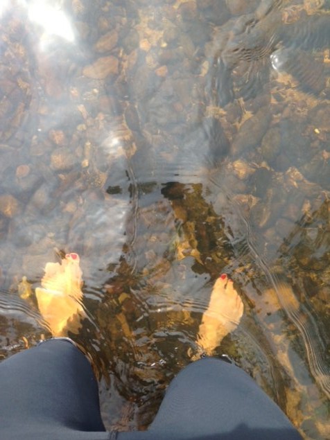
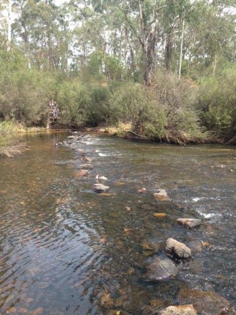
To reach The Big Hole, be warned that you’ll probably going to get your feet wet.
After about 100 metres, you need to cross the Shoalhaven River. There are stepping stones but I slipped off them after a couple of steps and decided the only way across was to take off my shoes and wade across the river.
Luckily it was warming up to be a 30 degree day so the river wasn’t too cold and by the time I got back it was a good temperature to even go for a dip.
Once on the other side, I put my shoes back on, and started the hike up. It’s a fairly easy track with a steep section closer to the sinkhole but there are steps built in.
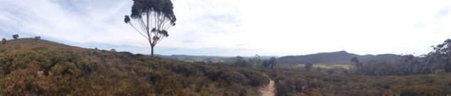
It’s a nice journey up with great views across the mountains once you get to the top of the first stretch. I read there were wildflowers in spring here but I must have been a few weeks too early.
If you’re brave, you can walk all around the sinkhole but the ground is quite sandy with lots of leaf litter so wouldn’t recommend it if it’s been raining as it could be very slippery.
After looking down into the sinkhole, I continued on through woodland areas for another four kilometres, past a fire trail and through a small gully where kangaroos were grazing.
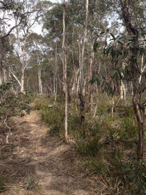
The trail is marked with wooden bollards along the way, but take care to stay on the trail as some parts are not that well defined.
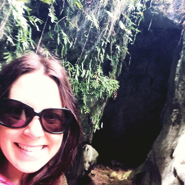
Then the hard bit begins, at least when you realise you what goes down has to come up. It’s about 350 steps down to reach the Marble Arch cave, but if you’re able to go up and down lots of stairs, it’s worth a look at the caves and canyons.
Once you get down the stairs, go to your right over some rocks and explore the caves.
Coming back up was the hardest bit of the hike, as well as an uphill section on the way back near the sinkhole. Other than those sections, I found the walk pretty easy going.
All up the round trip took about three hours to complete with a few photo stops on the way.
If the weather’s warm, the river is a great spot for a swim.