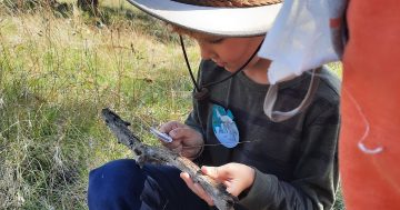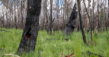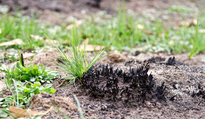
Grassland showing signs of life in the Namadgi National Park after the summer’s bushfires. Photos: Michael Weaver.
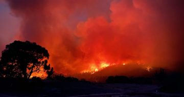
More than two-thirds of Namadgi National Park reopened to the public on Monday (27 July), almost six months after the Orroral Valley fire impacted 80 per cent of the park’s popular walking trails and camping areas.
However, the Namadgi Visitors’ Centre and the hardest-hit areas such as Booroomba Rocks and a significant area of the Orroral Valley remain closed. It could be up to three years before some of those areas are declared safe for visitors.
Teams from ACT Parks and Conservation have been busy addressing the significant impacts to wildlife and ecosystems, cultural and heritage sites, as well as erosion caused by flooding rainfall.
The work undertaken has included continual surveys of threatened species and management of feral animals and invasive weeds. Rangers have also established a feral deer monitoring program within the Cotter Catchment.
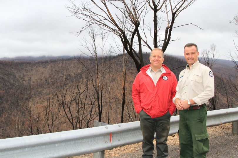
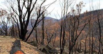
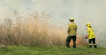
Justin Foley and Brett McNamara of ACT Parks and Conservation after the Orroral Valley fire burnt through the Namadgi National Park.
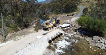
Teams have cleared burnt trees from public roads and walking tracks and have undertaken detailed post-fire condition assessments of walking tracks and management roads.
A large amount of work has also gone into protecting threatened ecological areas such as Alpine bogs and fens which are critical to soaking the rainfall in the mountains before it makes its way into the ACT’s catchment system.
READ MORE: First signs of life in Namadgi National Park
Minister for Environment and Heritage Mick Gentleman said he was pleased to welcome visitors back to the Corin and Naas/Boboyan Road precincts, along with many other popular areas of the park including Gibraltar Falls, Corin Dam, Settlers Walking Track and Square Rock.
“Campers will be happy to know that both the Woods Reserve and Mt Clear campgrounds have also been re-opened and are taking online bookings. Dedicated camper-trailer spaces are now available at Woods Reserve for the growing demand for this type of recreational camping.
“While many parts of Namadgi are now accessible, please be aware that they may still be fire-impacted. When setting out to explore the park, take proper precautions, plan your visit carefully and let someone know where you intend to go,” he said.

Namadgi National Park’s reopened and closed areas. Image: Supplied.
Mr Gentleman said it has been a long road to recovery and that there will be no single point in time that will determine when the environment, including rural lands, have recovered.
“The ACT Government has effectively responded to the most immediate threats to our natural and cultural landscape. Work is also underway to restore walking tracks and roads across Namadgi,” Mr Gentleman said.
“The Namadgi team has taken advantage of the closures, undertaking an ambitious spruce up of Woods Reserve campground, with infrastructure improvements, weed and erosion control, ecological restoration and fire mitigation works designed to lessen the impact of any future bushfire on this much-loved campground.”
Honeysuckle, Orroral Valley and Bimberi Wilderness Area remain closed as major works are required to restore public access roads, walking trails, low-level crossings and fire trails.
Old Boboyan Road also remains closed to allow for works at Yankee Hat to protect the rock art site. This also means that visitors will not be able to access the Gudgenby Valley and Ready Cut Cottage until further notice.
READ MORE: Tidbinbilla’s koalas finally return home, with one or two new arrivals
The Minister also released the Rapid Response Progress Update, a report detailing how the Namadgi and Tidbinbilla areas are recovering from the summer’s bushfires and flooding rainfall. The report also acknowledges the effect of the COVID-19 pandemic and that much of the area is still recovering from the impacts of the 2003 fires.
“Recovery efforts in the ACT have ebbed and flowed within the unique scenario and challenges of the COVID-19 global pandemic, which has impacted on our community, staff and day-to-day operations,” the report says.
“The 2020 fires were greatly influenced by a preceding long and dry period that led to unprecedented fuel levels and uncommon fire behaviour characteristics.
“Three years from now, we will have responded to the most immediate threats facing fire impacted areas and a better understanding of the ongoing impacts of climate change on natural recovery processes.”
People can access more information on bushfire recovery efforts and the plan to reopen Namadgi via at Environment ACT.