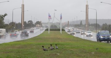
Winter has certainly arrived in Canberra with more polar blasts on the way. Photo: File.
Canberra has experienced its wettest May since records began in 1995, according to climate summary data from the Bureau of Meteorology.
The city’s airport recorded 91 mm for the month, which is almost three times the usual average (280 per cent, to be precise).
While Tuggeranong had 117.6 mm fall from the skies, Mount Ginini recorded 133 mm – a whopping four times the May average.
The highest daily totals were recorded in the middle of the month when an inland surface trough moved across the region, bringing 40 mm to 70 mm falls over 12 and 13 May.
But it wasn’t just rainfall records that toppled in the ACT.
Both the Canberra Airport and Tuggeranong sites recorded their coldest May maximum temperatures since 2000.
On 30 May, it only reached a top of 8 degrees at the airport, while Tuggeranong locals shivered with a maximum of 7.4 degrees.
But Mount Ginini took the prize for the coldest day, reaching a top of minus-1.8 degrees on 31 May. This was due to a strong low-pressure system that passed over southeast Australia, bringing very cold air and seeing snow levels in the Brindabellas drop below 1000 metres.
Overall for May, the capital’s nights were relatively warm with mean minimum temperatures about 2 degrees above average. However, the daily temperatures were around 0.5 degrees below average.
Canberra Airport recorded only three nights below zero, the fewest in May since 2009.
May also rounded out autumn, with the ACT’s overall season also wetter than usual.
While rainfall totals were average to below-average for the month of March, the totals were brought back up with well above average rainfall in April and May.
Those lack of zero-degree nights at Canberra Airport meant the site had its warmest autumn mean minimum temperature since 2016.
But that’s not the end of our cold, wet and windy weather.
According to Weatherzone meteorologist Ben Domensino, more polar air is on the way for the region next week.
“Another mass of frigid air has its sights on Australia and some areas could see even lower temperatures and more damaging winds [than the first week of winter],” he said.
“The strongest winds from this system will occur between Saturday night and Monday, with damaging gusts possible in parts of South Australia, Tasmania, Victoria, the ACT, NSW and southern Queensland.
“Winds should ease on Tuesday into Wednesday, although another frontal system could cause winds to re-strengthen Thursday.”
He said maximum temperatures for Canberra were expected to be about 1 to 4 degrees below average on most days next week.
“This impending cold weather will also bring widespread showers across southeastern Australia, along with snow in elevated areas of Tasmania, Victoria, NSW and the ACT,” Mr Domensino said.
“The mainland alps could see more than 50 cm of snow between [3 June] and the middle of next week, with higher ski resorts likely to see the most snow.”
It’s possible severe weather warnings will be issued in the coming days.