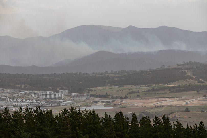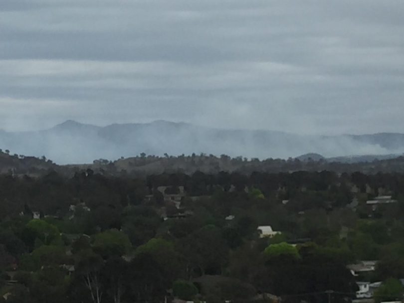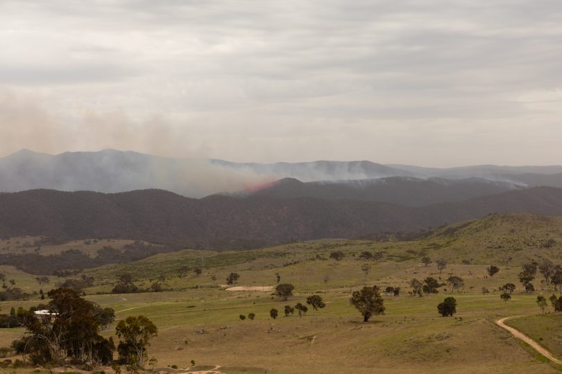
The fire is still growing and is now about 7km from the nearest suburb, Kambah. Photo: Jack Mohr.
Tuggeranong residents are breathing a sigh of relief after a relentless air campaign combined with more benign conditions kept the Pierce’s Creek bushfire at bay, providing hope that it can be contained over the next few days.
A storm that swept through Canberra’s south brought some respite with a few millimetres of rain and calmer conditions in its wake.
The fire is still out of control, 147 hectares and growing and only 7km from the nearest suburb, Kambah, but without the gusting north-westerly fanning it, fire crews are hopeful they have checked its progress and will now be able to contain it.
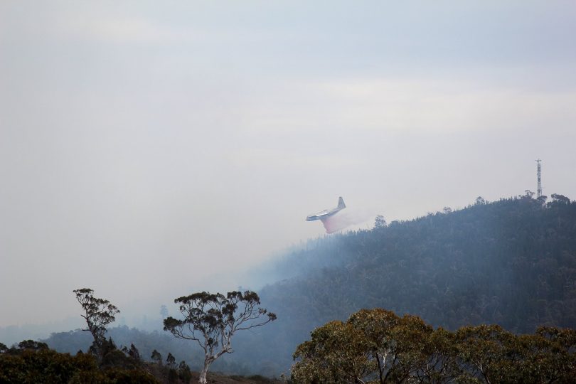
This evening they were still deploying waterbombing helicopters, while the NSW air tankers had proven especially effective at keeping the fire where it is.
The Emergency Services Agency said there were 10 crews on site and they would do backburning overnight. Graders and bulldozers had also been brought in to cut trails and strengthen containment lines. The alert level had been downgraded from Watch and Act to Advice, meaning that while there was still a fire, there was no immediate danger to the community.
Emergency Services Agency Commissioner Dominic Lane said crews would work hard over the next 12 hours to contain the fire.
Milder, less windy conditions mean there will not be a Total Fire Ban on Saturday, although the Fire Danger Rating will still be Very High.
Firefighters battled all day on Friday to prevent the bushfire, which started on Thursday from a burnt-out car, breaking out and racing to Tuggeranong’s suburban edge as conditions played havoc with their ability to contain the blaze.
The fire at Pierce’s Creek in the south-west of the ACT is burning in steep and inaccessible country with about half a dozen farms and the Tidbinbilla Deep Space Communications Complex in its path.

Photo: Richard Stephenson.

Photo: Richard Stephenson.

Photo: Richard Stephenson.
It was fanned by strong and unpredictable winds and fuelled by tinder dry conditions reminiscent of the catastrophic 2003 bushfires that devastated the western edge of Canberra.
LIVE from Region Media HQ with the latest update on the bushfire. http://ow.ly/HMUU30mt5Mg
Posted by The RiotACT on Thursday, November 1, 2018
We’re LIVE from Region HQ with Genevieve Jacobs for an update on the ACT bushfire emergency. Follow updates on The RiotACT website, Facebook and Twitter pages. For the latest information on the weather forecast, click on this link: http://ow.ly/Oj0A30mt2zD
Posted by The RiotACT on Thursday, November 1, 2018
Pierce's Creek bushfire Tidbinbilla water bomber
Tidbinbilla Deep Space Tracking Station is just 3km from the Pierce's Creek fire frontline. Staff are safe, but have a box seat for the action. Richard Stephenson shared this amazing video with RiotACT viewers. For more information: http://ow.ly/ccbn30mt13d
Posted by The RiotACT on Thursday, November 1, 2018
We are LIVE at Cotter Road with the latest update on the Pierce's Creek bushfire. Head to the RiotACT website or click on this link for more information: http://ow.ly/ccbn30mt13d
Posted by The RiotACT on Thursday, November 1, 2018
Mr Lane said earlier that firefighters had not been in a position to directly attack the fire and had focused on protecting property and preparing the community for any deterioration in the situation.
“We saw overnight even at 2 o’clock in the morning flames at treetop height, and whilst firefighters tried bravely to get in and contain the fire it was just too dangerous,’’ Mr Lane said.
He said resources had been positioned to protect farms and the Tidbinbilla complex.
“If it breaks out on to open farmland we have resources there to stop it but what I’m particularly concerned about is if we do get that spotting activity that could spot well in advance of the main fire front,’’ he said.
That would make it almost impossible for firefighters to stop the fire before it hit the urban edge.
Mr Lane said resources included Parks and Conservation, Rural Fire Service, ACT Fire and Rescue personnel, and more than 400 colleagues from NSW.
There were 21 fire appliances, supported by five helicopters waterbombing the fire and providing aerial observation, as well as the two large air tankers from NSW.
He said much depended on the weather. “Whilst we’ll see some slightly milder weather tomorrow, we’ll be back into very high and possibly severe fire weather by Sunday. This not over by any means and because it is so dry firefighters have a lot of work to do here,’’ Mr Lane said.

Police and Emergency Services Minister Mick Gentleman said the ESA had the full support of government and was throwing all available resources at the fire.
He urged Tuggeranong residents to be alert and bushfire ready.
Volunteers doorknocked between 400 and 700 homes from Kambah to Gordon this afternoon in an exercise to educate people about what the fire threat alert levels mean, their current bushfire plan and what materials are available to them via www.esa.act.gov.au.
The ESA said no evacuations had been ordered for residents, horses or other animals, and as yet there was no threat to property.
But people, particularly those in Bushfire Prone Areas, should activate their bushfire plans, monitor ESA updates on its website, and listen to ABC radio.

“It is important residents start thinking about their bushfire plan and be aware of the bushfire alert levels so they can take appropriate action as firefighters continue work to extinguish the fire,” the ESA said.
“Targeted areas include those homes already identified as part of the ACT Government’s annual CBR Be Ready bushfire awareness doorknock campaign announced by the Minister for Police and Emergency Services two weeks ago.”
A Total Fire Ban was declared for the whole of the ACT on Friday, and the Fire Danger Rating (FDR) was Very High.
One hundred and fifty primary school children from Miles Franklin School were evacuated from Birrigai Outdoor School by bus this morning.
The ACT Government closed Kambah Pool and Kambah Pool Road. Camp Cottermouth is also closed until further notice.
The following nature reserves and roads were closed for the duration of the Total Fire Ban:
Tidbinbilla Nature Reserve, selected roads within Namadgi National Park including Apollo Road, Orroral Road, Old Mill Road, Warks Road, Mount Franklin Road and the Corin Dam Road, Googong Foreshores, Kowen Forest, Lower Molonglo River Corridor, Molonglo Gorge Nature Reserve, Mulligans Flat Woodlands Sanctuary and the Centenary Trail between Goorooyarroo Nature Reserve and Hall.

Photo: Jack Mohr.
The Tidbinbilla and Namadgi Visitors Centres remained open.
All public inquiries regarding bushfires and emergency management should be referred to the ACT ESA on 6207 8444 or at www.esa.act.gov.au or to Access Canberra on 13 22 81 or at www.accesscanberra.act.gov.au.
If you have any images of the Pierce’s Creek bushfire that was taken from a safe location, please share them with us in the comments section below or on our Facebook or Twitter pages.


