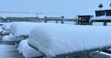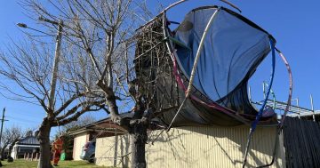
Gusty winds, snow and hail could all potentially impact southeastern NSW and Canberra as a cold front and polar air mass move across the region. Photo: File.
We’re just a week away from the official start of winter, but Mother Nature’s decided to give us another early taste with a polar air mass moving across southern NSW and the ACT.
Blustery winds, snow and hail could all be on the cards throughout Thursday evening (25 May) and into Friday as the frigid air mass moves east across southeastern Australia.
Predictions of how far down the snow could reach vary, with the Bureau of Meteorology (BoM) forecasting snowfall to 1300 metres, while Weatherzone meteorologists have it pinned to 1000 metres.
Regardless, temperatures will plummet, with the windchill making things feel that much more bone-chilling.
“Daytime temperatures are expected to be around 4 to 6 degrees below average for large areas of southeastern Australia by Friday (26 May),” Weatherzone senior meteorologist Ben Domensino said.
“This cold snap will be exacerbated by windchill, making it feel more like 10 degrees below average in some places.”
A severe weather warning for damaging winds has already been issued, with gusts increasing ahead of the cold front.
The BoM warned damaging winds averaging 60 to 70 km/h, with peak gusts of around 90 km/h, were expected for elevated parts of the Snowy Mountains, South Coast, Southern Tablelands and Illawarra districts, while damaging wind gusts in excess of 125 km/h were possible over alpine areas above 1900 metres.
Locations that may be impacted include Braidwood, Cooma, Charlotte Pass, Thredbo, Selwyn and Thredbo Top Station.
Perisher had already recorded a wind gust of 93 km/h and Thredbo’s seen sustained wind speeds of 91 km/h.
“Winds are forecast to ease below warning thresholds by early Friday morning,” the warning stated.
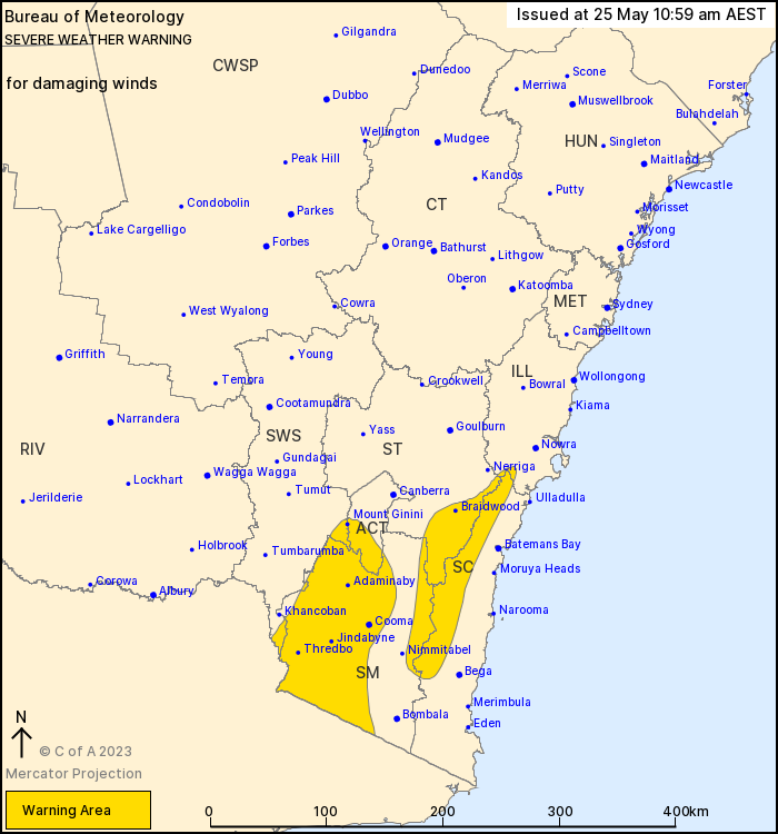
A severe weather warning for damaging winds has been issued on Thursday (25 May). Photo: BoM.
In the case of severe weather warnings, the State Emergency Service advises people should:
- Move vehicles under cover or away from trees
- Secure or put away loose items around your house, yard and balcony
- Keep at least 8 metres away from fallen power lines or objects that may be energised, such as fences
- Trees that have been damaged by fire are likely to be more unstable and more likely to fall
- Report fallen power lines to either Ausgrid (131 388), Endeavour Energy (131 003), Essential Energy (132 080) or Evoenergy (131 093) as shown on your power bill.
- Stay vigilant and monitor conditions. Note that the landscape may have changed following bushfires.
For emergency help in floods and storms, ring your local SES unit on 132 500.
Original Article published by Claire Fenwicke on About Regional.