8 September 2012

Mount Gingera Trail Pics (Aug 2012)

| mcleodwealth
Join the conversation
24

I went up the Mount Gingera trail a few weeks ago, thought I’d post up a few pics.. Was a bit dangerous though as I kept losing the track under the snow (and I was on my own), so I’m happy to mark it out a bit better during the spring. Any suggestions? A few posts? String ties? I’d like to leave something fairly durable for others during the winter.

Beautiful hike although I could not stay up top long due to the cold but the view was just stunning. Can’t wait to get up in spring, and for next winter to come around again. I’m not a big fan of stinking hot hikes!

For the geeks I’ve included a shot of my tablet barometer (Motorola Xoom) that recorded the air pressure drop as I walked up. I think I hit the snow around 885mb, if that means anything to anyone, or around 1550 metres.

http://img204.imageshack.us/slideshow/webplayer.php?id=20120812071509.jpg

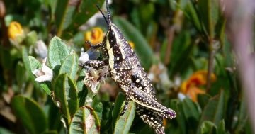
On another note, has anyone ever seen a corroboree frog in the wild?

What is the Brindabella’s like in the spring?

Join the conversation

24
All Comments
  • All Comments
  • Website Comments
LatestOldest
IIIIIIIIIIIIIIIIIIII12:17 pm 13 Sep 12

Jivrashia said :

IIIIIIIIIIIIIIIIIIII said :

it might be best to reconsider walking 10km (one way) and 1100vm into an alpine area alone while relying on the emergency services for rescue

U mad?

I don’t think you understand – re·con·sid·er/Verb: Consider (something) again, esp. for a possible change of decision regarding it.

eg. reassess a decision to walk to Mt Gingerra alone if you’re genuinely concerned about spraining your ankle in the absence of a clearly marked track.

IIIIIIIIIIIIIIIIIIII said :

it might be best to reconsider walking 10km (one way) and 1100vm into an alpine area alone while relying on the emergency services for rescue

U mad?

IIIIIIIIIIIIIIIIIIII10:16 am 13 Sep 12

“To each his own, but I had serious trouble. The snow hides bushes and sometimes it’s not obvious you’re standing on very uneven ground, with the potential to sprain your ankle.”

“it would be easy for someone to slip and sprain their ankle or something. I did lose the trail a few times but the GPS got me back”

If you’re concerned about slipping and spraining your ankle you can take precautions like training and strengthening your ankle muscles, wearing footwear with grip and (most importantly) placing your feet sensibly. If this is a genuine concern then forgive my bluntness but it might be best to reconsider walking 10km (one way) and 1100vm into an alpine area alone while relying on the emergency services for rescue if an accident occurs, or the weather changes or your andriod tablet crashes/gets wet/runs out of batteries. It’s a wilderness area in a national park at an elevation only 373m lower than Mt Kosciuszko – 1855m above sea level. Keep in mind that the track to Gingerra itself is uneven, rutted and rocky – maybe rather than modifying the environment to be suited to your skills and fitness you could consider gaining skills and experience – modifying yourself – to be comfortable in the wilderness.

mcleodwealth9:45 pm 12 Sep 12

OK it was just a suggestion for others as I relied heavily on a hand held GPS with the downloaded trail to reach the top, and it would be easy for someone to slip and sprain their ankle or something. I did lose the trail a few times but the GPS got me back (I use the ViewRanger app on an Android tablet with downloaded OSM maps). But of course I don’t want to ‘deface’ anything. That being said the trail is already ‘defaced’ to an extent with logs and other trail developments. I don’t see how it would hurt to bang in a few more wooden stakes. But of course I would never do anything without checking with the parks authority first.

In the meantime I have completed the Stockyard Spur to Gingera trail on Open Street Map so that’s a non-intrusive way to help out. I will continue adding to OSM as I come across more trails needing to be mapped, like Mount Gudgenby.

c_c said :

shauno said :

I have worked with numerous models over the years nothing wrong with a transparent case its just a strong as an opaque case. The GPS units since selective availability has been taken off will easily get these units down to 5m especially when activated your hardly going to be moving which will ensure it gets a good lock on your location. GPS units I work with at work in the offshore oil industry we have get us down to decimetre accuracy in the range of 10cm and below.

Im actually offshore Nigeria at the moment and I actually took my PLB with me as they are so small these days and Im flying in Helicopters all the time and working in very dodgy areas its handy to have in case something happens which could be anything over here.

I’m fully aware of all of this. The GPS on my phone can manage better than 1m accuracy. Creepily it manages better than 10m accuracy using WiFi only, non GPS positioning (thanks to a company that has mapped out Wifi all over the world including Canberra).

Point is the post I was responding to claimed 5m accuracy, I wanted to make clear that the actual manufacturer specs were, like most units, for greater than 100m accuracy, so there wasn’t an impression it was particularly better than other units.

As for the transparent casing, it’s well known that transparent polycarbonate (and other hard plastics) is less robust, more brittle and more prone to failure than opaque. From electronics to water filtration systems, this has and continues to be the case (no pun intended). There’s no practical reason from a design stand point to make the device transparent, it just gives a cool view of the PCP inside.

Well I like the one Ive got it does the job and more than robust enough for my purposes. The AFP uses these ones as well as they had a big order in for them when I got mine. Its water proof and floats with the neoprene cover. There is a floating one as well for the same price but I didn’t need it and its slightly bigger. My main concern was to have a very small one. If you actually checked these ones out you would be surprised they are very tough.

IIIIIIIIIIIIIIIIIIII said :

navigation from the fire trail to Mt Gingerra is not an issue in snow or otherwise.

To each his own, but I had serious trouble. The snow hides bushes and sometimes it’s not obvious you’re standing on very uneven ground, with the potential to sprain your ankle.

IIIIIIIIIIIIIIIIIIII said :

In National Parks and wilderness areas the rule of thumb is to ‘leave no trace’, this preserves the area for the next person who might not appreciate tape hanging from the trees.

That’s fine. But the trail up to the peak of Mt. Gingerra is quite obvious when there is no snowfall (well worn track with man-made steps), so I’m not sure if we’re intrusively adding, or taking away, anything at all.

Having said that:
Environmental Skills and Ethics (April 2005) – Leave No Trace Australia
(Australian Government – Department of the Environment and Heritage)

Do not build cairns or deface rocks or trees to mark your way. Flagging tape should also be avoided. If flagging tape is absolutely necessary, be sure to remove it before leaving the area.

There you go, that’s gospel.

IIIIIIIIIIIIIIIIIIII1:14 pm 11 Sep 12

Jivrashia said :

IIIIIIIIIIIIIIIIIIII said :

“so I’m happy to mark it out a bit better during the spring. Any suggestions? A few posts? String ties? “

Hey, before you mark the trail up Gingerra it might be an idea to check with Parks and Conservation Services on whether this is a good idea.

Actually the trail is already mapped. It shows up on the topography map for Corin Dam, published by Geoscience Australia, and is also maintained.
I think what mcleodwealth is trying to say is to allow the track to be found even in the snow.
I’d say ribbons tied to tree branches is the best way to go.
.

I’m aware that mcleodwealth means marking the track (in ‘RL’) with track markers so it can be found in the snow, s/he suggests using posts and string ties. My post suggests that this isn’t necessary, navigation from the fire trail to Mt Gingerra is not an issue in snow or otherwise.

I’ve also checked my maps and the Bimberi wilderness area extends into the Corin Dam catchment area and includes the track up to Mt Gingerra, this is another reason why there are no track markers – the track is in a wilderness area. Here’s some information from the Namadgi Management Plan, if you dig around you’ll find more:

“Dissected mountainous terrain, native vegetation cover, limited vehicle access and
lack of intrusive developments mean that Namadgi is able to provide a remote
or ‘wilderness’ experience and a sense of isolation from the features of modern
society. The Bimberi Wilderness in Namadgi connects to similar areas in NSW
in Kosciuszko National Park, Scabby Range Nature Reserve and Bimberi Nature
Reserve.”

In National Parks and wilderness areas the rule of thumb is to ‘leave no trace’, this preserves the area for the next person who might not appreciate tape hanging from the trees.

If you have any doubts, pick up the phone: Namdgi Visitor’s Centre 6207 2900.

IIIIIIIIIIIIIIIIIIII said :

“so I’m happy to mark it out a bit better during the spring. Any suggestions? A few posts? String ties? “

Hey, before you mark the trail up Gingerra it might be an idea to check with Parks and Conservation Services on whether this is a good idea.

Actually the trail is already mapped. It shows up on the topography map for Corin Dam, published by Geoscience Australia, and is also maintained.
I think what mcleodwealth is trying to say is to allow the track to be found even in the snow.
I’d say ribbons tied to tree branches is the best way to go.

IIIIIIIIIIIIIIIIIIII said :

Solo walking in the snow and in cold exposed areas is risky.

Yep, would definitely not risk it if the track was unfamiliar.
But as a rule of thumb:
1) Let your family/friends know that you are doing a trek and when you are expected to return.
2) Be sure to register yourself at the entrance to the track (at Corin Dam there is one near the car park).

Safe trekking people.

shauno said :

I have worked with numerous models over the years nothing wrong with a transparent case its just a strong as an opaque case. The GPS units since selective availability has been taken off will easily get these units down to 5m especially when activated your hardly going to be moving which will ensure it gets a good lock on your location. GPS units I work with at work in the offshore oil industry we have get us down to decimetre accuracy in the range of 10cm and below.

Im actually offshore Nigeria at the moment and I actually took my PLB with me as they are so small these days and Im flying in Helicopters all the time and working in very dodgy areas its handy to have in case something happens which could be anything over here.

I’m fully aware of all of this. The GPS on my phone can manage better than 1m accuracy. Creepily it manages better than 10m accuracy using WiFi only, non GPS positioning (thanks to a company that has mapped out Wifi all over the world including Canberra).

Point is the post I was responding to claimed 5m accuracy, I wanted to make clear that the actual manufacturer specs were, like most units, for greater than 100m accuracy, so there wasn’t an impression it was particularly better than other units.

As for the transparent casing, it’s well known that transparent polycarbonate (and other hard plastics) is less robust, more brittle and more prone to failure than opaque. From electronics to water filtration systems, this has and continues to be the case (no pun intended). There’s no practical reason from a design stand point to make the device transparent, it just gives a cool view of the PCP inside.

IIIIIIIIIIIIIIIIIIII10:28 am 11 Sep 12

“so I’m happy to mark it out a bit better during the spring. Any suggestions? A few posts? String ties? “

Hey, before you mark the trail up Gingerra it might be an idea to check with Parks and Conservation Services on whether this is a good idea. You can call the Namdgi Visitor’s Centre on 6207 2900.

The area is in a National Park, and the primary purpose of the park is the conservation of the natural environment. The NSW side of Gingerra (the border runs across the top) is in the Bimberi Wilderness area, where there are no signs marking trails (not even the Australian Alps Walking Track). Also keep in mind that many people for many years have been navigating to the top of Gingerra in fresh snow, sometimes at night without the assistance of trail markers. The nav is pretty easy especially if you have a map and pay attention to your surroundings – basically though if you’re going uphill, it’s the right way then coming back just follow your tracks or just go downhill to the fire trial.

There are a couple of good bushwalking clubs in Canberra – joining one is a good way to learn nav, gain experience and have company on your walks. Solo walking in the snow and in cold exposed areas is risky.

Speaking of accuracy we are actually positioning certain things on the ocean floor here at a depth of 1800m within 1m of where we want them. Using acoustic sound waves tied back to GPS above.

c_c said :

PLB or EPIRB, they all get registered with AMSA and require renewed registration every 2-3yrs.

Also when considering models, check how long the battery is rated for, both in transmit time and storage time.

When I was looking, I found a lot of cheaper ones were only rated for a short transmit time, and about 4yrs storage, while paying fractionally more delivered 7yrs storage and longer transmit time.

This is the one I chose, light but built very solid. IP67 Waterproof certified and it’s built to float, so you can take it into the wet and snow without concern.
http://www.gme.net.au/products/emergency-beacons/plbs/MT410G

Aussie made too, highly recommend.

shauno said :

http://www.mountaindesigns.com/online-store/products/ACR-Cobham-ResQLink-Device.aspx?prodID=20343

Its the smallest one you can get and very good 64 channel GPS so it locks on to your position within 5m or so.

I wouldn’t recommend this model. The transparent casing alone screams cheap. Contrary to the above post, it only locates to within 100m, like most PLBs including the GME.
Big thing is the warranty and battery storage life is only 5yrs, so you’ll have to replace it sooner = more $$$.

I have worked with numerous models over the years nothing wrong with a transparent case its just a strong as an opaque case. The GPS units since selective availability has been taken off will easily get these units down to 5m especially when activated your hardly going to be moving which will ensure it gets a good lock on your location. GPS units I work with at work in the offshore oil industry we have get us down to decimetre accuracy in the range of 10cm and below.

Im actually offshore Nigeria at the moment and I actually took my PLB with me as they are so small these days and Im flying in Helicopters all the time and working in very dodgy areas its handy to have in case something happens which could be anything over here.

PLB or EPIRB, they all get registered with AMSA and require renewed registration every 2-3yrs.

Also when considering models, check how long the battery is rated for, both in transmit time and storage time.

When I was looking, I found a lot of cheaper ones were only rated for a short transmit time, and about 4yrs storage, while paying fractionally more delivered 7yrs storage and longer transmit time.

This is the one I chose, light but built very solid. IP67 Waterproof certified and it’s built to float, so you can take it into the wet and snow without concern.
http://www.gme.net.au/products/emergency-beacons/plbs/MT410G

Aussie made too, highly recommend.

shauno said :

http://www.mountaindesigns.com/online-store/products/ACR-Cobham-ResQLink-Device.aspx?prodID=20343

Its the smallest one you can get and very good 64 channel GPS so it locks on to your position within 5m or so.

I wouldn’t recommend this model. The transparent casing alone screams cheap. Contrary to the above post, it only locates to within 100m, like most PLBs including the GME.
Big thing is the warranty and battery storage life is only 5yrs, so you’ll have to replace it sooner = more $$$.

mcleodwealth9:41 pm 10 Sep 12

Thanks for this… PLB it is then, not EPIRB…

Definitely going in the budget.. Can’t wait to get back out there. I’ll mark out the Gingera Trail while I’m up there too, now the snow is gone. I can see where people can get in to trouble, I had a PLB and several GPS devices (one being a downloaded OSM trail map on my Android tablet) and I relied on it completely to stay on the track and not fall down a wombat hole or something.

I’m happy to continue mapping out trails on OSM too. Mount Gudgenby is next as I notice it doesn’t have a trail mapped yet (which made it hard going on our first attempt).

Dont wish to be picky but its not an EPIRB they are a completely different things. EPIRBS are used for offshore applications and are quiet large and they are designed to float upright in the water. What you were using is a PLB personal locating beacon. If you want to buy one there is only one way to go head down to Mountain Designs and pick up one of these

http://www.mountaindesigns.com/online-store/products/ACR-Cobham-ResQLink-Device.aspx?prodID=20343

Its the smallest one you can get and very good 64 channel GPS so it locks on to your position within 5m or so.

mcleodwealth8:08 pm 09 Sep 12

Nothing beats being on your own too sometimes.. I did have an EPIRB though, I am looking to buy my own and I’m also going for my amateur radio licence as an added backup. Can’t wait to see this in spring. Thanks for the tips on fungicide too.. I never thought of that.

Great pics. I’ve been wanting to do that walk for a long time.

I have to say though that I reckon doing such a walk by yourself is a bit dodgy at this time of the year and given the current weather conditions. EPIRBs are good, but nothing beats having someone immediately by your side to render first aid etc in the event that you become incapacitated

Any suggestions? A few posts? String ties? I’d like to leave something fairly durable for others during the winter.

What about the venerable soup-tin-lid sprayed in a bright colour?

Funky Claude4:30 pm 08 Sep 12

mcleodwealth said :

Funky Claude said :

the main threat to the remaining population is the chytrid fungus which is spread by bushwalkers amongst others, it maybe wise to let the populations recover before trying to find one.

Thanks for letting me know. So as a general precaution then, for bush walking in general, would it be wise to spray boots with fungicide before going off hiking? Or just if you intend to go off the track, which we intend to do?

I believe the Chytrid fungus is already up there and is responsible for the population crash, however I am not entirely sure so I am happy to be corrected. There remains the possibility that there are areas not infected plus the chances of introducing other pathogens. I have always disinfected my boots before and after going bushwalking with a metho water mix 70:30, but I know a lot of people who don’t. I suppose it is all about what you are aware of and how much you care.

Great photos by the way.

🙂 Nice shots. It looks bleak.

mcleodwealth3:32 pm 08 Sep 12

Funky Claude said :

the main threat to the remaining population is the chytrid fungus which is spread by bushwalkers amongst others, it maybe wise to let the populations recover before trying to find one.

Thanks for letting me know. So as a general precaution then, for bush walking in general, would it be wise to spray boots with fungicide before going off hiking? Or just if you intend to go off the track, which we intend to do?

Funky Claude2:31 pm 08 Sep 12

The Northern Corroboree Frog occurs in a few restricted places in montane and sub-alpine bogs in the Northern Australian Alps which include places in the ACT. I highly doubt that the frog seen near Smokers Gap was a Corroboree Frog as they have very specific habitat requirements, a fire trail pool is not one of them and it is some distance (in frog travel) from there remaining populations. The status of the remaining population has not been upgraded and since the main threat to the remaining population is the chytrid fungus which is spread by bushwalkers amongst others, it maybe wise to let the populations recover before trying to find one. The Southern Corroboree Frog does not occur in the ACT

mcleodwealth1:51 pm 08 Sep 12

I drive to Corin Dam and hike up from there. It’s a 1200 metre climb though (counting all the ups and downs) so you need a whole day, starting off no later than 8am to be back by sun down. Of course I recommend an EPIRB too. I intend to go back over Spring and map out phone reception across both Vodafone and Telstra using a 850 / 2100 device and check the accuracy of the trail on Open Street Map (as I updated and completed the Stockyard Spur trail on OSM for all to enjoy).

May be a bit late for snow now though, tomorrow is probably the last day of any snow, but I’m sure sure it’s still stunning over Spring.

I know the Southern Corroboree Frog is almost extinct (sadly) however I hear the Northern frog (the one we have here) has been upgraded recently so more likely to find one.

Some more trails I intend to take on over spring are the overnight hike to Bimberi (to scope out for next winter) and conquer Gudgenby down south – that hill was laughing at me when we had to turn back last time because we lost the trail. So I’m going to map something out on OSM there too.

Glad you enjoy the pics. I look forward to posting up contrasting spring pics soon.

Anyone know what it’s like in spring? Any wildflowers or interesting wildlife? Nice camping?

Thanks for these pictures, really great. I’ve been meaning to get up to that trail for months but I might do so now after seeing them. Did you park on Mt Franklin Rd and would you consider it safe to leave your car there? (I had my windows smashed at Namadgi last time so bit hesitant).

I don’t think I’ll be seeing a Southern Corrroboree frog any time soon (think there are only about 50 left) but thought I saw a Northern Corroboree (a bit more common) in a fire trail pool near Smokers Gap, Namadgi in May.

Daily Digest

Want the best Canberra news delivered daily? Every day we package the most popular Riotact stories and send them straight to your inbox. Sign-up now for trusted local news that will never be behind a paywall.

By submitting your email address you are agreeing to Region Group's terms and conditions and privacy policy.