Are we really safe from bushfires in the ACT?
The screams! We always remember the screams.
Whether they came from a neighbour as flames entered their home or from a paddock across the road when earth burned beneath horses and their owners, memories of their ordeal remain.
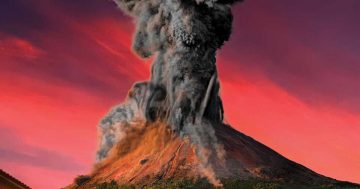
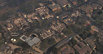
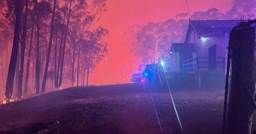
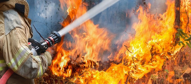
Fifteen years ago today, a firestorm of unheard of intensity roared over Canberra.
Four lives were lost: Dorothy (Dolly) McGrath, 76; Alison Tener, 38; Peter Brooke, 73; and Douglas Fraser, 60.
Almost 500 houses were destroyed. At the Canberra Equestrian Centre in Weston Creek, 28 horses perished.
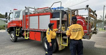
Since then life has been different for many Canberrans. Outwardly, they and the authorities are better prepared.
But—perhaps inevitably—the pendulum is swinging back. We are not as safe as we thought.
Emeritus Professor Ian Falconer told a bushfire symposium in Canberra last July that the peak of regrowth after major bushfires is 10 to 15 to 20 years after the fire.
At that same symposium, Professor Jason Sharples said embers have a dominant role in extreme fires and, in dynamic fire propagation, wind, terrain and fire have complex interactions. Other researchers have found that embers from a forest fire up to 1 km away are a greater hazard than the area of forest within 100 or 200 metres of a house.
Like climate change, the science of bushfire management is becoming more precise.
So too is the experience and knowledge of the community, but who’s listening?
In consultations with community groups recently, the ACT Government has downplayed concerns about bushfire risk and the management of bushfire prone areas.
You will find decision makers and even ministerial advisers today who were in primary school when the 2003 disaster occurred. If they were lucky enough to live on the northside, they might not have seen the carnage on the southside in areas of Weston Creek and Kambah.
“We’re the government,” reprimanded one official when a resident dared to challenge the selection of a Chapman site for public housing.
The controversy over public housing in Chapman illustrates why lessons from 2003 should not be forgotten.
The government has taken extraordinary measures in an attempt to sidestep opposition from residents that’s based on the danger the site poses for vulnerable tenants.
For example, it has changed a declared bushfire prone area that included the site to one that skirts around it. Its gerrymandered map has consequences for other parts of Canberra.
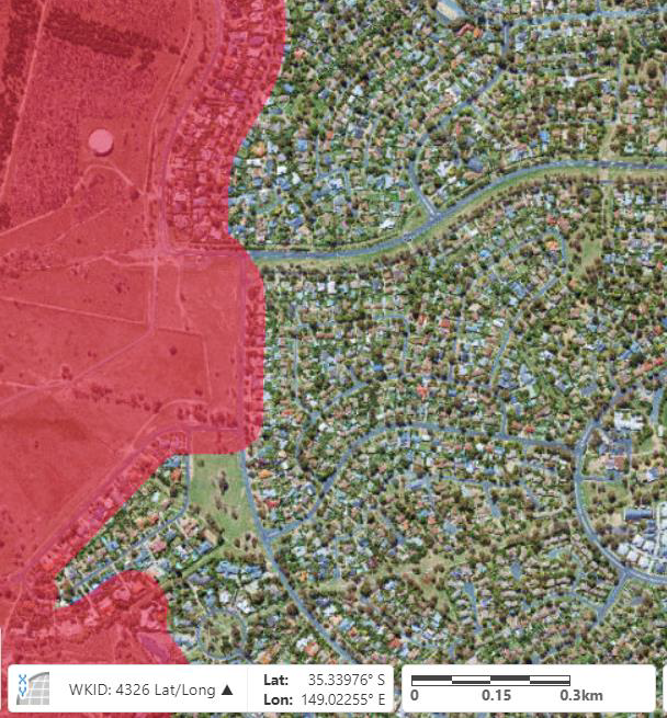
These maps show the bushfire-prone rural area (pink) leading into the bushfire-prone suburban edge. The top image is from February 2017. The second image is the revised BPA from June 2017. (Source: actmapi.act.gov.au)
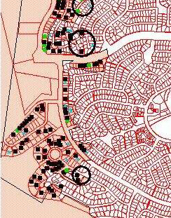
This map of the same area shows the locations of house loss from the major bushfires of 2003. Note that many of these burnt-house locations are no longer within the previous “bushfire-prone area”. The shaded area represents, approximately, the coverage of the fire.
And it has rejected a consultant’s report which warned against any development at that location. Instead, another consultant was found, new guidelines were issued, and a favourable risk rating was obtained.
The first consultant’s report, released only after an FOI request, concluded:
“The site is located on the western edge of the suburb of Chapman and was over-run by the 2003 Canberra bushfires, causing substantial damage to surrounding assets. This exposure to a Catastrophic fire event remains, irrespective of the provision of fire protection measures as the landuse is for frail aged persons who are not likely to be capable of either self-evacuation or attending to fires which occur on site.”
Notably, a development application for the project allows “ageing in place” and supportive housing.
The first consultant’s report considered international and domestic standards for the safety of people and buildings; the second consultant’s reference was based on the standard for constructing buildings in bushfire prone areas and didn’t include the risk management standard for people. What is more important?
Worse was to come.
During 2017, boundaries for the bushfire prone area (BPA) around Chapman and Duffy were amended to exclude hundreds of sites where houses were burnt to the ground in 2003.
Among them were those in Burrendong Street, Duffy where two people died in the 2003 fire. Tragedy left that street in ruins.
One person’s address remains in a BPA, as does next door, but the remainder of houses up Burrendong Street are now officially out of the danger zone, including the second deceased person’s home.
Experts put the firefront’s speed at 11km/h at around 2.30 pm that day and estimated it covered 12 km in two hours to hit Weston Creek just after 3.00 pm. North-westerly winds of more than 80 km/h carried a barrage of embers.
Residents who were still in their homes at the time were caught by surprise. As were the firefighters who had never seen a front move so quickly.
Under the revised BPA maps, this part of Duffy—and most parts of the urban edge of Canberra—has a BPA that follows straight lines. Of course, a bushfire knows it must not cross these lines.
Until three years ago they were marked as Ember Zones, meaning each area needed special bushfire precautions. Since then, the emphasis on embers has been downgraded by a broader interpretation of a BPA—weakening its protection.
The rerating of areas is part of a 2003 legacy: the Strategic Bushfire Management Plan. It’s reviewed every five years “to reflect changes in land use and tenure, as improved vegetation mapping becomes available and to address local and site-specific issues as required”.
In Chapman, the changes in 2017 were as significant as they were outrageous.
The number of houses within a BPA fell from 463 to 193.
And the timing was crucial for the government.
It came just after an announcement by the Minister for Housing Yvette Berry to use open parkland in Chapman, Holder and Wright for public housing. Tenants would be relocated, mostly from Northbourne Avenue, to make way for light rail and upmarket apartments. In each case, the new locations had to be repurposed from a Community Facility Zone to allow for supportive (and public) housing.
The new bushfire prone boundaries excluded Block 1 Section 45 Chapman which had been ravaged by fire, embers and windstorms in 2003.
Approximately 50 houses surrounding Section 45 were destroyed on 18 January 2003.
So how can the site now be ruled out of the bushfire prone area? By a gadget favoured by the ACT Emergency Services Agency called a light detection and ranging (LiDAR) tool, which measures bushfire attack levels at the urban and bushland interface.
It automates what was previously a physical assessment of land. It classifies vegetation and building footprints to measure distance and slope. But it does not take into account the impact of embers or strong west to north-westerly winds, both being the causes of attack around Section 45 Chapman.
Nevertheless, the new technology has been used to review and then change the boundaries of BPAs set in 2014 across the western edge of Canberra.
It can assess—from a desk—16,000 properties in one hour.
A senior risk manager at the ESA, Mr Nick Lhuede, told the ACT bushfire symposium the device had an “up to” 73 per cent accuracy rate and was a decision-support tool, not a decision-making tool. And as an automated device, it could not exercise the judgement that a human assessor could.
Even so, the Minister for Planning and Land Management, Mick Gentleman, is on board.
In answer to a question on notice in the Legislative Assembly from Mrs Giulia Jones, he said last September:
“Emerging science, such as LiDAR, also allows us to make more accurate determinations on the risk of bushfire on properties.”
And he added: “The reason for the reduction in the number of houses that fall within the BPA in Chapman and Duffy is that we are able to make more accurate determinations on risk of bushfire on properties…”
The aftermath of a bushfire 15 years ago is still with us.
A DA to build 20 dwellings on Section 45 for public housing is before the Environment, Planning and Sustainable Development Directorate awaiting its fate.
Lessons once learnt are being forgotten. Scientists tell us there have been more extreme temperatures in the ACT since 1977 than before and the likelihood of extreme temperatures will increase over the next 30 years.
The increasing risk of bushfires means longer fire seasons and more smoke—another negative for those living on the urban edge. Pity the vulnerable tenants who move from Northbourne Avenue.
Enjoy today’s forecast temperature of 34 degrees! It will be 39 on Saturday.
(In memory of the victims, the survivors, the fighters and their supporters during and after the Canberra Firestorm)
(Warwick Costin is a Chapman resident whose home was saved in 2003 while others surrounding it were destroyed.)