Whilst fiddling around tonight with Google maps I made an astonishing discovery, public transit data is available for Canberra.
This means using the directions function in Google Maps, you can select where you are, where you want to go, and when you want to get there, and Google will tell you the best way to do it by bus.
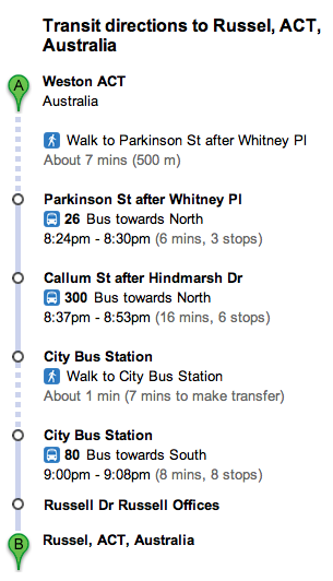
Strangely Canberra still isn’t listed on the Google Maps Transit site, nor is there any mention of it on the ACTION website. However inputting ACT addresses into the directions fields provides public transport directions anyway. Weston Creek to Russel for example.
Has anyone seen any announcements about this? Perhaps they are still testing it. Still, this is a massively useful feature.