The original took 60 hours to draw. Photo: Wildwood Maps, Facebook.
Alexander Broers has been a fan of JRR Tolkien’s various books for as long as he can remember. It’s not only the dramatic and intriguing storyline of The Hobbit and Lord of the Rings that caught his imagination, but also those first and last pages the rest of us might well skip over.
Christopher Tolkien sketched detailed maps by hand for each of his father’s books and the iconic ‘Middle-Earth’ style was fascinating to Alex.
“I wanted to capture that same magic and apply it to Australia,” he says.
Having applied it to the rest of the country on massive sheets of A1 sketch paper, he’s now completed the final piece of his Australian series and his favourite one yet – our own ACT.
He might have grown up in Bahrain, but Alex now lives in Australia and has visited Canberra a number of times.
“I love the ACT’s rugged wilderness and mountains,” he says.
“As someone who absolutely loves the outdoors, it’s a special place for me and I have visited several times to go on some epic hiking adventures and camping trips with friends.”
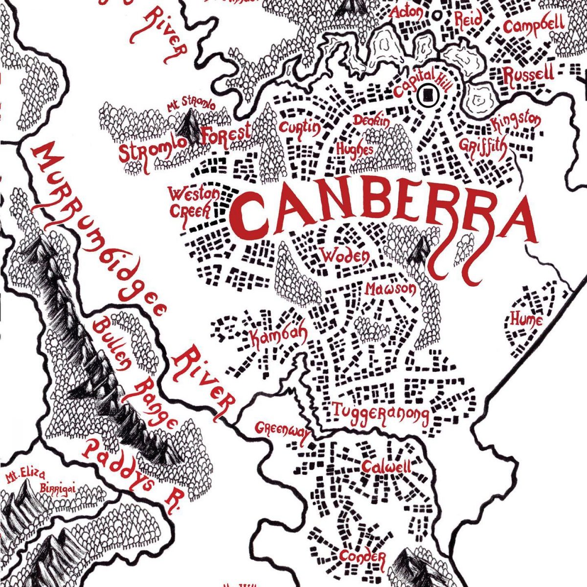
Spot your suburb. Photo: Wildwood Maps, Facebook.
He started his own design studio called ‘Cartography Chronicles’ in 2020 before changing the name to ‘Wildwood Maps’ at the beginning of this year. He began work on the ACT map in November 2021.
He likes to spend as much time as possible in a place while he’s drawing a map of it, so he started by exploring the ACT’s nature reserves, city layout and river systems in person.
Then over two months and 60 hours, he got stuck into the actual drawing.
“A cornerstone of what I do is that everything is completely drawn by hand using pencil, pen and inks,” he explains.
“In an age where most things are computerised and online, it’s extremely satisfying to make a detailed, hand-drawn map that is packed full of character. They don’t just tell you where some place is – they give you a hint of adventure.”
The first map he ever drew was of the Victorian high country, but not only has his style improved since then, the ACT’s smaller scale meant he could deep dive into the details.

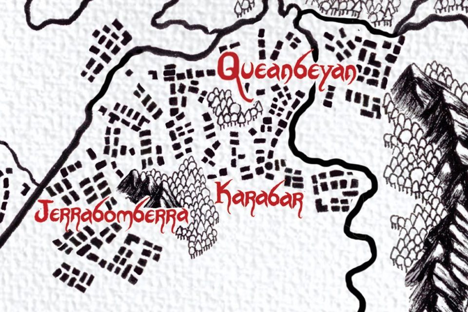
Each tree and mountain is drawn painstakingly by hand. Photo: Wildwood Maps, Facebook.
“For each map, I try to add a few elements that are unique to that particular map,” he says.
“For instance, the Tasmania map has over 100 red tree markers to show where the largest of Tassie’s giant trees can be found. For the ACT, I decided to focus on its rich hut heritage and made sure to include a handful of historic huts and homesteads.”
The eagle-eyed will note other landmarks such as Capital Hill, Stromlo Forest, Black Mountain, One Tree Hill, the Pinnacle, and many historic suburbs.
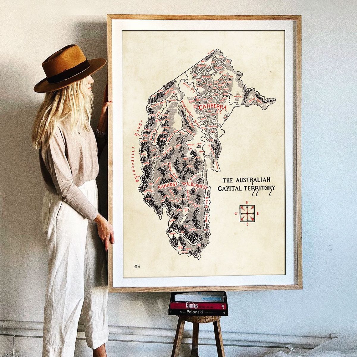
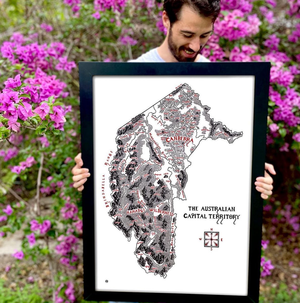
As big as it comes. Photo: Wildwood Maps, Facebook.
“Once that stage is done I can begin inking in the actual mountains, forests and rivers themselves,” he says.
“This can also take quite a bit of time – if you look closely, you’ll notice that the forested areas are made up of tiny individual trees.”
The more details, the more relatable – something Alex says comes out loud and clear in the reactions.


“There is always a wonderful amount of feedback, and I can really see that people are extremely proud of where they come from and the patch of Australia they call home,” he says.
“It shows that drawing maps in this particular style, where you can see the mountains and forests in an illustrative manner rather than a traditional cartographical one, really resonates.”
It doesn’t stop there either. Alex offers buyers of the A1-sized prints the chance to add their own details.
“People regularly ask me to mark a particular property, grandparents’ houses, hiking huts, sailing boats for special fishing spots, little cabins for people’s bush blocks, interlocking wedding bands for a wedding site, and many other personalisations.
“I am also able to add on towns or suburbs if they are not already included on a map.”
The ACT might mark the end of his Australian series, but Alex is already sketching his next map.

Alex and his map of Australia. Photo: Wildwood Maps, Facebook.
“At the moment, I am working on a map to showcase the First Nations people found across Australia, which is turning into a big project and has taken several months already,” he says.
“Once that is done, I will be doing more regional and special interest maps of places like Kangaroo Island, the Blue Mountains, the Snowies and other interesting corners of Australia.”
Prints of the ACT map are available on the Wildwood Maps website in three different sizes, A3 ($75), A2 ($95) and A1 ($140). Print numbers are limited.