20 February 2012

Climbing on Gibraltar Peak

| Pork Hunt
Join the conversation
13
gibraltar peak

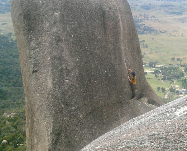
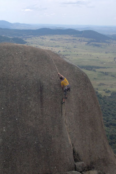
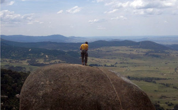
Hi Rioters, I went to Gibraltar Peak today with a buddy of mine and saw a couple of guys not satisfied with the view and had to climb just that little bit higher.

For those who don’t know, it is the big bunch of rocks overlooking Tidbinbilla Nature Reserve and Birrigai.

Access is from Corin Road by a dirt track and a 4WD is required to get you to the locked gate and then a 10 minute walk to some very impressive boulders the size of houses.

Of course, you can also walk from Corin Road to the top if you have no 4WD.

gibraltar rocks rocks

Join the conversation

13
All Comments
  • All Comments
  • Website Comments
LatestOldest

Pork Hunt said :

Do you mean the track that goes via The Fortress, or the one that’s further south?

Take the first track on right once you get onto Corin Rd and that will take you past a smaller bunch of big rocks.

The first road, past the bunch of rocks (the Fortress), used to be the much rougher of the two options back in the day. The only time I’ve been stopped from getting up there though is when huge gullies have formed across the track after heavy rains. This was made much worse after the ’03 fires.

chris820 said :

The last I heard was that the dirt track from Corin rd to the locked gate was an absolute dog’s breakfast. Not even 4WD-able.
Do you mean the track that goes via The Fortress, or the one that’s further south?

Take the first track on right once you get onto Corin Rd and that will take you past a smaller bunch of big rocks.
The roads in the area are deeply rutted but my Defender made easy work of them…

The last I heard was that the dirt track from Corin rd to the locked gate was an absolute dog’s breakfast. Not even 4WD-able.
Do you mean the track that goes via The Fortress, or the one that’s further south?

Another accessible rock formation is at the end of the dirty road after Honeysuckle Creek (former tracking station site). In Google Earth go to Latitude 35°36’12.09″S Longitude 148°57’11.36″E. Zoom in and you can see them all along the ridge line.

Ben_Dover said :

What grade does it go at, and is it trad gear?

The climber in the photo is on “Nail Biter” 10m 16. Trad, but with a bold belay on top.

There is a slab route up the left arête called “Consumer Item” 10m 19, which has a couple of bolts (which it would need to, since the only gear you could use on it would be duct tape…

What grade does it go at, and is it trad gear?

Gungahlin Al said :

What a sweet little crack climb. Love crack climbing. Comes from learning to climb on the Glasshouse Mountains I guess. Need to find myself a local climbing partner…

🙂
Cube or similar joint will be a good place to start looking. LOL

Gungahlin Al said :

What a sweet little crack climb. Love crack climbing. Comes from learning to climb on the Glasshouse Mountains I guess. Need to find myself a local climbing partner…

Gungahlin Al1:14 pm 20 Feb 12

What a sweet little crack climb. Love crack climbing. Comes from learning to climb on the Glasshouse Mountains I guess. Need to find myself a local climbing partner…

🙂 Great photos!

Nailbiter, the classic route there!

It’s actually a pretty easy climb too.
I used to go to this crag so often when I was younger.

The absail down the other side is nice too!

martyo said :

now that’s a rock! – could you post a google maps link for the location 🙂 cheers

Just put Gibraltar peak into Google maps. then switch on photos, you will find a photo close by. Zoom in on the map and see all the rocks.

now that’s a rock! – could you post a google maps link for the location 🙂 cheers

Daily Digest

Want the best Canberra news delivered daily? Every day we package the most popular Riotact stories and send them straight to your inbox. Sign-up now for trusted local news that will never be behind a paywall.

By submitting your email address you are agreeing to Region Group's terms and conditions and privacy policy.