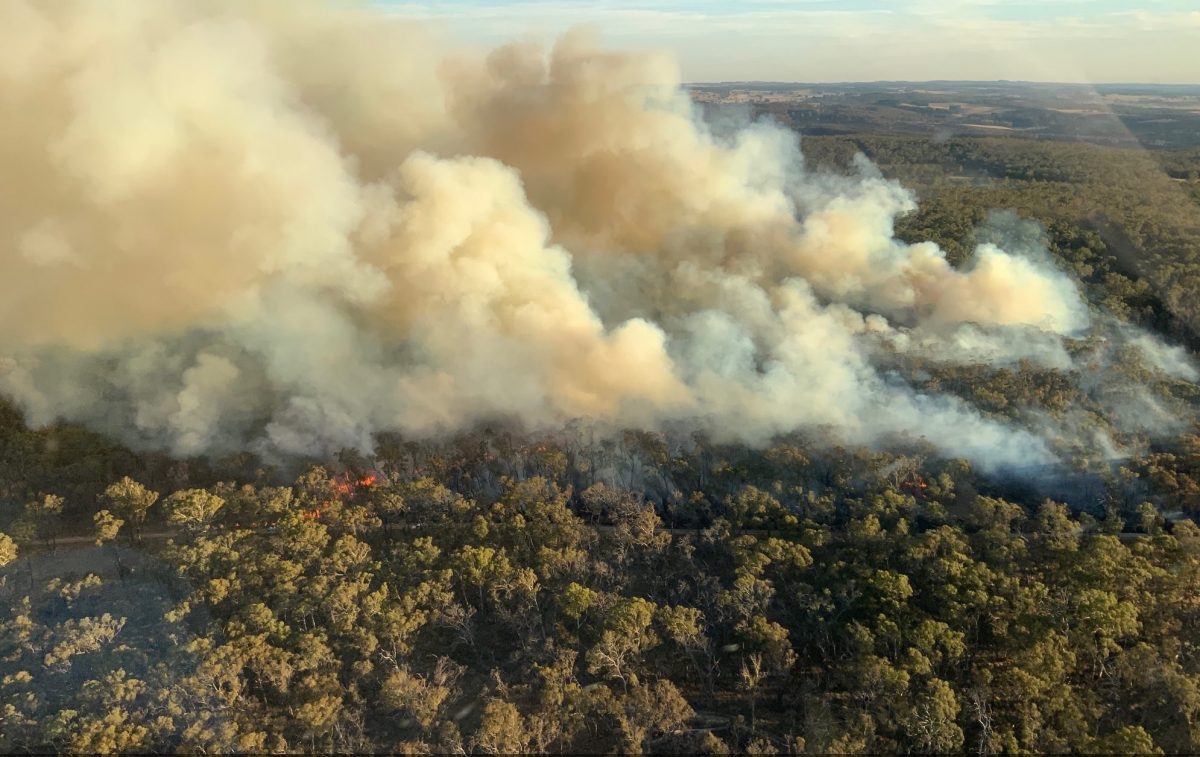
An aerial view of the Craigs Rd Fire near Curraweela. Photo: NSW RFS.
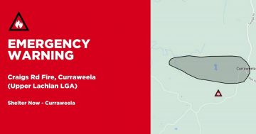
A cool southerly change overnight Sunday (19 March) appears to have allowed NSWRFS crews to slow the advance of the Craigs Rd Fire near Curraweela.
The fire, 35 km northeast of Crookwell, started in windy heatwave conditions last Thursday, quickly spread eastwards, and had grown to some 3700 hectares by Sunday night.
Reports that two houses were lost on Friday have been confirmed by a NSWRFS spokesman, who also said about a dozen other structures, such as sheds, have also been lost.
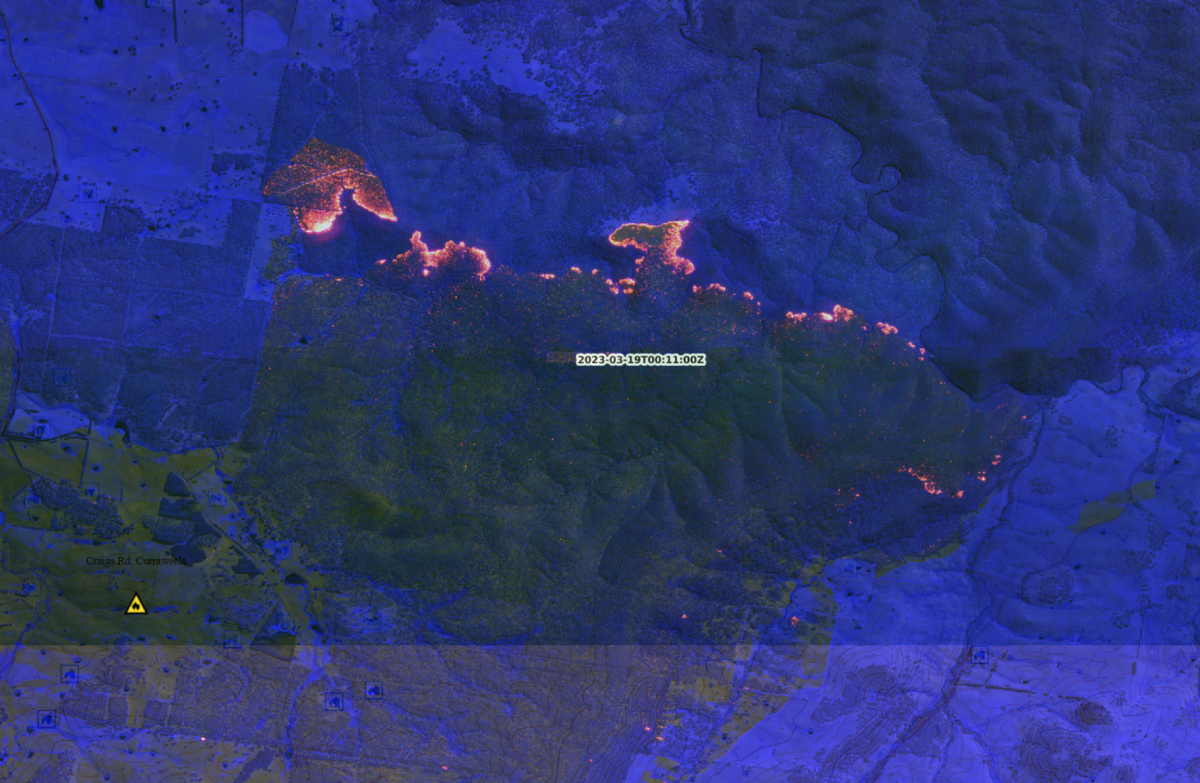
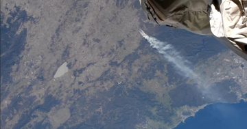
An aerial linescan map of the Craigs Rd Fire – with Curraweela at left – shows it moving northeasterly into the Wiarborough nature reserve on Saturday evening. Photo: NSWRFS video screenshot.
The fire continues to burn in the Taralga Road and Old Station Creek Road area and in rough terrain in the nearby Wiarborough nature reserve, but cooler temperatures of around 15 degrees – down from a high of 36 degrees on Sunday – and moist south-easterly winds were aiding the battle.
Crews were conducting a backburn operation on the fire’s southern edge, while the north and northeastern edge remains largely inaccessible. The fire remained at the Advice level today.
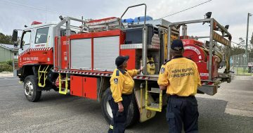
A complement of 75 NSWRFS firefighters from Lake George and the Southern Highlands were reported to be on hand over the weekend, and these have been augmented by out-of-area crews from Cumberland and the Illawarra regions.
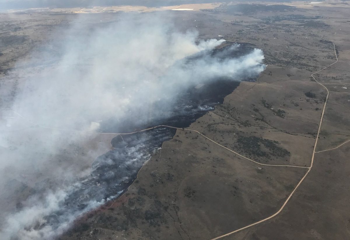
An aerial photograph of the Dalgety Rd Fire taken on Saturday afternoon. Photo: NSWRFS social media
Meanwhile, a fire in the Berridale area southwest of Cooma over the weekend was brought under control by NSWRFS crews supported by aircraft, fortunately, with no property losses reported.
The Dalgety Rd Fire burnt about 530 hectares of grassland between Dalgety and Bobundara Roads, about 5 km southeast of Berridale on Saturday afternoon. It was brought under control overnight Saturday, but crews from Rocky Plains, Adaminaby, Cooma and the ACT remain on hand to continue mopping up and watching for flare-ups.