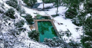
Has anyone been up this trail recently? We went up last year and loved it… lots of snow up the top although there are no reports of any snow recently (even though it seems cold enough).
Either way, a REALLY good walk, really enjoyed it..
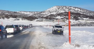
Has anyone been up this trail recently? We went up last year and loved it… lots of snow up the top although there are no reports of any snow recently (even though it seems cold enough).
Either way, a REALLY good walk, really enjoyed it..
We share skills, insight and resources, as well as a client-centric approach that's based on a deep understanding of your business.
Since 2014, True Connection Electrical have been servicing residential and small commercial clients with reliable, trustworthy and top-quality electrical work.
We're proud to give you a place where friends and family can come together for good food and great entertainment.
 allinsure
Allinsure has been a trusted insurance advisory to thousands of Australian business owners for almost 20 years.
A passionate team of Canberrans helping other Canberrans secure their home loans. No frills, no commissions, no brainer.
BDN has provided legal services to to Canberra, Queanbeyan and the region for over 160 years.
Want the best Canberra news delivered daily? Every day we package the most popular Riotact stories and send them straight to your inbox. Sign-up now for trusted local news that will never be behind a paywall.