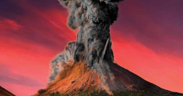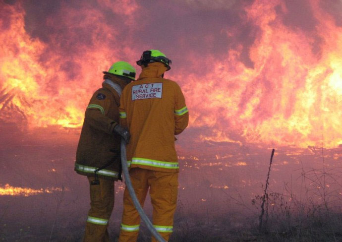
Firefighters in the field. Only the light winds kept the ACT from going into a Severe Fire Danger Rating at the weekend. Photo: ACT Rural Fire Service.
As the ACT baked in near 40-degree temperatures at the weekend, one would have thought the Fire Danger Rating would have been higher, especially with Total Fire Bans in place across the border in NSW.
But as the ACT Rural Fire Service Chief Fire Officer Joe Murphy explained, it isn’t as simple as just tracking the mercury.
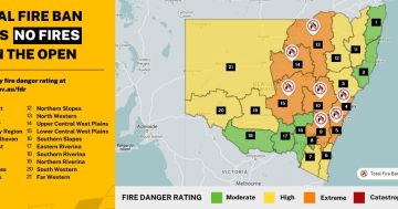
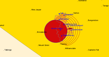
The RFS uses the same system as other agencies do across Australia, with the Fire Danger Rating – from low-moderate to catastrophic – calculated daily based mainly on a Fire Danger Index from the Bureau of Meteorology determined by temperature, wind speed, humidity and dryness of the soil. These indexes range from 1 to 100 and across the ratings.
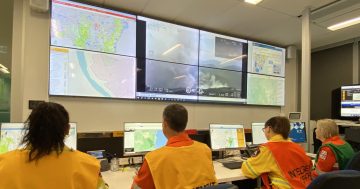
The RFS receives three reports a day – the morning FDI, the 2 pm preliminary report about the following day and the 4 pm forecast.
Other factors influencing the rating include whether there are any significant fires in the ACT and surrounds, what the fire ratings and indexes are in surrounding areas, the current capability – or people and trucks – available to fight fires, and if any other weather events are expected.
What saved the ACT from a higher fire rating on the weekend were the light winds. 10km/h higher and the Territory would have moved to Severe.
While a Total Fire Ban was in place across the border, Mr Murphy said this was a factor of NSW’s massive fire districts compared with the ACT.
“Over the weekend, we were both experiencing hot dry conditions, but it wasn’t windy,” he said. “The ACT is the smallest fire district in NSW. If you look at NSW fire districts they’re massive compared to us, they get a range of indexes across the landscape and what we saw in the fire district to our north and east was some severe fire danger weather at the top end of that district. Because it reached their thresholds, more than 10 per cent of that district was in severe fire weather, therefore it went to total fire ban.”
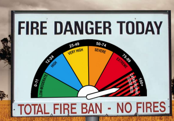
The familiar Fire Danger Rating sign may be changing.
He said both the ACT and NSW typically used more than 10 per cent of territory as a threshold in making determinations on whether they go to one rating or another.
“Even though down near us there were a couple of spots of severe weather, according to the Bureau, it was mostly up near the northern end of that district not near the ACT, but because that area was inside their fire district they had to declare it,” Mr Joseph said.
However, if there was a Total Fire Ban in the ACT then one would expect the surrounding area to follow suit. “The weather doesn’t respect borders,” he said.
Mr Joseph also said that what the ratings actually meant were often misunderstood, saying they did not forecast the risk of fire but how difficult a fire will be to manage and control.
“Very High doesn’t mean the chance of having fire is very high, it means that if a fire occurs and it is a Very High fire rating it’s going to be ‘x’ for us to manage and control,” he said.
“They are not a predictor of the chance of a fire, they are saying to the community if a fire occurs this is how hard it will be for us to control and manage the danger to you. This is what you need to do.”
But the current system and the familiar roadside signs, developed in the 1950s and 60s by the CSIRO’s Alan McArthur, may be about to change with a national project due to report at the end of March after trialling a new approach this fire season.
Mr Joseph said Rural Fire Services across Australia has been feeding data into the federally funded National Fire Danger Rating System Project conducting the trial.
He said the current model was quite old and flawed particularly when there were high winds and more extreme weather.
“We’re not pre-empting what the outcome will be but it could well change the way we look at everything,” he said.
But now the summer pattern in the ACT was establishing itself with the hot spell extracting any moisture left in the ground.
“You will see in the next week all the grass will turn brown, fully cured, and we’ll have a grassfire danger that we’ll have to deal with as well,” he said.
The week will bring a brief respite with cloud and some moisture that will help the RFS wrap up the Nerriga fire near Braidwood.
But “it’s summer and it’s in Canberra, it’s going to get hot and dry, it’s going to get windy every now and then, the hot dry north-westerly wind will arrive that draws that dry air from central Australia and dry everything out. Our fire dangers will increase, people need to be prepared now, fill out that bushfire survival plan, talk with family, and neighbours, and be aware of your own risk and understand what the ratings are.”
For more information on the Fire Danger Rating system go here.