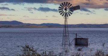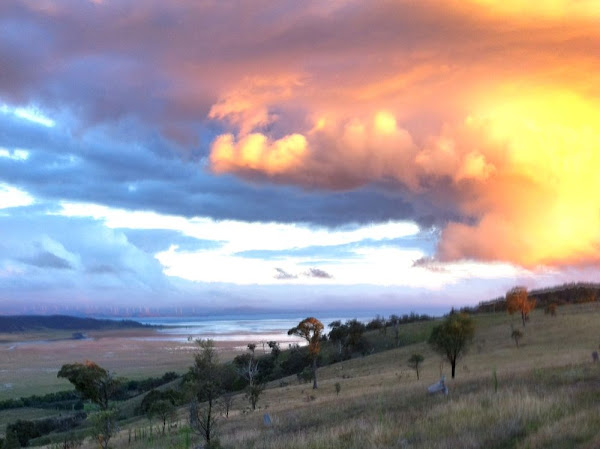
Rich took this great picture of Lake George filling up on his phone and sent it in.
Got an image of Canberra you want to share with the world? Email it in to images@the-riotact.com .
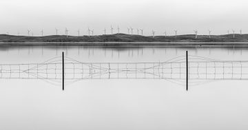
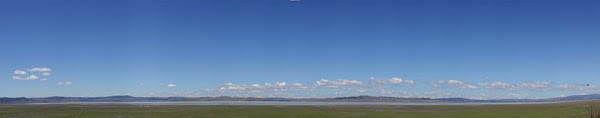
UPDATE 06/03/12 10:40: Ben_Dover has sent in this pano:
Rich took this great picture of Lake George filling up on his phone and sent it in.
Got an image of Canberra you want to share with the world? Email it in to images@the-riotact.com .
UPDATE 06/03/12 10:40: Ben_Dover has sent in this pano:
The Walking Clinic has perpetuated an attitude of excellence in foot health provision. The experienced Podiatric team provide current and innovative care to all patients.
 allinsure
Allinsure has been a trusted insurance advisory to thousands of Australian business owners for almost 20 years.
BDN has provided legal services to to Canberra, Queanbeyan and the region for over 160 years.
We're proud to give you a place where friends and family can come together for good food and great entertainment.
Since 2014, True Connection Electrical have been servicing residential and small commercial clients with reliable, trustworthy and top-quality electrical work.
When you need a criminal or commercial lawyer, you don’t want to take any chances. You want someone in your corner that you can trust like your life depends on it - because it does.
Through a spirit of entrepreneurialism, collaboration, and future-forward thinking, MV Law have earned an industry-leading reputation.
A passionate team of Canberrans helping other Canberrans secure their home loans. No frills, no commissions, no brainer.
Want the best Canberra news delivered daily? Every day we package the most popular Riotact stories and send them straight to your inbox. Sign-up now for trusted local news that will never be behind a paywall.