[First filed: Sep 29, 2010 @ 10:45]
The following in from the ESA:
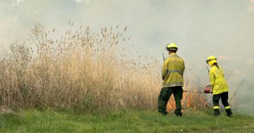
10:35am Wednesday 29 September 2010 – Hazard reduction burns in Mitchell and Campbell today The ACT Department of Territory and Municipal Services (TAMS) will conduct hazard reduction burn today in Mitchell and Campbell.
The Mitchell burn is located on Flemington Road closed to Wells Station
Drive. The ACT Handy Map grid reference point for the burn is L10.The Campbell burn is located on the corner of Constitution Avenue and
Anzac Park. The ACT Handy Map grid reference point for the burn is A3.Both burns are expected to start at 11:30am.
The ACT Handy Map can be found on the inside back cover of the current
Yellow Pages Canberra and region phone directory or by clicking on the
link below.
UPDATE: Aranda bushland gets the works tomorrow:
4:50pm Wednesday 29 September 2010 – Hazard reduction burn in Belconnen tomorrow The ACT Department of Territory and Municipal Services (TAMS) will conduct hazard reduction burn tomorrow in Belconnen.
The burn site is located the in Aranda Bushland adjacent to the Gungahlin Drive Extension in Belconnen. The ACT Handy Map grid reference point for the burn is K11.
The burn is scheduled to start at 10:00am.