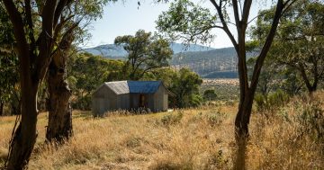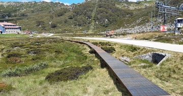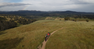
See Canberra differently and get some fresh air, too. Photo: Michelle Kroll.
Canberra’s still living under lockdown, but restrictions have eased a little, so if you’re fed up with walking the same streets or want to avoid crowds at some of Canberra’s more popular walks, here are some trails and tracks in your local area that provide spectacular views over the city, scenic strolls through bushland and some reprieve from your house.
Gungahlin
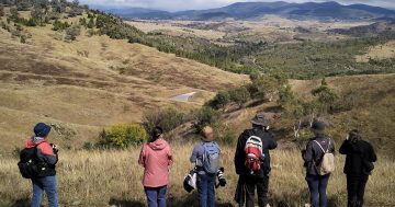
Starting from the top of the ACT, there are a few local options for people around Gungahlin. The One Tree Hill lookout near the ACT-NSW border in Hall provides hikers with a spectacular view over Canberra’s north with glimpses of Telstra Tower and the city in the background.
Hikers can access the start of the 8.4 km trail at the corner of Hoskins Street and Hall Street.
Mulligans Flat has two walking tracks – the full 11-kilometre circuit or the 5 km Little Mulligans circuit north of the first trail. Those who want to do the full circuit can start the walk from the car park entry for the Mulligans Flat Nature Reserve bird walk, while people can start the shorter circuit from the car park just off Mulligans Flat Road in Forde.
The even shorter Northern Campground trail starts from the edge of Bonner and Forde and has a full view of the Mulligans Flat Nature Reserve. Hikers can utilise a few different options along the 3.1 km track, which forms part of the 145 km Canberra Centenary Trail.
Belconnen
Shepherd’s Lookout to the west of Hawker and Holt provides a nice reprieve away from some of Canberra’s more frequented trails. The Woodstock Nature Reserve walk reveals an impressive view along the Murrumbidgee. Hikers can also look out for the ACT-NSW border marked by power lines over the river, 3 km downstream.
The walk can be accessed from the parking area 3 km down from the last traffic island on Stockdill Drive.
The Mount Painter Nature Reserve in Cook, the West Belconnen Pond in Dunlop and the Pinnacle Nature Reserve just south of Hawker and Weetangera also provide other options for scenic walks in the local area.
Inner north
The Mount Ainslie track is a Canberra staple, with the trailhead located in Remembrance Park behind the Australian War Memorial.
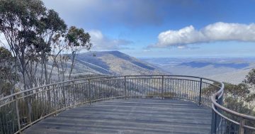
The 4.5 km trail provides hikers will a stunning lookout over the city and a direct view of Parliament House, making it one of Canberra’s most popular walks and tourist destinations.
The Arboretum, also located in Canberra’s inner north, is another popular spot, especially heading into spring.
But with both walking trails being some of the most frequented in Canberra, those looking for solitude during lockdown might want to try some paths less travelled.
The Mount Majura circuit is one such track, and it can also be joined with the Mount Ainslie trail for those looking for a more traditional Canberra walk.
Inner south
The Bridge to Bridge walk and Red Hill lookout are some of the inner south’s better-known trails and walking destinations.
Weston Park, while popular, has lots of nooks along Lake Burley Griffin as well as picnic and recreational areas – although some public facilities are closed due to COVID-19 restrictions.
The Isaacs Ridge Nature Reserve, just south of the Mount Mugga Mugga Nature reserve, also provides some fantastic views over the Woden and Tuggeranong valleys.
Weston Creek
The Cooleman Ridge walking track in Chapman offers Canberrans a shorter stroll, with the track running just 3.6 km, but all of the stunning views over the city that some of the longer tracks provide.
Those looking for a longer trail in the area can add the Mount Arawang Summit walk, which is also in the Cooleman Ridge Nature Reserve, or can reach the 1.3 km summit separately if they prefer.
Further west, the Murrumbidgee Discovery trail stretches the river, with the full track hitting 27 kilometres. It traverses the Point Hut Crossing in the south, the Kambah Pool and Casuarina Sands to the north.
Gorges and cascading waters along the trail offer nice resting spots for hikers looking to cool their feet after a strenuous walk.
Tuggeranong
The most central and easily accessible trail in Canberra’s south would probably be the Tuggeranong Hill Nature Reserve. The 3 km summit provides views over the 365-hectare reserve in the Tuggeranong Valley.
There are numerous public access points into the reserve across Theodore and Conder.
The Theodore Hills summit just down from Tuggeranong Hill also provides some spectacular views over the valley. While the 3 km is not a particularly long walk, the hill is consistently steep.
The Tuggeranong Pines and the Old Railway Loop can add variety and history to your stroll, revealing the old railway lines that ran between Queanbeyan and Cooma in Canberra’s early years.


