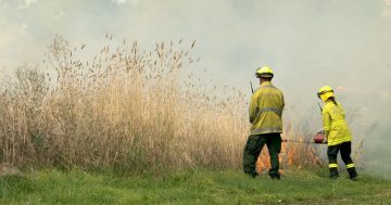
Today’s ESA hazard reduction brought to you by the letter G:
12:30pm Monday 13 December 2010 – Controlled burn at Gordon this afternoon The ACT Department of Territory and Municipal Services (TAMS) will conduct a controlled burn this afternoon on Amber Ridge in Gordon.
The ACT Handy Map grid reference for the burn is K16.
To view the ACT Handy Map click on the link below or go to inside back cover of the current edition of the ACT and region Yellow Pages phone directory.
A further burn is planned for Gilmore Hill in Gilmore tomorrow, weather-permitting.
The ACT Handy Map grid reference for the burn K14.
act handy map.pdf


