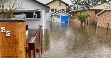
Mogo highway underwater in December. Photo: Tom McGann.
The intense rainfall that has ravaged south-eastern Queensland and north-eastern NSW is on the move and expected to hit the South Coast and adjacent ranges in the next 36 hours.
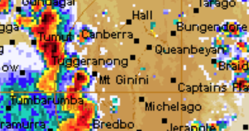
The Bureau of Meteorology is expecting upwards of 200 mm in areas of the South Coast. In contrast, the ACT and inland southern NSW are expected to receive the “extracts” of the weather system, which could also lead to intense rainfall and significant rain totals.
Up to 40 mm of rain is predicted for the ACT tomorrow (Wednesday 2 March).
Duty forecaster at the Bureau of Meteorology Morgan Pumpa explained the current weather systems in play.
“The trough that brought heavy to intense rainfall to the north-eastern parts of NSW has moved offshore and we expect it to develop into an east coast low today, which is an intense low-pressure system that combines with warm sea surface temperatures,” Ms Pumpa said.
“We are expecting it to be around the coastal parts of NSW. There is some uncertainty in regards to its timeline and also its location of where it will pinpoint the most.
“At the moment, we’ve got a warning from below Forster to Eden, in terms of a rough estimate of where it could be. We’ve also got hazardous surf, galeforce winds and abnormally high tides. So, for coastal parts, there is that combination of the east coast low and so we will continue to monitor the warning throughout the day in regards to its location and what it may bring,” she said.
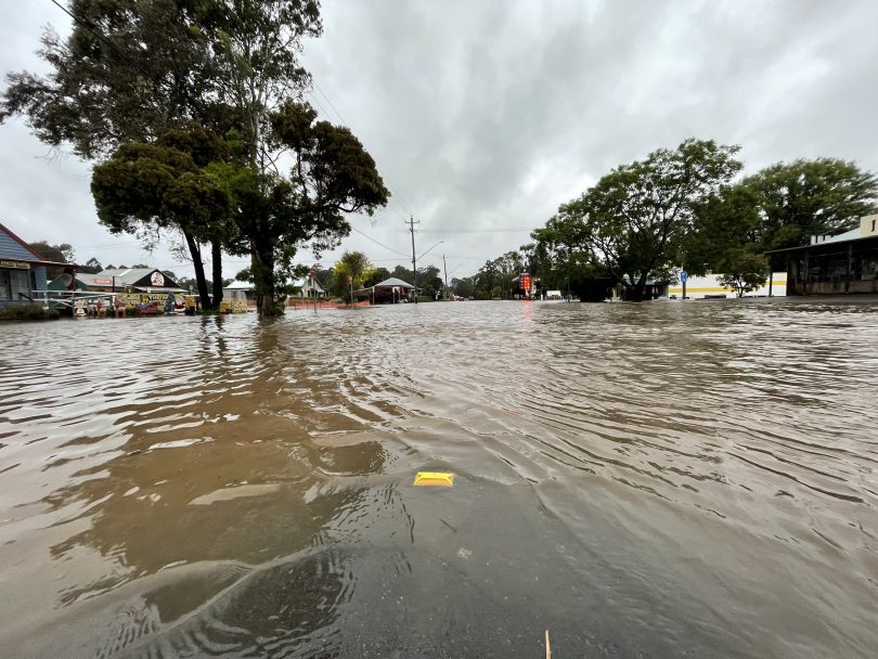
Heavy rain is considered possible on the South Coast continuing into the weekend.
Sunday has a wide rainfall range of between 2 and 25 mm at Batemans Bay and along the coastal region. It means the flood risk will likely continue for up to a week.
“It’s really important that people over the coming days and even into the weekend are mindful of the possibility of river rises or riverine flooding, so keep an eye on those flood watches that are current and will continue to be updated,” Ms Pumpa said.
Chief Superintendant of the NSW SES South East Zone Colin Malone stressed that “now is definitely the time the community gets prepared for what is coming their way”.
He asked that residents prepare early, take the necessary steps to make their property safe and have an evacuation plan ready.
Chief Superintendant Malone said that in the South Coast region, residents are generally aware of what areas will flood in extreme rain events. However, he did caution that this event may be different due to the unusually wet conditions this summer caused by La Niña.
“What the damp and wet conditions will mean is that any rain that falls will runoff. It will run to the river systems. It will run off overland flooding, so I think we will see more of that flash overland flooding on the catchments and start to see water over roads that may not normally have water over the road,” he said.
The Chief Superintendant was pleased by reports of community members picking up sandbags in advance this morning.
“That’s amazing because it means during the severe weather, we can minimise our actual responding to the ones that really need our help.”
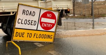
ACT Policing and the ACT Emergency Services Agency are reminding Canberrans to stay safe and be cautious of the hazardous and unpredictable nature of floodwaters and the dangers associated with heavy rainfall. Coppins Crossing, Point Hut Crossing and Oaks Estate already closed due to flooding on Sunday.
Looking further inland in regional NSW, the Riverina and South West Slopes are expecting the inland trough currently sitting in western NSW to move east and combine with a moist easterly weather system to create thunderstorms that could include damaging wind, light hail and heavy rainfall.
The NSW and ACT SES Emergency contact number is 132 500.