Whether you’re hiking in the mountains or taking a dip on the South Coast, we’ve got your Australia Day forecast covered. Photo: Thredbo Resort.
Everyone has been urged to take care as they mark the Australia Day weekend, with a low-intensity heatwave on the cards for southern NSW and the ACT.
While not officially a long weekend, many are expected to take the Friday off to create a final four-day break before getting fully back into the swing of things.
Maximum temperatures are expected to be in the high 20s to low 30s into the weekend – even hitting the high 30s the further inland you go – before a cool change comes through on Sunday (29 January).
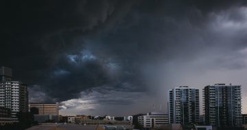
Bureau of Meteorology’s Morgan Pumpa said unsettled conditions increased the chance of thunderstorms across the ACT and southern NSW.
“We’ll see temperatures increase and there’s the chance of even severe thunderstorms across South East NSW and the Southern Tablelands,” she said.
“If those severe thunderstorms do develop, there’s the chance they’ll bring damaging winds, large hail and heavy rainfall.”
An inland trough with a weak southerly change on the South Coast also increases the chance of a ‘supercell’ forming, especially today (26 January), so keep an eye on warnings and the radar.
“If you’re planning any outdoor activities or camping, Australia Day is the day to watch for possible supercell activity and thunderstorms,” Ms Pumpa said.
“The overnight and maximum temperatures, combined with increased humidity, means some temperatures will hit that low-intensity heatwave threshold into the weekend.”
Ms Pumpa advised anyone on the roads to take extra care as the possible heavy rainfall could impact visibility, while those heading out on the water should also monitor conditions.
Over the entire weekend, Saturday (28 January) looks like the pick of the lot.
“There is a chance of thunderstorms on Saturday afternoon, but that depends on the timing of the next cold front coming across the state,” Ms Pumpa said.
“We do expect to see a drop in temperatures come Monday.”
We’re being reminded to take plenty of breaks if hitting the road and pack some supplies just in case your vehicle breaks down.
People are also urged not to leave children or pets in the car, even with the windows down or for short periods as the interior can heat to over 60 degrees in just five minutes.
In the ACT, government bodies have asked people to consider parking a little further away if attending an event or taking public transport.
“While parking will be free in ACT Government car parks this Thursday (26 January), Access Canberra parking inspectors and mobile speed vans will be out to keep us all safe,” a spokesperson said.
“When swimming in the ACT’s waterways, rainfall can make conditions unpredictable, so it’s important to stay extra safe and check the conditions before swimming. Never dive into water if you are unsure of the depth.”
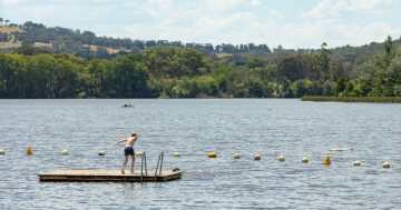
It’s also a great time of year to be out and about, be it bushwalking, cycling or going for a swim.
However, we’ve also been reminded to watch out for heat-related illnesses in those around us.
“Some groups of people – such as babies and young children, pregnant people, older people and people with medical conditions – are more at risk than others,” an ACT Government spokesperson said.
“Stay cool and avoid excessive time outdoors between 11 am and 3 pm. Be sun smart and protect yourself by wearing light clothing, a hat, sunglasses and sunscreen and seeking shade.”
Australian Capital Territory
Thursday 26 January: Partly cloudy with the chance of a thunderstorm. Overnight temperatures falling to between 11 and 14 degrees with daytime temperatures reaching 27 to 33 degrees.
Friday 27 January: Partly cloudy with variable winds. Overnight temperatures falling to between 12 and 15 degrees with daytime temperatures reaching 25 to 30 degrees.
Saturday 28 January: Mostly sunny with a slight chance of a thunderstorm in the afternoon and evening. Overnight temperatures falling to between 12 and 15 degrees with daytime temperatures reaching 28 to 34 degrees.
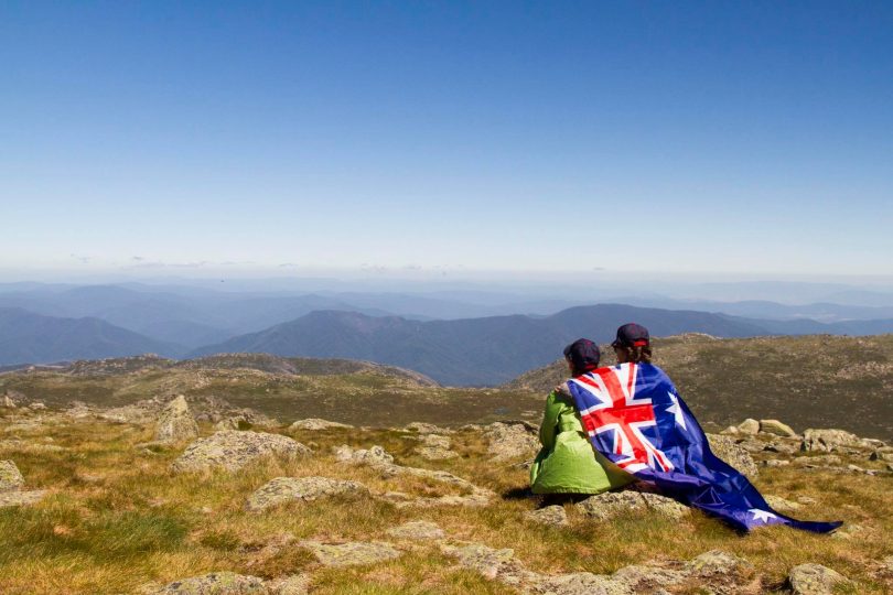
Australian Alps – Snowy Mountains
Thursday 26 January: Partly cloudy with a medium chance of showers in the afternoon and evening, along with the chance of a storm.
Friday 27 January: Partly cloudy with variable winds.
Saturday 28 January: Sunny with the chance of a thunderstorm in the evening.
South Coast
Thursday 26 January: Partly cloudy with a medium chance of showers most likely in the afternoon and evening, along with the chance of a thunderstorm. Overnight temperatures falling to between 13 and 17 degrees with daytime temperatures reaching 24 to 30 degrees.
Friday 27 January: Cloudy with a medium chance of showers in the north, slight elsewhere. Overnight temperatures falling to between 12 and 17 degrees with daytime temperatures reaching the low to mid-20s.
Saturday 28 January: Sunny with the chance of a thunderstorm in the north. Overnight temperatures falling to between 13 and 17 degrees with daytime temperatures reaching around 30 degrees.
Southern Tablelands
Thursday 26 January: Partly cloudy with a medium chance of showers in the southeast, along with the chance of a thunderstorm. Overnight temperatures falling to between 12 and 15 degrees with daytime temperatures reaching 29 to 34 degrees.
Friday 27 January: Partly cloudy with the chance of a thunderstorm in the north throughout the day. Overnight temperatures falling to between 11 and 15 degrees with daytime temperatures reaching 23 to 31 degrees.
Saturday 28 January: Mostly sunny with the chance of a thunderstorm in the evening. Overnight temperatures falling to between 12 and 15 degrees with daytime temperatures reaching 30 to 35 degrees.
South West Slopes
Thursday 26 January: Partly cloudy with the chance of a thunderstorm in the afternoon and evening. Overnight temperatures falling to between 13 and 16 degrees with daytime temperatures reaching 27 to 34 degrees.
Friday 27 January: Sunny with the chance of a thunderstorm in the afternoon and evening. Overnight temperatures falling to between 13 and 16 degrees with daytime temperatures reaching 27 to 34 degrees.
Saturday 28 January: Sunny with the chance of a thunderstorm in the afternoon and evening. Overnight temperatures falling to between 14 and 17 degrees with daytime temperatures reaching 30 to 37 degrees.
Riverina
Thursday 26 January: Sunny with the chance of a thunderstorm in the southeast in the afternoon and evening. Overnight temperatures falling to around 17 degrees with daytime temperatures reaching the low to mid-30s.
Friday 27 January: Sunny with light winds. Overnight temperatures falling to around 14 degrees with daytime temperatures reaching the low to mid-30s.
Saturday 28 January: Mostly sunny with the chance of a thunderstorm in the afternoon and evening. Overnight temperatures falling to around 17 degrees with daytime temperatures reaching around 40 degrees.