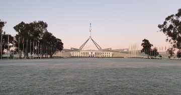
Winter sunset over Black Mountain and Lake Burley Griffin. Photo: Michelle Kroll.
After a string of warmer days at the beginning of last week, we were left in no doubt that winter is on its way as cold and wet weather descended on the ACT and NSW over the weekend. However, this may not last – Bureau of Meteorology forecasts suggest a drier winter season overall, and things are likely to improve later this week too.
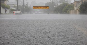
Around 100 mm of rain was recorded over Saturday (29 April) at Point Perpendicular near Nowra, with 36 mm of rain recorded at Canberra Airport by 5 pm on Sunday.
The NSW State Emergency Service (SES) received 133 calls for help in 24 hours as of 5 am on Sunday and warned that “the threat from this weather system has not yet passed”. SES crews were working tirelessly overnight as residents called for help with downed trees and branches, leaking roofs and water damage as a result of the heavy rainfall.
Elsewhere, the wintry weather was welcomed at the Perisher ski resort in the Snowy Mountains, which posted a video of a flurry of snow falling on Sunday morning captioned “Winter’s on our doorstep”.
Weather Update: Cold fronts for south-east Australia this week.
Video current: 1:30pm AEST Monday 1 May 2023.
Know your weather. Know your risk. For the latest forecasts and warnings go to our website https://t.co/q3pk8mUuAe or the BOM Weather app. pic.twitter.com/x32JDVVbhZ
— Bureau of Meteorology, Australia (@BOM_au) May 1, 2023
While the colder weather may be here to stay, BOM meteorologist Helen Reid said that after the wet weekend, “we’re on an improving trend for this week”, with “nothing in the sense of rain as we’ve seen”.
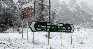
Though there might be a couple of showers and potentially some snow up on the Brindabellas, the latter part of the week could bring “clear skies and frosty mornings” in the Canberra region.
With the BOM predicting highs of 18 degrees Celcius on Tuesday in Canberra, 16 on Wednesday and Thursday and 15 on Friday, daytime temperatures are still relatively high, but there’s a chance of morning frost on Thursday and Friday as the mornings get a lot more crisp and cold. BOM forecasts lows of 1 degree Celcius on Thursday and 0 on Friday.
For the weekend, the high is forecast to be 15 degrees, with a low of 0 on Saturday and 1 on Sunday.
In a weather update on 1 May, BOM said a “burst of winter” is on the way, with cold fronts coming into the south-eastern states this week.
While its satellite imagery shows quite a bit of clear sky, there could be onshore showers as the first front moves through on Tuesday.
By Wednesday, a second, larger front is forecast to move through, bringing wet and windy conditions, with strong winds expected in alpine areas. A third front is due to come on Friday and into Saturday and Sunday, bringing more cold weather for the weekend, though winds are expected to be lighter.
As for the snow, “it’s more likely to be a few flurries a little bit on the ground” as rainfall accumulations ease, so despite excitement at Perisher, it may be a while to go until the snow fields get the good blanket they need.
Looking at the bigger picture, Ms Reid said the BOM’s climate outlook indicates a dry winter from May to July, and the BOM is anticipating below-median rainfall for most of the country.
For Australia as a whole, temperatures are expected to be milder than average, with the BOM predicting maximum temperatures are highly likely (more than 80 per cent chance) to be warmer than the median.
BOM says long-range forecasts suggest a neutral El Niño–Southern Oscillation (neither El Niño nor La Niña) through the autumn, with El Niño potentially developing in the winter or as early as May. El Niño would increase the chance of below-average rainfall in eastern Australia in the winter months.
While the warmer temperatures can lead to lower snow depths, skiers and snowboarders shouldn’t give up hope just yet. Cold, dry weather is generally ideal for snow, Ms Reid said, and failing that, dry weather is ideal for snowmaking.
BOM’s winter long-range forecast is set to be released on 1 June, which will give a better indication of what the future holds for our snow season and the winter as a whole.
The latest weather forecasts are regularly updated on the BoM website.