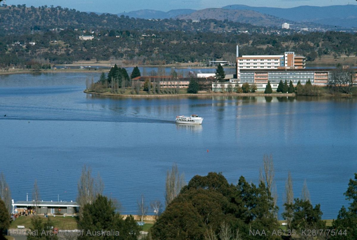
Lake Burley Griffin, in 1975. Photo: National Archives of Australia.
North of the lake or south of the lake — which are you? We wouldn’t have that dilemma if Treasurer Harold Holt had had his way in 1959. He saw the lake as a drain on the national purse and had struck the construction out of the budget.
Fortunately, John Overall, Commissioner of the National Capital Development Commission (NCDC; 1958–1972), whose job was to fulfil the progress of the Griffin Plan, waited patiently for the return of Prime Minister Menzies from a visit to the Queen.
So important was the lake to the Griffin Plan that Overall met the Prime Minister soon after he touched down at Canberra airport, and it was on the tarmac that the item was put back into the budget.
Eleven kilometres long, 1.2 kilometres at its widest point, an average depth of four metres, maximum depth of 18 metres (near Scrivener Dam), with the distance around the lake about 40 kilometres, the lake is actually smaller than originally planned.
Government Surveyor Charles Scrivener, after whom Scrivener Dam was later named, surveyed the Federal Capital Territory in 1909. His contour maps were used by entrants in the international competition to design the new capital and included the potential of an ornamental lake. The Griffin Plan was quite geometric, with three separate but connected lakes, but this was later modified to a more organic design of one single lake with three basins — East, Central and West.
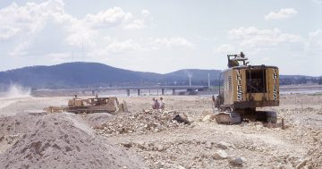
In 1963, Scrivener Dam began impounding the waters of the Molonglo River, but nature was not particularly compliant. A drought had created an opportunity for rapid completion of the dam, lakebed and Commonwealth and Kings Avenue Bridges, but rain was needed to fill the lake.
Fortunately, a heavy downpour broke the drought in April 1964 and transformed mosquito-ridden puddles into a fully filled lake in just six days.
Inaugurated by Prime Minister Menzies in October that year, the lake remained unpopular with some. Members of the original Royal Canberra Golf Course weren’t happy to see their beloved course flooded. Vocal public opinion included concerns of flooding, potential mud flats and mosquito or fog traps, loss of productive land, and the biggest concern, the cost. Some bureaucrats declared the plan to be “grandiose”.
During his speech at the inauguration of the lake, Menzies quipped, “There were powerful forces against me because there was a golf course and all the heads of all the departments belonged to it”.

Crowds celebrate at the inauguration of Lake Burley Griffin in 1964. Photo: National Archives of Australia.
The lake’s formation created six islands, the largest of which is Springbank Island, a popular stop today with kayakers and paddleboarders. ‘Springbank’ was named after the property given as a land grant to John MacPherson in the 1820s — a reward for capturing a bushranger. Springbank extended to where the Australian National University is today.
In 2015, an archaeological dig on Springbank Island exposed many Aboriginal artefacts highlighting that Aboriginal people were active in the area when European settlers arrived. The dig also revealed evidence of European settlement, including a door handle, nails and a metal button. Of particular interest was a glass bottle stopper believed to belong to the early European residents, possibly indicating their preference for a good drop of rum.
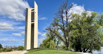
Queen Elizabeth II Island (formerly Aspen Island) where the carillon stands, was created to slow the water inflow in that part of the lake. As the carillon was being built in the late 1960s, the then (Sir) John Overall would jog around the lake to check on its progress. He no doubt would have been pleased to see the lake’s transformation during those years.
And while Canberrans continue to refer to the northside-southside divide, Menzies saw the lake as particularly special, saying, “this is the heart of the city and I hope it will be a heart that will be quietly beating for the rest of our lives”.
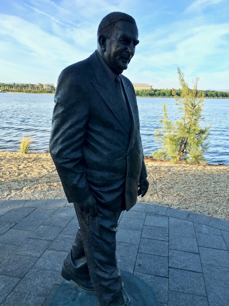
Prime Minister Menzies sculpture by Peter Corlett, on Menzies Walk along the shoreline of Lake Burley Griffin. Photo: Marg Wade.
The RG Menzies Walk, not far from Regatta Point, with its sculpture of Menzies by artist Peter Corlett, was named in acknowledgement of Sir Robert Menzies’ crucial contribution to the development of Canberra, including Lake Burley Griffin. Thank you, Sir Robert.


