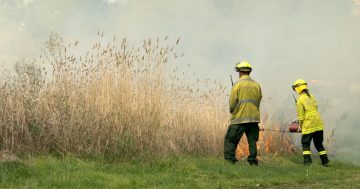
The ESA are advising that they’re doing a burn off on Stromlo tomorrow:
3:35pm Friday 29 October 2010 – Hazard reduction burn at Stromlo tomorrow. The ACT Rural Fire Service Rivers Brigade will conduct a small hazard reduction burn tomorrow Saturday 30 October, 2010 near Barrenjoey Drive, Stromlo, weather permitting.
The burn will be conducted to remove accumulated fuel, six individual piles of combustible material, each measuring 15 x 3 metres in size from 9am.
Two tankers, two light units and 20 personnel will conduct the burn.
Weekly Newsletter
Every Thursday afternoon, we package up the most-read and trending RiotACT stories of the past seven days and deliver straight to your inbox..The ACT Handy Map grid reference for the burn is K12.
What’s Your opinion?
Stromlo burning
Oldest to Newst
Barrenjoey Drive, while technically part of Stromlo Forest, is at the peninsula on the western side of the lake between the lookout opposite the Governor General’s and the old museum site… a long way from Mt Stromlo.
And some feedback for the ESA… the ACT Handy Map grid is not a very useful reference for purposes such as this because the grid sqares cover a reasonably big area (eg all of Weston Creek). Hmmm, has anyone there ever heard of Google maps??