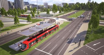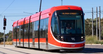
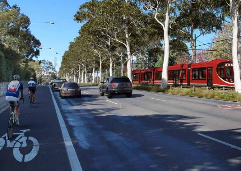
Light rail on Adelaide Avenue. The southern corridor will provide different development challenges from the north. Images: ACT Government.
Development along the light rail route to Woden is likely to include apartments of some kind but not to the same density as on Northbourne Avenue.
Planning Institute of Australia ACT Division Vice-President Imogen Featherstone says the journey to Woden probably requires any new development to be considered in a different context to Northbourne where the tone had already been set by established multi-storey buildings in the approach to the city.
“It’s built form was already established and it was very clear that it would continue in that fashion,” she said.
But the run to Woden will provide different challenges.
“That’s the next thing that the community needs to consider thoughtfully: what is the response that actually makes sense for the people to use it [light rail] but is sympathetic to the national significance within the landscape?”
That doesn’t rule out high density at some points because Ms Featherstone argues that there was not much point in having a line to Woden if there aren’t people living along the expensive bit of infrastructure to support it.
But the levels of density and building types will have to be appropriate for their proposed location and environment. That will mean considering the views and vistas that are very much a part of the national capital.
“We need to be mindful of those national significant areas while ensuring we have a city for now and into the future and for future generations,” she said.
Ms Featherstone was responding to news that the ACT Government had contracted a consultant to identify potential urban infill along the route.
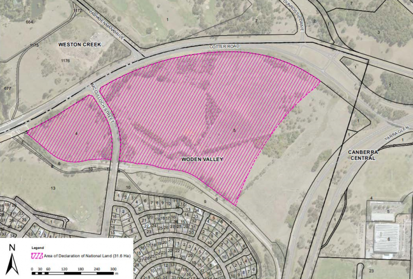
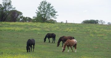
The North Curtin Horse Paddocks. The area in pink is now national land, but the unmarked strip next to Yarra Glen is ACT land earmarked for future development as part of the light rail corridor.
She said the Planning Institute supported density that creates a more compact interconnected equitable city – and that meant density connected to hubs and transport routes.
Bad density was putting people where they don’t have access to services, schools, employment opportunities and they became more reliant on their cars, she said.
Ms Featherstone said there was likely to be a mix of building types, including multi-storey apartments, on the ACT-owned horse paddock land on Yarra Glen, given Curtin was closer to the city than other suburbs further out that do have apartments.
But the area should be developed holistically as a precinct so you don’t have, for example, 10 storeys next to a single-level house.
Ms Featherstone said that idea was something the ACT was still grappling with from a planning point of view.
“We’re still coming to identify what is density in this city and what is an appropriate response to density and into the future,” she said.
“We’re all grappling with what that looks like.”
READ MORE: Two city car parks to become light rail compounds next month
The good news is that the urban infill study consultant has been tasked with taking a precinct perspective, rather than block by block, emphasising identifying opportunities for more medium-density housing, the so-called ‘missing middle’.
The study will look at five areas – the North Curtin horse paddocks, West Deakin, the Phillip/Woden Town Centre, Mawson and the rest of the corridor.