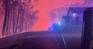
Orroral Valley fire, January 31. Photo: David Marriott via The Canberra Page.
Update January 31, 11 pm: After an afternoon battling rising temperatures and erratic wind behaviour, the RFS says that fire crews have sheltered in and saved Old Gudgenby Homestead from the Orroral Valley fire.
There are unconfirmed reports that the crew included Namadgi National Park District Manager Brett McNamara, who lost his own home in the 2003 fires. All crews are safe, but the Orroral Valley fire has grown today to more than 24,000 hectares.
There are deep-seated concerns about the effects of soaring temperatures, winds and potential thunderstorm activity on Saturday. These risks prompted the ACT’s first declaration of a state of emergency since 2003 around midday on Friday.
As of this evening, the RFS advice is that people in Tharwa village and the southern suburbs of Banks, Gordon and Conder and surrounding areas should monitor conditions closely and be ready to act.
The fire remains out of control and properties are under threat near Top Naas Road. If you are in that area, you should leave now if you are able to do so. There has also been an increase in fire activity in the south-west moving towards Cotter Hut.
If it’s safe to leave, you should do so from the following areas: Apollo Road; Boboyan Road, north of the Glendale depot; Top Naas Road, south of the Boboyan Road intersection. Corin Road has now been added to that list. If you are not in the area, do not return.
The safest route out remains to the north, using Naas Road towards Tharwa and Canberra. This route has been cleared and is being monitored by emergency services. An evacuation centre is open at Erindale College, on McBryde Crescent.
The fire’s erratic behaviour over steep, heavily wooded and bone dry terrain has made firefighting challenging as crews are able to safely reach less than one per cent of the blaze. Properties may be impacted by embers well ahead of the fire causing spot fires.
RFS predictive mapping shows a risk that this may occur in Canberra’s southernmost suburbs if worst-case conditions occur on Saturday.
Spotting has already fuelled a number of outbreaks at Michelago including the Clear Range fire, which remains at watch and act level. Residents of The Angle, Bumbalong or Colinton, should monitor conditions and enact their bush fire survival plan.
This fire is expected to cross the border into NSW, somewhat complicating identification and management. Once this happens, the eastern flank will also be known as the Clear Range Fire. This part of the fire response and public information will then be managed by NSW Rural Fire Service.
The Orroral Valley fire continues to be the responsibility of the ACT ESA. Commissioner Georgeina Whelan has stressed a number of times throughout the crisis that the two emergency service agencies are working very closely together.
If you are threatened by the fire, power, water and mobile phone service may be lost, and road conditions may become dangerous. Leaving early is always the safest option.
The ESA has also made repeated pleas for sightseers to stay away from public roads which are being used by emergency crews and the ESA has added that drones are not permitted to operate anywhere near the fireground.
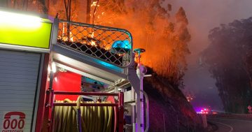
The Orroral Valley Fire at an emergency level from the Red Hill lookout on 31 January. Photo: Michelle Kroll, Region Media.
Update January 31, 6 pm: The RFS is warning that people need to stay alert in what is now a very dangerous situation as the Orroral Valley fire moves south and east, spotting vigorously. The fire now covers more than 21,000 hectares.
There is no current threat to Canberra’s suburbs although the RFS anticipates spotting tomorrow afternoon in Canberra’s southern suburbs including Banks, Conder and Gordon. The fire is currently moving slowly north too, and is about one kilometre south of the Corin Rd.
The fire has been at emergency level since mid-afternoon and is behaving erratically, spotting in the Billy Range to the west of Naas Rd.
Residents in Apollo Rd, Boboyan Rd north of the Glendale depot, Top Naas Rd south of the Boboyan Rd intersection, and Corin Rd should all leave if safe to do so. The safest route is north to Tharwa using the Naas Rd, which has been cleared and is being monitored by emergency services.
A second fire has also begun at Clear Range not far from Michelago. This fire, across the state border, is a result of the Orroral Valley fire but is currently at watch and act status. Water-bombing aircraft are working in the area but fire activity is expected to increase this evening in the area to the west of The Angle.
RFS chief Joe Murphy told ABC Radio that wind conditions are contributing significantly to the difficulty of fighting the fire. Canberra’s prevailing winds are from the north-west during summer but at ground level in mountainous terrain the fire is driven by the topography rather than the upper-level activity.
“Up above the range the usual winds are persisting, but in the ranges there’s a lot of variability and that’s why fire is spreading rapidly. Conditions are making it very hard to predict what will happen next,” he said.
“We have crews everywhere providing feedback but we can’t predict where it will go.”
Door-knocking has now extended to more suburbs in Canberra’s bush fringes including areas such as Wright. The intention is to help people prepare and consider their plans. This is not an evacuation.
Erindale College at Wanniassa is open for evacuation and can take pets. Larger animals can go to EPIC or Braidwood Showground, but not to the showgrounds in Queanbeyan or Bungendore.
January 31, 3 pm: “The ACT is now facing the worst bushfire threat since the devastating fires of 2003,” ACT Chief Minister Andrew Barr said while declaring a state of emergency in the ACT today.
The Orroral Valley fire has now been upgraded to an emergency warning level.
The Orroral Valley fire has reached emergency level this afternoon after the declaration at midday that the ACT is now in a state of emergency. It’s possible we could see ember attacks in Conder, Banks and Gordon on Saturday afternoon, according to the ESA’s predictive models. The Chief Minister has repeated that the ACT is now facing the worst bushfire threat since the devastating fires of 2003.Full story: http://ow.ly/pgby50y9Kmo
Posted by The RiotACT on Thursday, January 30, 2020
The fire is travelling in an easterly direction towards Top Naas Road. Properties are under threat and people should leave now if they are able to.
The bushfire is approaching Apollo Road, Boboyan Road, north of the Glendale depot and Top Naas Road, south of the Boboyan Road intersection.
A new fire, the Clear Range fire, is at watch and act level in the Michelago area. This fire can be found on the NSW Rural Fire Service website.
“A state of emergency is the strongest signal we can send to the ACT community that they must prepare themselves and their families for the worst possible situation. There is now no higher priority for the entire ACT Government at this time than this bushfire threat,” the Chief Minister said.
The state of emergency will stay in place until the city is no longer at significant risk from the Orroral Valley Fire, which has now burnt nearly eight per cent of the ACT’s landmass and has grown to 19,618 hectares or 185 square kilometres.
Icon Water has pumped three days of water supplies into the city reservoirs. Water has also been transferred to dams away from the fire-impacted areas.
Evacuation centres at Erindale College and Stirling are being stood up as required. Endangered species and precious wildlife have been relocated from Tidbinbilla Nature Reserve.
As the temperature gauge tipped 40 degrees in Canberra today, the ACT Emergency Services Agency Commissioner Georgeina Whelan said all the elements of a fire emergency such as weather, heat, fire activity, topography and fuel loads are lining up.
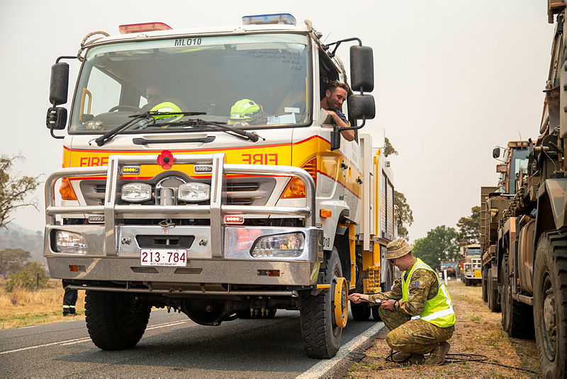
Australian Army Corporal Jaymes Hasler from the 6th Engineer Support Regiment helps the crew of a Molongolo Brigade RFS truck pumping up a flat tyre in Banks during the Orroral Valley Fire response. Photo: ADF.
The scenario is that the fire could break containment lines at the Bobyan Road. This is an area where firefighters only have access to approximately one per cent of the current fire spread due to inaccessible terrain. The Commissioner said heavy smoke may also prevent some aircraft from doing their job.
“If wind conditions prove to be challenging, we could see suburbs such as Conder, Banks and Gordon come under attack from ember attacks on Saturday afternoon,” Commissioner Whelan said.
“The models also show the potential for ember attack in the southern ACT in the next 72 hours.”
The commissioner said Canberra’s emergency team is prepared to respond to any scenario in the coming days.
“We have been planning for our worst day, and if we get there we have the support we need from the ESA, Parks and Conservation Service, the Australian Defence Force, ACT Policing, interstate firefighters and the whole of the ACT Government.
“We are concerned that the conditions will be the worse we have seen since 2003 and having learnt from 2003 this is why we are having the conversation with you today.”
However, since the state of emergency was declared, the ESA website has gone down a number of times due to surges in traffic. Those seeking updates can go to the ESA’s Twitter and Facebook accounts.
The Canberra community should expect road closures and possible evacuation notices if an area comes under direct threat from the bushfire.
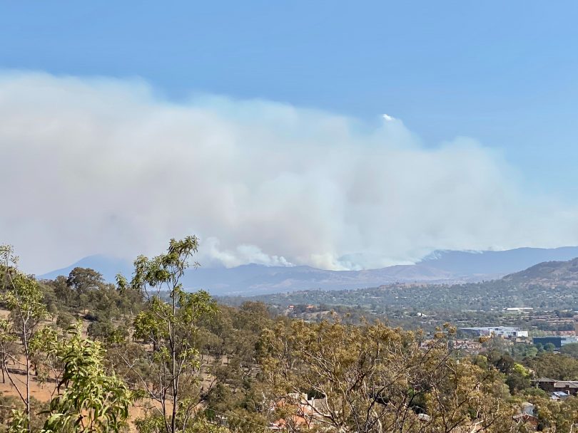
Already the Orroral Valley fire is creating its own weather pattern.
Fire prediction maps show the potential for fire spread within the ACT during the next 72 hours. A second map, put together with the NSW RFS, shows the likely spread of the fire across the border into NSW for today.
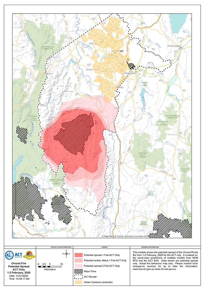
The combined ESA and NSW RFS fire spread prediction map for the Orroral Valley fire on 31 January. Photo: NSW RFS.
ACT Policing’s Chief Police Officer Ray Johnson said police are authorised to move people and vehicles on, particularly if they are blocking emergency service vehicles and evacuation routes.
“Don’t go where you don’t need to go,” Assistant Commissioner Johnson said. “Don’t go to the suburbs close to the fire if you don’t live there.
“Should evacuations happen, police will be there to help during and after the event. We will send additional resources to areas that have been evacuated to help and protect homes.
“As of this afternoon, we intend to increase patrols in the southern part of Canberra as a result of the state of emergency to provide comfort to the community and where people might be considering disaster tourism or anything else.”
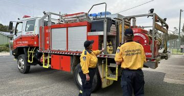
Commissioner Whelan said there are more than 2000 firefighters on the ground, while the ADF has more than 300 people and numerous air and ground assets at work. New Zealand Defence Force personnel are also assisting. Two strike teams from Queensland Fire and Emergency Services also arrived in Canberra yesterday.
Fire crews from Fire and Rescue NSW and the NSW RFS have also arrived. Tankers from Narrabri, Laurieton and Wee Waa have also bolstered the ranks today as conditions deteriorate.
The ADF’s coordinator of the national bushfire response, Major General Jake Ellwood, said ADF helicopters have increased night-time fire spotting, while RAAF P-8A aircraft surveillance are constantly mapping the fire within the Namadgi National Park.
Engineers are supporting fire break tasks, while fire breaks are being constructed to the immediate south of the Canberra suburb of Banks and near HMAS Harman, near Queanbeyan.
ADF teams are also supporting emergency services to assist the doorknocking of residents in Canberra’s south. To date, doorknocking has commenced in Wright, Kambah, Duffy and Greenway. ACT Policing says this is not an evacuation at this stage and personnel are working their way through the suburbs.
The following roads remain closed:
- Angle Crossing at Monaro Highway
- Boboyan Road at the NSW/ACT border
- Tharwa Drive at the Knoke Ave roundabout
- Tidbinbilla Road at Point Hut Road
- Corin Road and Tidbinbilla Road
More information is available on the ESA website, ESA Twitter and Facebook or the NSW RFS Fires Near Me mobile app.