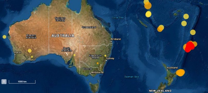
Earthquake activity in the Oceania region overnight included Cootamundra, in the NSW South West Slopes. Image: Geoscience Australia.
If residents near Cootamundra felt the earth move under their feet last night, it’s likely it was due to a 2.5 magnitude earthquake that hit the region.
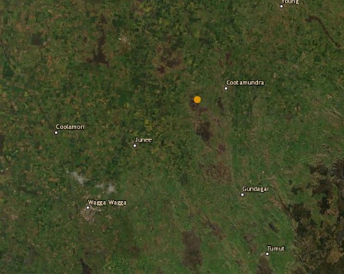
Frampton Road, midway between Cootamundra and Bethungra, was the reported epicentre of the quake, recorded at 1.58 am on Friday, 5 March, but Geoscience Australia seismologist Spiro Spiropoulos said that due to the density of the seismic network, this is an inexact estimate, and it could vary up to five to 10 kilometres.
But wherever it occurred, it was at a depth of 10km, which, according to Mr Spiropoulos, is shallow and likely accompanied by a rumbling sound as the seismic waves propagated across the earth.
With no public-felt reports of the quake, Mr Spiropoulos said it was likely to have occurred in a low-density rural area, but may have been felt in Cootamundra.

The epicentre of the earthquake near Cootamundra on 5 March, although seismologists suggest this data could be inexact. Image: Geoscience Australia.
“It depends how close they were to the epicentre,” he said. “Because it was a small earthquake, they might have heard rattling of windows or the house.”
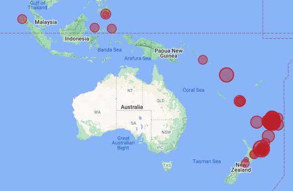
Mr Spiropoulos said the seismic activity was unrelated to the trio of seven-magnitude earthquakes that occurred in the Oceania region overnight – one in New Zealand and two further north in the Kermadec Islands. Additional five-magnitude earthquakes were reported in Tonga and Vanuatu.
“That’s fairly unusual – you don’t get that often,” he said. “But earthquakes are assumed to be a random process and sometimes you can get a bunch of them together.”
Most of the world’s high-level earthquakes happen at so-called plate boundaries – parts of the planet where tectonic plates are pushing against one another – with about 80 per cent occurring around the edge of the Pacific Plate, also known as the ‘Ring of Fire’, which encircles the Pacific Ocean but impacts the north-moving Indo-Australian Plate near New Zealand, Papua New Guinea, the Pacific Islands and South East Indonesia.
Earthquakes still occur from time to time in Australia, with the biggest on record, in 1988, a 6.6 magnitude earthquake in Tennant Creek in the Northern Territory, and the most deadly being the 1989 earthquake in Newcastle with a magnitude of 5.6.
A reported 70 earthquakes have occurred in the Southern Tablelands and South West Slopes region in the past 10 years, equating to roughly one earthquake per year with an average magnitude of two on the Richter scale.

Earthquake activity in the early hours of 5 March at the convergence of the Indo-Australian and Pacific tectonic plates. Image: Supplied.
2020 was the black sheep year, with two magnitude 3.3 earthquakes recorded – one near Yass in August 2020, and another at Gundagai in November 2020.
The largest earthquake on record for the area was estimated to be a magnitude 5.6 in 1934, near Gunning, followed closely by a magnitude 5.3 earthquake occurring at Lake Eucumbene, near Adaminaby, in 1959.
“I guess there is a history of larger earthquakes in the area,” said Mr Spiropoulos.
Seismic activity near Canberra is much higher, with the city one of the highest rated in terms of earthquake hazard because of its proximity to one of Australia’s most active faults, on Lake George, which is roughly 75km long.
On average, that area experiences 10 earthquakes per year, with a magnitude range of 1.1 to 2.8.
Only 15 earthquakes have been estimated to be greater than magnitude five since 1886.
Original Article published by Edwina Mason on About Regional.


