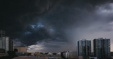
Up to half of October’s average rainfall could fall on Thursday. Photo: Michelle Kroll.
Packing the picnic basket and dusting off the camp chairs in readiness for when the ACT lockdown lifts on Friday morning? You might need to revisit those plans.
There is a very high chance of heavy showers and possible thunderstorms for Canberra this week, according to the Bureau of Meteorology (BOM).
Thursday, in particular, is expected to see up to 25 mm of rain, or half the ACT’s average rainfall for October.
A high-pressure front is slowly moving up over the Great Australian Bight, on track to drop up to 50 mm of rain and explosive supercell thunderstorms across regional parts of Victoria and NSW.
There is also the possibility of tornadoes developing over north and north-eastern Victoria and into southern inland NSW specifically.
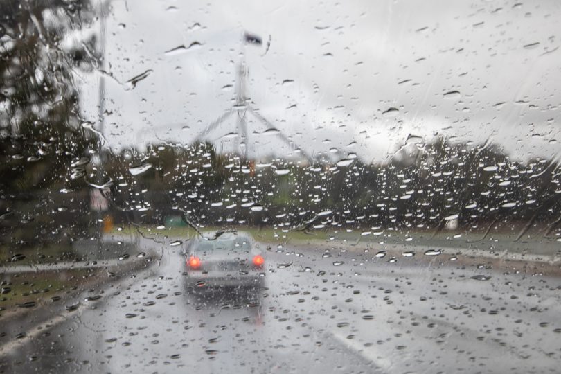
The front has reached the ACT (13 October), covering our skies with clouds and drizzle. Between 2 and 5 mm is expected to fall throughout the afternoon and into the evening.
There is a chance of a thunderstorm moving in overnight, although the Riverina and Western Slopes are more likely to have already taken the ‘heat’ out of this.
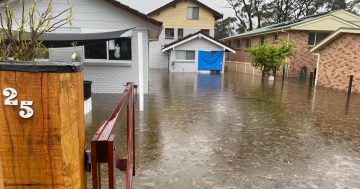
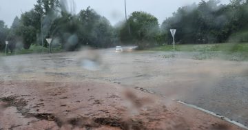
Thursday is the day the front will arrive in force, with a near 100 per cent chance of heavy showers, with the potential for flash flooding.
A thunderstorm is likely, and keep a lookout for a severe thunderstorm with damaging winds and hail.
On Thursday, winds will range from 15 to 20 km/h but will speed up to 35 km/h towards the end of the day. Snow is expected to fall above 1500 metres.
“Thursday will be dynamic, so there’s a good chance we’ll see 25 mm of rain, if not more,” a BOM forecaster told Region Media.
“There will still be a lot of cool and unstable air associated with these fronts around on Friday, so there’s still the chance of storm and heavy showers then.”
Expect to see 3 to 6 mm of rain and strong gusts continuing across Friday. Snow will fall from 1200 metres.
The maximum daytime temperatures will also rise, with a high of 17 degrees Celsius predicted today and 18 on Thursday, before dropping off to 13 on Friday.
The drizzle will have scurried off by noon on Saturday, leaving a partly cloudy Sunday and a high of 18 degrees. Similarly, balmy days will continue throughout next week.
As at 10 am this morning, no severe weather warnings for the ACT have been issued.
The BOM released its Severe Weather Outlook yesterday, warning Australians of an average or slightly above-average cyclone season across the north-east.
The outlook also outlines the risk of severe thunderstorms, heatwaves and bushfires, and is released in early October every year and looks ahead to the end of April, when the high-risk weather season in Australia officially ends.
Senior Climatologist with the BOM Greg Browning said while severe weather could occur at any time of the year, we are now entering Australia’s peak high-risk weather season.
“This summer, with above-average rain, more cloud and higher humidity, the number of individual extreme heat days are likely to be lower than we’ve seen in recent years,” he said.
“But the potential for bushfires and severe storms remains near average.
“It’s also a timely reminder for all of us to follow the advice of local emergency services before, during and after severe weather.”