The blossoms were out early across the ACT in an unusually warm August. Photo: Michelle Kroll.
The ACT is looking at a warmer and wetter than average spring and the Bureau of Meteorology (BOM) is now on La Nina watch after a winter with a split personality.
The second-warmest August on record, with a median temperature of 16.7 degrees driven by westerly winds and high pressure, lifted the overall mean minimum and maximum marks to be above average.
One has to go back 42 years for Canberra’s warmest August, in 1982.
BOM climatologist Hugh McDowell said while the first two months of winter were the coolest for about a decade, the warming trend continued.
“So although it’s much cooler than we’ve seen in recent times, actually, compared to the historical record, even those early months were kind of average to above average,” he said.
The mean daily maximum temperature for Canberra Airport was 14.0 degrees Celsius, 0.6C above the long-term average of 13.4C. The mean daily minimum temperature was 1.0C, 0.2C above the long-term average of 0.8 °C.
It was a relatively dry winter with rainfall below average from June to August across the Territory.
While some fear the early spring may portend a long, hot summer ahead, Mr McDowell said this was not necessarily the case.
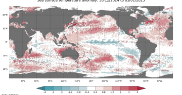
At present the climate drivers were neutral, but there were warmer than average temperatures in the Tasman Sea that would provide a little more moisture and heat in the atmosphere for spring.
“The forecast for Canberra and the ACT region is yes, there’s an increased chance of warmer than average conditions,” Mr McDowell said.
“It’s not a hugely strong signal, 60 to 70 per cent above the median maximum and minimum temperatures.”
There was also more chance of above median rainfall than dry conditions.
“There will be some dry periods, but it’s likely to balance out a little bit wetter,” he said.
There was double the chance a La Nina, generally associated with wet conditions, could develop, and that would bring rain from the east.
“But that is still only a 50 per cent chance, so there’s still 50 per cent chance that we’ll see neutral conditions,” Mr McDowell said.
“So I would say the forecast is balanced on a chance of La Nina and also those increased temperatures in the Tasman.”
But the forecast for increased temperatures was “likely a bit of a climate change signal” as this was happening year on year.
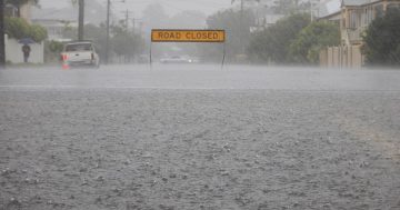
If the ACT remained in neutral conditions, that didn’t mean a less hazardous spring and summer because there could be an increased risk of severe thunderstorms.
“So you might lose the widespread increased risk of widespread rain, of widespread flooding. But you can actually see increased risk of individual thunderstorms and damaging wind events with small-scale thunderstorms and hail and flash flooding,” Mr McDowell said.
“So whichever way you go with those drivers, it can give you a different risk profile, but not necessarily a lesser risk profile.”
Mr McDowell said the winter produced patterns that the bureau had not seen before, and forecasting was becoming increasingly difficult.


