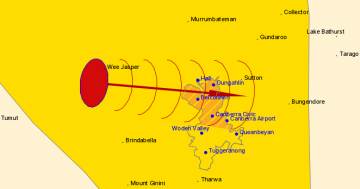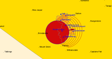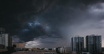
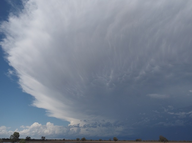
Storm cells with hail and damaging winds are likely across the region today. Photo: Supplied (BOM).
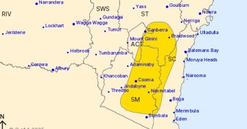
UPDATED: The Bureau of Meteorology (BOM) has forecast possible large hail and severe thunderstorms across the ACT and southern region of NSW later today.
The BOM issued a severe thunderstorm warning at 3:00 pm, saying severe thunderstorms are beginning to develop and are likely to produce damaging winds in the warning area during the next several hours.
Locations which may be affected include Nowra, Bowral, Braidwood, Goulburn, Yass and Nerriga.
BOM meteorologist Helen Reid said the storm cells could develop quickly and unleash damaging winds and heavy rainfall, including the possibility of large hail.
Ms Reid said further warnings may be issued as the storm cells develop during the day.
“We are definitely expecting to have thunderstorms develop through the ACT and south-east of NSW today,” Ms Reid said.
“These thunderstorms do have the possibility of being severe, with damaging wind gusts and there might even be some hail and heavy rainfall in places.
“We’re not expecting that to be a feature until sometime this afternoon. It is too early to say when as thunderstorms have a very short life cycle, but we’ll be watching them very keenly during the day.”
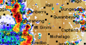
Severe #thunderstorms are likely across the ACT today. Watch out for warnings, and take precautions against possible large #hail, damaging #wind gusts and heavy #rainfall. https://t.co/ywrW2UFlZ4 pic.twitter.com/BePxKIGQrc
— Bureau of Meteorology Australian Capital Territory (@BOM_ACT) February 17, 2020
Ms Reid said a trough line with a low-pressure system is moving across the south-west of NSW today, which is mixing with a humid airmass from northern Australia.
Heavy rainfall of between 20 and 50 mm can be expected as the low-pressure system forms off the NSW coast later today. Wave heights of between 3 and 5 metres along the NSW South Coast are also forecast for Wednesday and Thursday as the low-pressure system moves out to sea.
“We’re expecting a lot of the storms to develop along the ranges and that could easily bring a lot more thunderstorm activity later today,” Ms Reid said.
“We’re looking at a very tropical atmosphere at the moment. It’s very humid and fairly warm which is very typical for this time of year. That all helps provide energy for the development of thunderstorms, and the trough moving through will also help.”
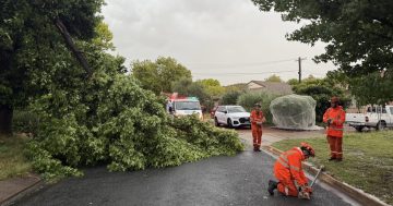
ACT Emergency Services Agency (ESA) Commissioner Georgeina Whelan said yesterday that the ESA had responded to more than 600 requests for assistance following heavy rainfall and storms over the past week. This was in addition to more than 2500 tasks that had been completed following Canberra’s horror hail storm on 20 January.
Ms Reid said the forecasts at the BOM definitely include the possibility of large hail and the development of ‘supercell’ storms later today, most likely in the afternoon or evening.
“We are expecting damaging wind gusts to be more of a feature today, but we can’t rule out the possibility of some large hail. Supercells may well form, but we do need to see how the day progresses, and if the environment is right for that kind of dynamic to occur,” Ms Reid said.
“People should definitely keep an eye on the immediate forecast later today.”