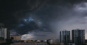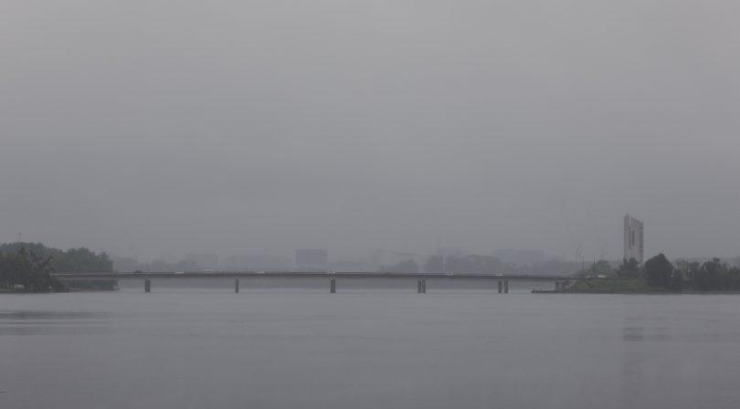
Poor visibility on Kings Avenue Bridge due to heavy rain in Canberra last month. Photo: Michelle Kroll.
The stop-start beginning to summer may be the weather pattern for the season, as again, after a brief dry period and a gradual increase in temperature, the Canberra region is preparing for more rainy days.
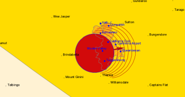
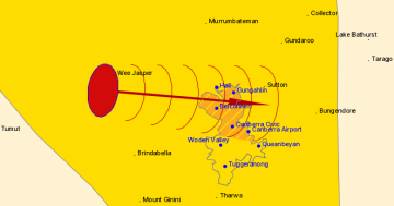
Senior meteorologist at the Bureau of Meteorology (BOM) Agata Imielska said that with everything being so wet at the present time, it’s creating increased humidity which “acts as a fuel that then increases our chances of thunderstorms”.
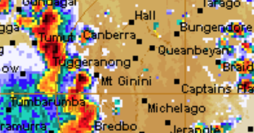
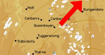
As it was with the previous rain events, this rain is the result of the broad low-pressure trough moving across the region, combined with the humid air coming down from northern Australia.
“We’ve had these back-to-back weather systems that have moved through, the broad low-pressure trough that’s moving across the state, it’s really acting as a trigger for potential for rain and thunderstorms as well,” said Ms Imielska.
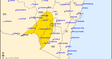
Rainfall today (7 December) will depend on whether thunderstorms arrive or not. Heavy rainfall is expected, especially over Wednesday and Thursday, and possibly into Friday. It’s expected to clear up again on the weekend, but the temperature will hover around the low 20s.
Addressing the potential for floods in the region, Ms Imielska said the community should be “keeping a close eye” on their surrounding environment over the next few days and check flood alerts from the BOM.
“The broad message is the region as a whole is wet, and even if there are places that aren’t necessarily flooding right now, it would just take some more substantial rain falling on that particular catchment that could then generate either flash flooding or regular river flooding,” she said.
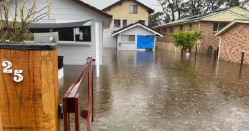
A catchment of interest over the next few days is the Murrumbidgee River, with the river likely to reach 7 metre deep levels by mid-December over parts of the Riverina.