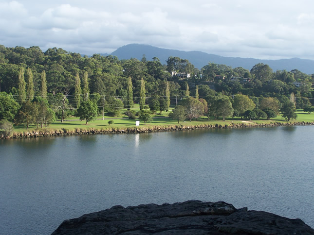
An alternative to the usual migration of Canberrans to Batemans Bay and further south is to focus on the Shoalhaven River area and also Jervis Bay.
The much improved road from Bungendore via Tarago, Nerriga and past the HMAS Albatross naval base brings you to the thriving regional town of Nowra picturesquely situated on the Shoalhaven River.
Although totally sealed, the section between Tarago and Nerriga needs care as parts are rather narrow and the sealed surface often seems to break up – there are plenty of heavy vehicles at times.
The pub at Nerriga is a popular stopping point. To me it always seems so remote but is often quite busy. It is a classic old bush pub.
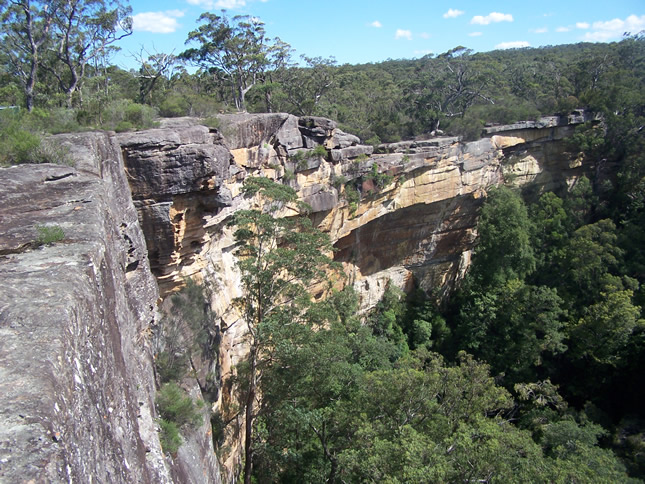
Just past Nerriga take the turnoff to view Tianjara Falls, which plummet from the escarpment into a deep gorge. Unfortunately every time I have stopped it has been nearly dry but it would be spectacular after rain. Further on another (unsealed) side road takes you (4km each way) to Jarrawangala Lookout from which you get fantastic views down to the coast. Wedge-tailed eagles often soar above the escarpment.
Nowra has developed rapidly in recent years with many retirement enclaves close by in towns such as Gerringong and trendy Berry. It has all the facilities of a modern regional town, good shopping, cafes and restaurants and a couple of hospitals.
The Shoalhaven River flows through the town (which is on the Princes Highway) and a pleasant way to while away a few hours is to join one of the scheduled Shoalhaven River Cruises from Nowra Wharf (close to the bridge across the river) either upstream to Red Rock or downstream to Greenwell Point.
I really like the area along the southern shore of the Shoalhaven River out to the Pacific Ocean. The land is very flat and rich pasture for cows. Huge herds always seem to be on the go to and from their milking sheds and a quaint sight is what look like lots of dog kennels but are actually protection for calves in colder months.
A diversion takes you by vehicle punt across the river to Comerong Island which is a great place for walks. Close to the mouth of the river where the smaller Crookhaven River merges is the pretty village of Greenwell Point. A couple of excellent fish and chip shops are a good stopping point.
Turning off the road to Greenwell Point at Pyree the road heads out to a number of smaller communities. Culburra and Currarong both face out to the Pacific Ocean and have become dormitory ‘towns’ for Nowra. The beaches are excellent and at both there are many signposted walks especially out to Beecroft Head at Currarong.
At the southern end of the promontory near Currarong is Point Perpendicular with stunning views to Jervis Bay from the lighthouse (the building is closed). The gravel road to the lighthouse is not great and at times the road is closed because of Naval gunnery training exercises.
There are a couple of communities on the northern rim of Jervis Bay, Callala Bay and Callala Beach and both are good spots for swimming or kayaking. The road ends at Myola which is cut off from the rest of Jervis bay (Huskisson and Vincentia area) by a narrow creek.
If you want to return to Canberra by a different route then the scenic drive through Kangaroo Valley past Fitzroy Falls brings you to Moss Vale and from there back along the Hume Highway. Nowra is next to Bomaderry which is the end of the South Coast railway line so Sydney is possible for a day’s excursion without the hassle of a car.
Pictured at top, view along the Shoalhaven River to Great Dividing Range. Above, Tianjara Falls near Nerriga. Photos: Roger Allnutt
