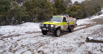
The Bureau of Meteorology is warning of a monster cold front coming through tomorrow:
Increasing northwest winds ahead of a strong cold front expected to move through southeastern New South Wales during Tuesday.
Destructive winds averaging 80 km/h with peak gusts around 130 km/h are forecast for parts of the Southern Tablelands and Snowy Mountains forecast districts above 1900 metres.
Alpine Peaks may experience winds averaging 100 km/h with peak gusts around 160 km/h
Damaging winds averaging 60 km/h with peak gusts around 95 km/h are forecast to develop this evening and overnight in the parts of the Australian Capital Territory, Metropolitan, Northern Tablelands, South Coast, Illawarra, South West Slopes, Hunter and Central Tablelands forecast districts.
The State Emergency Service advises that people should:
— Move vehicles under cover or away from trees.
— Secure or put away loose items around your house, yard and balcony.
— Keep clear of fallen power lines.For emergency help in floods and storms, ring your local SES Unit on 132 500.