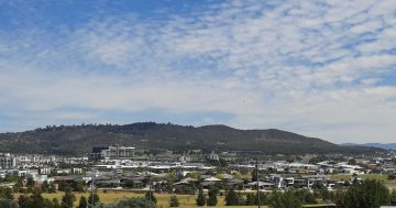
Looking down at the Tuggeranong Town Centre from Urambi Hills. Photo: Glenn Schwinghamer.
This week, the Federal Government signed off on a change to the National Capital Plan to bring the total number of the ACT’s town centres to six.
Molonglo Valley, made up of the suburbs of Coombs, Wright, Denman Prospect, Whitlam and Molonglo, joins a list that currently includes Gungahlin, Belconnen, Weston Creek, Woden and Tuggeranong.
ACT Labor says the reclassification from a group centre to a town centre opens more doors for commercial development in the area.
It expects Molonglo Valley will eventually include homes for more than 80,000 people, on top of a dedicated police station, library, community centre, child and family centre and “flexible working hub for ACT Government employees to work closer to home”.
On the other side of the political aisle, there’s talk of yet another town centre.
Included in their plan to deliver 125,000 new dwellings in the capital by 2050 – when the ACT’s population is expected to hit 700,000 – the Canberra Liberals will clear Kowen Forest, north of Queanbeyan, to establish a new town centre with 100,000 homes.
The party has also promised to address a long-standing planning feature with one we already have.
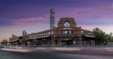
Unlike any of Canberra’s other town centres, Tuggeranong’s isn’t actually located in the centre. It sits well off to the western side.
But it was never meant to be this way.
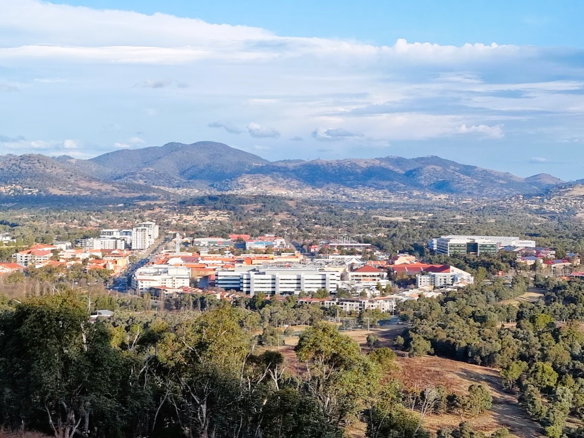
Tuggeranong as it appears today. Photo: Screenshot, Google Maps.
According to resident historian Glenn Schwinghamer, the original masterplan for the ACT’s southernmost district, developed by the National Capital Development Commission (NCDC) in the early 1970s, included suburbs on the other side of the Murrumbidgee River.
“The original idea was to have the Tuggeranong Parkway sweep around behind Urambi Hills and down the Kambah Pool Road alignment, and down along to where the town centre is today, with a parkland spine along both sides of the river,” he says.
“And they had two bridges that would cross the Murrumbidgee.”
This would put the Tuggeranong town centre bang in the middle, complete with the lake and medium-density retail, office, entertainment, and hotel/motel areas that together would “provide employment opportunities for 70 per cent of Tuggeranong’s workforce” – at least according to Tuggeranong: A Guide for Residents, published by the NCDC in 1974.
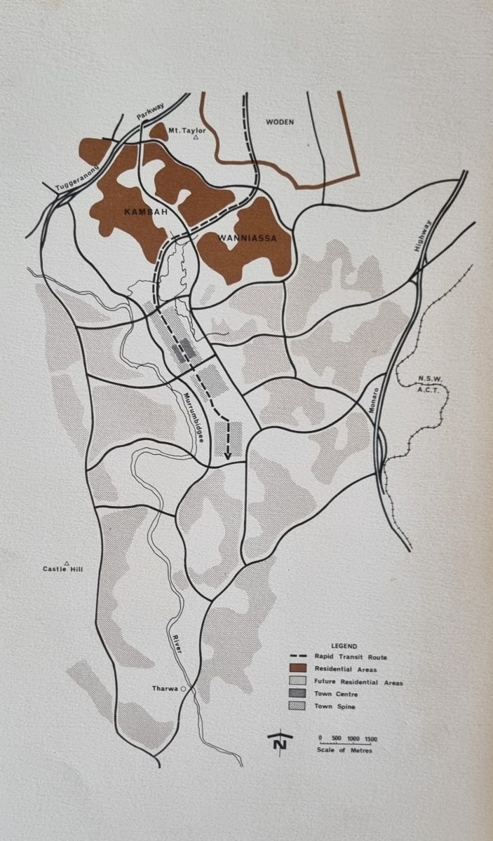
Tuggeranong, as the original plans would have it (note how Tuggeranong Parkway crosses the Murrumbidgee River). Photo: Tuggeranong: A Guide for Residents, National Capital Development Commission (NCDC).
With their latest pitch, the Canberra Liberals aren’t quite promising a revisit of this, but the party has mentioned a “feasibility study”.
The ACT Government ruled it out more than a decade ago, largely based on a report from the former Territory and Municipal Services (TAMS) department.
“West Murrumbidgee should not be considered for development as it contains significant areas of yellow box and red gum grassy woodland endangered ecological community and secondary grassland,” TAMS wrote to then Planning Minister Andrew Barr in 2010.
“In addition to the conservation values, TAMS has also highlighted the fire risks associated with development in this location.”
Last year, the government confirmed with Region that development over the river was still off the cards due to “the huge costs of development”.
“It is also important that we maintain a buffer between the urban fringe and Namadgi National Park,” the spokesperson added.
Glenn agrees the original plans never materialised due to the cost of infrastructure – “it’s not exactly flat territory over there” – as well as what would happen “if you have a fire coming off the Bullen Range and you have to evacuate everyone across the river over the two bridges”.
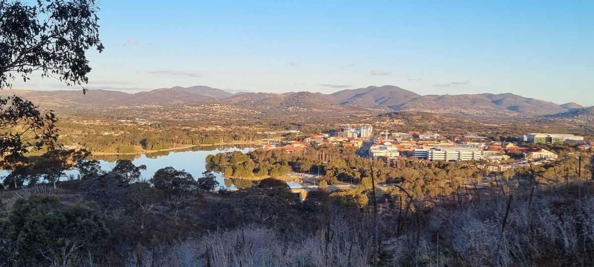
Tuggeranong town centre and lake, viewed from Urambi Hills. Photo: Glenn Schwinghamer.
There’s also the matter of what to do when you double Tuggeranong’s sewerage.
At the moment, the current line to the Lower Molonglo Water Quality Control Centre (LMWQCC) near Holt in Belconnen is enough, but add extra pressure from the bottom end of the ACT and chances are a whole new treatment plant would have to be built.
“The river is a potable water source for a lot of areas downstream, and putting in sewerage infrastructure would have to consider that,” Glenn adds.
As it stands, the most recent population projections put most of the ACT’s growth in the city’s north, across Gungahlin, Belconnen, North Canberra and Molonglo Valley.
The latter is expected to grow 5 per cent every year between now and 2060.
Tuggeranong, currently Canberra’s second-largest district, has a zero per cent growth forecast. Now home to just under 90,000 people, it’s expected to stay that way up to 2060, with likely even a small drop in population.