1 June 2011

Ginninderra Drive - road to nowhere

| nobody
Join the conversation
23

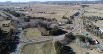
Ginninderra Drive begins in Dunlop and travels East for 6.5km until it stops just 500m before it would reach Northbourne Avenue. Most major roads continue until they intersect with another major road, but this road just meanders into Mouat Street.

I used to assume it was to be extended that last 500m when the traffic increased, or when the land became available, or when the funds where found, but it appears it will always just stop a little short. Does anyone know why this was left as a road to nowhere?

Join the conversation

23
All Comments
  • All Comments
  • Website Comments
LatestOldest

00davist said :

Holden Caulfield said :

Ginninderra Drive is only 6.5km long?!

Did the real estate agent tell you it would only take 15 minutes to commute to Civic too?

I’d say it would be close enough to double that, so Maybe 12-13km? Definatly no less than 10!

Google Maps says 12.1 km

Holden Caulfield5:09 pm 02 Aug 11

Chop71 said :

Keijidosha said :

There were plans to “fix” Kuringa Drive that went right through to survey pegs being driven, but ground was never broken.

The current extension of Claire Hermes Drive almost demands further upgrades to Kuringa (especially the intersections with Owen Dixon and Kingsford Smith), however I have no doubt our incompetent road planning/funding system will ensure that it will take a fatality or two before significant improvements are made.

Considering the accidents and deaths on that road, you would think the road planning/funding system would have it at a higher priority …. or maybe they are just waiting for the next fatality

Put in a speed camera. Everyone wins, haha!

Holden Caulfield said :

Ginninderra Drive is only 6.5km long?!

Did the real estate agent tell you it would only take 15 minutes to commute to Civic too?

I’d say it would be close enough to double that, so Maybe 12-13km? Definatly no less than 10!

Holden Caulfield2:58 pm 02 Aug 11

Ginninderra Drive is only 6.5km long?!

Did the real estate agent tell you it would only take 15 minutes to commute to Civic too?

Keijidosha said :

There were plans to “fix” Kuringa Drive that went right through to survey pegs being driven, but ground was never broken.

The current extension of Claire Hermes Drive almost demands further upgrades to Kuringa (especially the intersections with Owen Dixon and Kingsford Smith), however I have no doubt our incompetent road planning/funding system will ensure that it will take a fatality or two before significant improvements are made.

Considering the accidents and deaths on that road, you would think the road planning/funding system would have it at a higher priority …. or maybe they are just waiting for the next fatality

Keijidosha said :

I have no doubt our incompetent road planning/funding system will ensure that it will take a fatality or two before significant improvements are made.

Sad but true

There were plans to “fix” Kuringa Drive that went right through to survey pegs being driven, but ground was never broken.

The current extension of Claire Hermes Drive almost demands further upgrades to Kuringa (especially the intersections with Owen Dixon and Kingsford Smith), however I have no doubt our incompetent road planning/funding system will ensure that it will take a fatality or two before significant improvements are made.

Keijidosha said :

Douglas Waterhouse Drive will eventually be connected to Kuringa Drive. 😉

Any chance they will straighten Kuringa Drive?

Gerry-Built said :

About 8-10 years ago, as the newer parts of the far West Belconnen expansion were being discussed and planned, there was discussion about extending the Dunlop end of Ginninderra Drive around the back of Dunlop and Fraser, to connect up to Karinga Drive. The was also discussion during the planning of MacWest, to throw a road off Ginninderra Drive to veer left, behind Mac West, joining Parkwood Road…

From memory of the plans that came across my desk, the plan was for Ginninderra Drive to wrap around Jaramlee Park (to the left), and follow the path of Old Charnwood Road across to Parkwood Road. AFIAK there were no plans for it to curve right, as this would have taken it straight into Dunlop Ponds or across the ACT border. Besides, by that stage Kerrigan Street was already joined to Ginninderra Drive, making a right-turning alignment redundant.

Douglas Waterhouse Drive will eventually be connected to Kuringa Drive. 😉

screaming banshee said :

You’ve got it backwards, Gin drive starts at Lyneham….nowhere is at the other end.

About 8-10 years ago, as the newer parts of the far West Belconnen expansion were being discussed and planned, there was discussion about extending the Dunlop end of Ginninderra Drive around the back of Dunlop and Fraser, to connect up to Karinga Drive. The was also discussion during the planning of MacWest, to throw a road off Ginninderra Drive to veer left, behind Mac West, joining Parkwood Road…

screaming banshee10:22 pm 01 Aug 11

You’ve got it backwards, Gin drive starts at Lyneham….nowhere is at the other end.

This is all very interesting, thanks, and there is a lot of good info with the users of this site.

Moat St was the Barton Highway years ago – I see, and the Old Canberra Inn was then on the main road (or dirt track) to Yass.

Extending to Northbourne at Swindon – This would make sense, and with an intersection similar to the Barton Highway and Northborne.

Surprised at the bottleneck – me too, which is what prompted me to ask.

Government head in the sand – yes I agree, see and hear little, then act surprised when the obvious is pointed out.

Yowani is no in the middle of the corridor – whoever allowed this may have enjoyed their golf too much.

Ryan said :

The map on this bus timetable from the late 1970s may help:

http://actbus.net/gallery/main.php?g2_itemId=14256&g2_imageViewsIndex=1

Whilst the alignment is no different, it shows Ginninderra Dr also formed what is now Mouat St.

Or that whoever made the map didn’t know any better.

Most major roads continue until they intersect with another major road ..
Mouat St was once the Barton Highway. (The road we now know as Barton Highway used to be a minor road called Dunsmore St.) So it does/did intersect with a major road.

The playing fields at Southwell park are a flood mitigation area. Thus the grassy banks and concrete overflow culverts.

You mean… the ACT Government planned something for a reason…! Oh, nope, that was before self-govt.

The map on this bus timetable from the late 1970s may help:

http://actbus.net/gallery/main.php?g2_itemId=14256&g2_imageViewsIndex=1

Whilst the alignment is no different, it shows Ginninderra Dr also formed what is now Mouat St.

There was always a corridor avaiable to extend Ginninderra Drive through to Northbourne at the intersection of Swinden Street. However someone allowed Yowani to build a motel smack bang in the middle of that corridor, and now the remaining section is being turned into a combination of car park and artificial wetlands.

I think the ultimate resolution for the benefit of traffic flow will be to modify the intersection of Ginninderra Dr and Moatt Street to prioritise Belconnen traffic, and block cross-stream access to Moatt from Archibald and Goodwin Streets.

Or the Government will just stick their heads in the sand and ignore the issue.

ACTPLA Maps isn’t much help (http://www.actmapi.act.gov.au/framesetup.asp). It shows what could be a road reservation across the western half of the intervening land, but nothing similar on the eastern half running across to Swinden St.

Isn’t there the beginning of a continuation of Ginninderra Drive on the other side of Mouat? I always assumed it was intended to finish it but they never got around to it… Bloody sport gets in the way of everything in this country…

Must have been a fold in the plans. It could have been an issue crossing what is now the playing fields as they are a huge flood area?

Surprised at that bottleneck too.

One doesn’t have to use much imagination to think of a realignment of the intersection with Mouat Street where Gin. Drive just flows into the Mouat-to-Northbourne section in one long curve, with the Mouat section through North Lyneham essentially hitting a T-Intersection (with lights, of course, for the Kaleen/North Lyneham-ites).

Don’t know why it ends there but that is the way the road was designed. An extension has never appeared on any Territory’s plans even those from when the road was built.

Besides if it did run through where would it come out, considering the sporting facilities on the other side and the close proximity to the intersection of Moat and Northborne?

Daily Digest

Want the best Canberra news delivered daily? Every day we package the most popular Riotact stories and send them straight to your inbox. Sign-up now for trusted local news that will never be behind a paywall.

By submitting your email address you are agreeing to Region Group's terms and conditions and privacy policy.