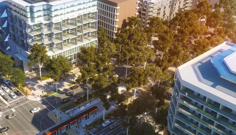
The City and Gateway Draft Urban Design Framework proposes higher building limits for the Northbourne corridor. Images from the Framework.
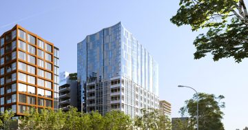
The ACT Government wants to lift building heights along Northbourne Avenue light rail corridor to a maximum of 48 metres and allow the development of 37,000 new dwellings as part of an overall growth plan for the main gateway to the capital.
The City and Gateway Draft Urban Design Framework released jointly by the ACT Government and the National Capital Authority for comment says the population of the city and gateway study area, currently about 54,000, is projected to reach 71,000 by 2030.
It has identified underutilised sites for renewal, including the surface car parks in the City Hill precinct around London Circuit and vacant land adjoining Parkes Way, and says two-thirds of development facing Northbourne Avenue is yet to reach the intended 25m building height.
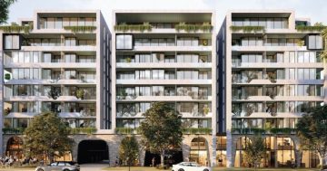
The Framework says future development is likely to be mainly multi-unit housing along the corridor and at commercial centres.
It envisages a three-phase approach to the city, growing in development intensity with higher buildings allowed at key intersection nodes.
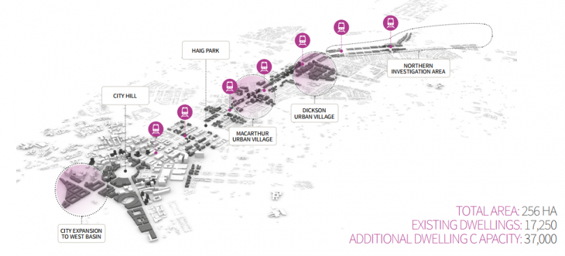
Where the development is proposed.
Between Exhibition Park and Antill Street building, heights are set at 8.5m, 12 and 18m, with 22m allowed at the Phillip Avenue light rail stop. From Antill Street to the City, heights increase to 25m plus 10 per cent, with 32m on the Dickson side of the Antill Street intersection and 48m at the Macarthur Avenue intersection.
The three precincts are the bushland Approach Route from the ACT border to the intersection of the Federal Highway with Flemington Road; the Informal Park Boulevard from Flemington
Road to Antill Street, characterised by a wide planted verge with a mix of endemic and introduced species with buildings visible through gaps in the tree line; and the Avenue, a strong urban boulevard from Antill Street to City Hill.
The Framework sees up to 11,000 new dwellings being developed under existing controls, 4000 from increased building heights, 8000 in an expanded city centre, including the city to the lake project, 6000 on key Government sites and 8000 in the Northern Investigation area covering the racecourse and Exhibition Park.

Proposed building heights for the corridor.
It envisages urban villages in Dickson and Macarthur to take advantage of light rail light and provide convenient higher-density housing, small-scale retail and employment opportunities.
It proposes an integrated transport system that incorporates walking and cycling paths and tracks, and diverts through traffic from Northbourne Avenue to alternative routes.
Car parking should be out of sight either in basements or screened from view by occupiable floor space.
The Framework also envisages recreational parks in strategic locations such as Haig Park and Sullivans Creek.
Implementation of the Framework will require changes to the National Capital Plan and Territory Plan.
To view the Framework and have your say, go here.