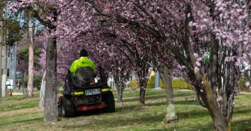
Treasure this taste of spring while it lasts, says the Bureau of Meteorology. Photo: Michelle Kroll.
Canberrans can look forward to weather that’s “a little bit more spring-like” this weekend, but it may be too early to ditch the puffer jacket.
Bureau of Meteorology (BoM) community information officer Morgan Pumpa told Region the ACT is set to welcome warmer temperatures over the next few days.
“We’ve got a top of 18 degrees in Canberra [on Friday, 23 August], and we’ll see above-average temperatures across NSW,” she said.
Over the weekend, for both days, the forecast is for a minimum of 5 and a high of 20 in Canberra, according to the BoM.
“When we look at Canberra’s average temperature for August, it’s 13.5, so it’s around six or seven degrees above average,” Ms Pumpa said.
“20 degrees is more of an October temperature.”
These warmer conditions will also be enjoyed in parts of coastal NSW, with Moruya and Bega to reach a high of 25 on Saturday.
Ms Pumpa said the forecast came as northern parts of South Australia, southern parts of the Northern Territory and south-west Queensland were all predicted to reach record maximum temperatures for August.
“It is expected to be very warm this weekend across many parts of the country,” she said.
“Perth is seeing a bit of a cold front coming in, but that’s the only area that isn’t seeing these above-average temperatures.
“Otherwise, this above-average temperature weather from our northerly airflow is bringing us the chance of some showers and an increase in wind.”
Ms Pumpa said the Bureau was also keeping an eye on wind conditions, with a Marine Wind Warning issued for Eden on the NSW South Coast.
“We have a quick succession of [a] frontal system ridge, and then we’ve got a cold front towards the end of the weekend,” Ms Pumpa said.
“Things are moving quite quickly, which is a little bit more spring-like.”
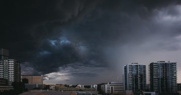
Ms Pumpa said that over the weekend, parts of the state may also see thunderstorms.
“Because we’ve got all this warm air, and we do have that change coming through as we get to the later part of Sunday, we’ll get more of that cold air coming up,” she said.
“With those above-average temperatures and the warm air, they’ll combine and bring some unstable conditions. Any thunderstorms will probably be to the west of Canberra, probably over the border with Victoria. Maybe we could see that for the southern parts of the Riverina.”
While it was too early to make detailed forecasts of spring-time weather, Ms Pumpa said, “For the most part, there’s nothing that’s going to stand out in that September-October [window]”.