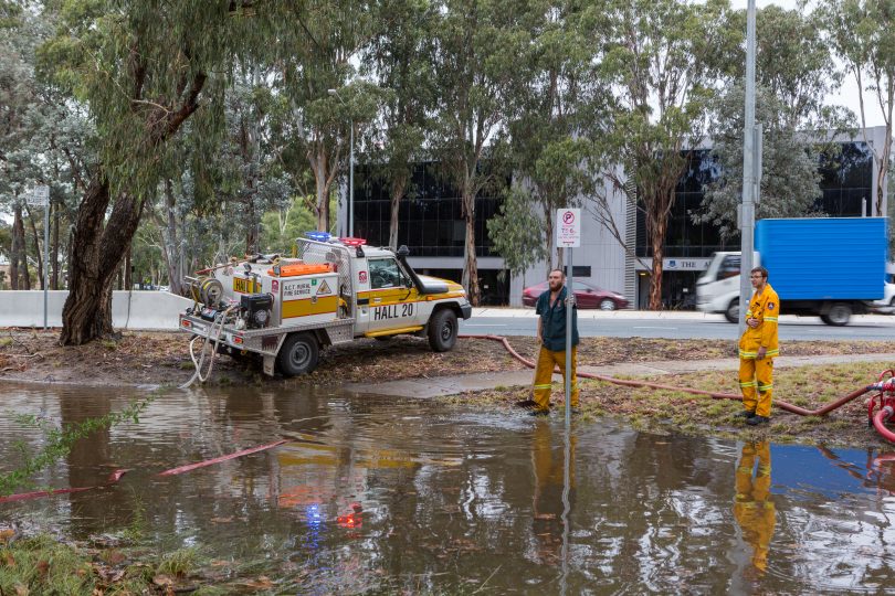
An RFS crew in floodwaters near the ANU after February’s deluge. Photo: Jack Mohr.
New flood maps now available online will help the Government manage the ACT’s stormwater system, plan for new developments and prepare for any emergency, as well as show the community where they may be at risk of being affected by a flood.
The updated maps, at www.actmapi.act.gov.au, show the flood risk is low in the ACT but identify which areas are more likely to be flooded during a major flood event, known as a 1% Annual Exceedance Probability (AEP) flood – previously referred to as a 1-in-100 year flood. They include comprehensive information on the probable depth and relative hazard of the water during a 1% AEP flood, down to the individual block level.
About 150 buildings across Canberra, and some public infrastructure such as roads, are at potential risk of flood damage during a 1% AEP flood, and letters have been sent to all residents and businesses on at-risk blocks.
The ACT’s emergency services will also benefit from the maps, which will guide their planning and preparations for any significant flood event, the last of which was in February.
The maps are the result of a major review and re-assessment of flood levels for eight ACT catchments. The latest technology has been used, providing greater accuracy and comprehensive predictions of flood paths and flood extent in the catchments.
The flood studies, funded from an Australian Government grant under the Natural Disaster Resilience Program with matching contributions from the ACT Government, are a joint initiative of the Environment, Planning and Sustainable Development Directorate and the Emergency Services Agency.
Minister for Planning and Emergency Services Mick Gentleman said that while the updated maps did not reveal any new areas at risk, they would help the Government to identify where mitigation works may be needed in new developments and suburbs, as well as major infrastructure projects.

The updated flood map showing flood extent, depth and hazards.
He said developers would need to reference the maps to ensure they took any flood risk into account.
EPSDD Executive Director Ian Walker said modelling was conducted around heights of properties and flow of water across all ACT catchments.
“The modelling was then verified by people actually going out on to the ground measuring the heights of floorboards on people’s dwellings so there’s a sense of exactly where floods may occur and the likelihood that a house may or may not be inundated,” he said.
“It is important that everyone understands where flood risks are and therefore developers or anyone else will know exactly where floods are likely to occur in that 1-in-100 year scenario.”
He said there was no concern around major stormwater system failures. “The issue is making sure our maintenance regime keeps stormwater drains clear of rubbish, debris and other things, to ensure that they flow appropriately in those storm events,” he said.
Chief Officer of the ACT State Emergency Service, Georgeina Whelan said key areas were near waterways including Jerrabombera Creek, Sullivans Creek, Molonglo River, and the Murrumbidgee River.
Increasing urban density and more extreme weather events due to climate change were factors contributing to the flood risk.
“We have a very good understanding now of the lay of the land across the ACT and how we would best respond depending on the cause of the flooding,” she said.
But she said it was important that the community prepared well, cleaning out gutters and managing their own stormwater drains.
Upcoming drop-in sessions at locations across Canberra will also provide people with the chance to speak with representatives from the Emergency Services Agency, the EPSDD and the Insurance Council of Australia about keeping safe and preparing for the possibility of flooding in an area.
SES volunteers will also doorknock at-risk areas in the New Year to advise residents about being prepared.


