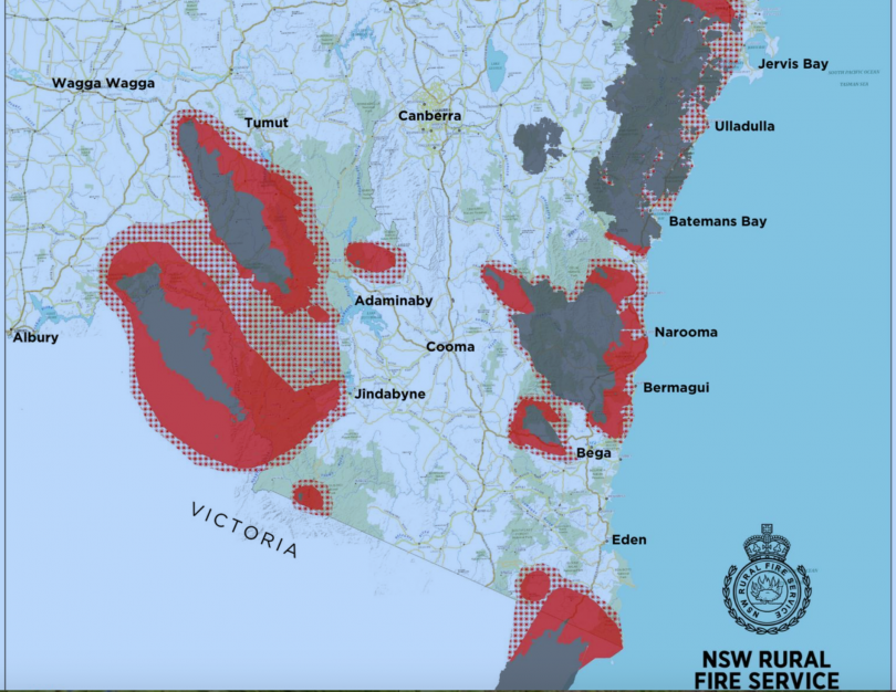
RFS fire spread predictions for Saturday. Image: Supplied.
The South East NSW region is readying itself for a day of extremes when fire is predicted to hit the South Coast, Snowy Valley and Monaro. Meanwhile, the ACT waits to see whether blazes reach the Namadgi National Park. Genevieve Jacobs has the latest advice and warnings, and ways that you can help if you are not directly threatened. http://ow.ly/PQ2g50xMXmP
Posted by The RiotACT on Friday, January 3, 2020
UPDATE: January 4, 4.30 pm : North Batemans Bay, Surfside, Long Beach, South Durras, Maloneys Beach and Long Beach are under direct threat from the Clyde Mountain fire.
Residents there are being advised that it is too late to leave and they should seek shelter in a solid structure to protect yourself from the heat of the fire and be alert to embers and spot fires. Any window of opportunity to leave has now firmly closed
Areas north of the Moruya River including the areas of Mogendoura and Polwombra and across to the coast in the area of the Moruya Airport have also been affected.
The fire has passed through Coastal areas east of the Princes Highway from Batemans Bay to Broulee, Mogo and Bimbimbie
and the Deua River Valley although there may still be areas of active fire.
NSW premier Gladys Berejiklian has Marine Rescue and Maritime Services vessels on standby to evacuate coastal areas if required. Those areas include Batemans Bay, Jervis Bay, Ulladulla, Merimbula and Moruya.
A spokesperson for the premier said “There is also a large naval ship sitting off the coast available to assist if we start seeing significant isolation and or dislocation in affected communities. It can provide extraction if we need it over the coming days and can assist in resupply and transport operations”
Essential Energy said in a statement that 30,627 customers in the Batemans Bay and Moruya region have just lost power due to bushfire affecting infrastructure. The company is warning that further outages may occur as the firs continue
The fire, which has grown from the Currowan blaze’s southern flank, is also burning on the southern side of the Kings Highway, in the Buckenbowra and Runnyford areas and has closed the Princes Highway between Batemans Bay and Moruya.
There are reports along the coast of people taking shelter on beaches and headlands from Bermagui to Tathra and Moruya.
At Braidwood, the Charley’s Forest fire has also hit emergency level again. Nerriga and Tomboyn areas including Oallen Road, Nerriga Road and Charleys Forest Roads are at risk and it is too late to leave. Residents should seek shelter as the fire approaches to protect yourself from the heat.
Further south, the Snowy Mountains Highway has been closed by a two kilometre firefront as the Werri Berri blaze explodes through the Mogilla area.
The Highway is now closed between the Princes Highway intersection north of Bega to the Princes Highway-Mogilla intersection. People should no attempt to travel on the road.
An emergency warning text has been sent to people between the Princes Highway, Snowy Mountains highway, Candelo, Bega Road and Buckajo Roads.
It is possible the firefront will impact Buckajo, Springvale, Kameruka, Desert Creek and Candelo Roads area.
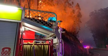
In the Snowy regions, a fire generated thunderstorm (pyro-cumulonimbus) has formed over the Doubtful Gap Trail fire, risking escalation in fire behaviour associated with this fire thunderstorm.
A pyro-cumulonimbus can create erratic winds and dry lightning and result in significantly faster fire spread. You may hear thunder, you may see lightning, and erratic winds will push the fire in multiple directions. This is a very dangerous situation and if you are in the area, you need to monitor the conditions around you and take appropriate action.
Multiple fires are now burning at emergency level including Inaloy Trail, Good Good, Doubtful Gap, Pollys gully, Adaminaby complex, Dunns Road and Green Valley.
If you are in the following areas you are at risk. The opportunity to leave has now passed, you must seek shelter in a solid structure: Peak View, Numeralla, Countegany, Jerangle, Jerangle Village, Bugtown, Old Adaminaby, Shannons Flat, Lake Eucumbene, Adaminaby, Snowy Plains, Bramear Bay, Anglers Reach
UPDATE: January 4, 3.30 pm Fire activity is mounting on the coast as the Clyde Mountain Fire reaches emergency level between Broulee and Moruya. The fire is currently out of control according to the RFS and it is too late to leave at areas north of the Moruya River including the areas of Mogendoura and Polwombra and across to the coast in the area of the Moruya Airport.
Strong winds are hitting the fire grounds and the Princes Highway is now closed in both directions between Mogo and Moruya and in both directions further north between Jervis Bay Rd south of Nowra and Little Forest rd, where fire activity has also reached emergency level on the Shoalhaven edge of the Currowan fire.
The RFS is reporting that a pyro-cumulonimbus or fire generated thunderstorm has formed over the Currowan fire on the northern edge near to Nowra.
As a result, there is a potential for escalation in fire behaviour associated with this fire thunderstorm. A pyro-cumulonimbus can create erratic winds and dry lightning and result in significantly faster fire spread. You may hear thunder, you may see lightning, and erratic winds will push the fire in multiple directions
In the high country, the Dunns Rd Fire, the Doubtful Gap and Inaloy Trail fires are all at emergency level.
Other South East bushfires have been upgraded to a watch-and act alert level, including the Counegany and Werri Berri fires near Bega, the Pilot Lookout and Adaminaby complex fires in the Snowy region.
UPDATE: 2.30 PM, JANUARY 4:
Fire activity is mounting on the coast as the Clyde Mountain Fire reaches emergency level between Broulee and Moruya. The fire is currently out of control according to the RFS and it is too late to leave at areas north of the Moruya River including the areas of Mogendoura and Polwombra and across to the coast in the area of the Moruya Airport.
Strong winds are hitting the fire grounds and the Princes Highway is now closed in both directions between Mogo and Moruya and in both directions further north between Jervis Bay Rd south of Nowra and Little Forest rd, where fire activity has also reached emergency level on the Shoalhaven edge of the Currowan fire.
The RFS is reporting that a pyro-cumulonimbus or fire generated thunderstorm has formed over the Currowan fire on the northern edge near to Nowra.
As a result, there is a potential for escalation in fire behaviour associated with this fire thunderstorm. A pyro-cumulonimbus can create erratic winds and dry lightning and result in significantly faster fire spread. You may hear thunder, you may see lightning, and erratic winds will push the fire in multiple directions
In the high country, the Dunns Rd Fire, the Doubtful Gap and Inaloy Trail fires are all at emergency level.
Other South East bushfires have been upgraded to a watch-and act alert level, including the Counegany and Werri Berri fires near Bega, the Pilot Lookout and Adaminaby complex fires in the Snowy region.
11.30 AM, January 4:
At mid-morning, the South East is poised and waiting for what today’s extreme weather will bring.
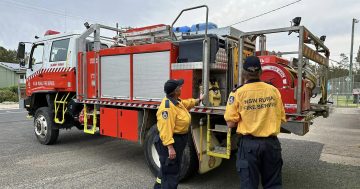
There is intense anxiety as the RFS has moved to reassure residents that while their focus is on life and property, in that order, towns are not being left undefended. Rather, they are deploying all resources strategically to provide optimal coverage.
That’s also behind the drive to get as many people as possible safely out of harm’s way, as early as possible.
Eurobodalla and Bega Valley residents have been told that if evacuating, they should all be at their destinations by now as mid-morning was the last possible safe time to leave. This includes people who live near bush on the outer fringes of larger towns.
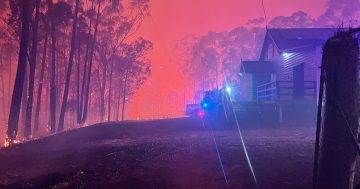
Severe to Extreme fire danger is forecast with temperatures in the 40s, with very low humidity and strong winds. These conditions will make fire behaviour erratic and very dangerous. It’s expected that forecast northwesterly winds will drive the fire towards the coast from mid-morning.
Eurobodalla emergency operations said this morning that fire is expected to cross the Princes Highway and roads leading to the coast, including George Bass Drive, North Head Drive, Bermagui Road, Hector McWilliam Drive, South Head Road and Potato Point Road. The advice is to avoid all unnecessary travel today.
In Eurobodalla, evacuation centres are open at Hanging Rock Function Centre, Hanging Rock Place; in Moruya at the Moruya Basketball stadium, in the showgrounds, Albert Street; and in Narooma at the Leisure Centre, Bluewater Drive.
Tuross Head residents have been asked to stay in place, although those with medical conditions should go to the Moruya evacuation centre. The Tuross Head Country Club is open 24/7 for residents to take refuge.
If you do have a medical condition, take all medications and prescriptions with you. Don’t go to the hospital unless you are in immediate need of medical attention: there are St John’s Ambulance personnel at the evacuation centres, along with RFS strike crews, NSW Police, road crews, water and sewer crews, generators and food during and after the fires.
If you’re evacuating, take a bag with medications, prescriptions, important documents, precious items, wallet, phone and charger, clothing for all seasons and toiletries for a few days. If you can, bring your own bedding and food if possible.
People with babies and young children, please bring nappies, formula, baby food, toys and activities.
Small pets are welcome. Please bring pet food and bowls. In the Eurobodalla, large animals can be accommodated under owner-care at Moruya Showground. Local Land Services reps are onsite to assist with animal welfare.
Transport for NSW has prioritised fuel deliveries to the far south coast. Generators are in place in Batemans Bay, Moruya and Narooma to continue fuel provision in the likely event of a power outage from Saturday’s fire activity.
Please register online with the Red Cross Register.Find.Reunite service so family and friends can find you without contacting response teams.
Rex flights in and out of Moruya Airport and the Moruya markets have been cancelled. Lifeguards will not be on duty and tips are closed.
In the Bega Valley, there is an urgent call for people to use water for essential purposes only as water levels in reservoirs across the Shire are currently dropping at a faster rate than can be replenished. Water is critically important for emergency supplies.
Residents in the following areas have all been advised to leave: Mumbulla, Cuttagee, Barraga Bay, Wapengo, Tanja, Nutleys Creek Road, Bermagui, Cobargo and Quaama areas; Warrigal Range Road, Upper Brogo Road, Coopers Gully, Desert Creek Road, Buckajo, Angledale and Greendale areas; Mogareeka, Tathra and Kalaru areas; Eden and Kiah areas.
Neighbourhood safer places are not an option this time.
Evacuation centres are open at the Bega Showground and Club Sapphire at Merimbula where there is power, food, water and mobile phone coverage. There is also a centre operating from the Eden Fishermen’s Club, but this is for registration purposes only.
If you choose to move to the Bega Showground or Club Sapphire bring bedding materials. If you can’t do that, alternative arrangements are available. In some coastal areas the pressure on evacuation centres means people are being moved into vacated holiday accommodation.
In the Snowy Monaro, evacuation centres are open at Bombala Community Centre, at 163 Maybe Street, Bombala and in Jindabyne at the Jindabyne Memorial Hall. An evacuation centre is open at the Cooma Multi-Function Centre at the Cooma Showground. Cooma and Bombala evacuation centres are for immediate emergency support only.
The Bombala Showground is also open for people with caravans, horses and other animals. While the Showground is open, it is not an official evacuation centre and support will not be available.
Areas of direct impact are likely to be Jindabyne and Numeralla this weekend and Delegate in the coming days. If you are in the far south, please also have regard to the Victorian emergency information. There are no evacuation orders at this stage for Cooma, Berridale, Bombala and Adaminaby.