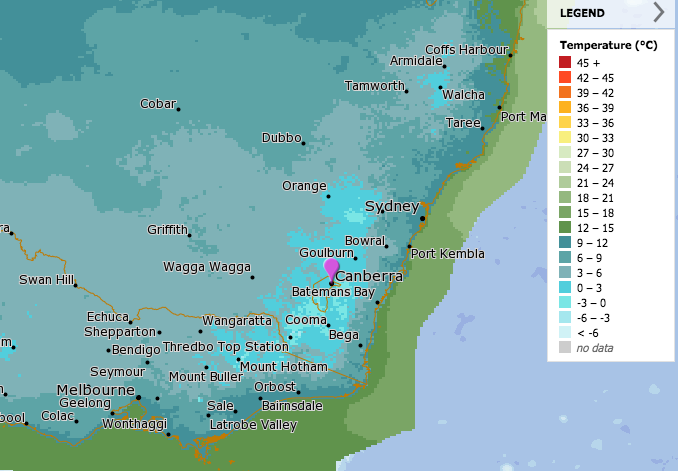
Temperatures are set to plummet this weekend, as shown by this forecast for minimum temperatures on Sunday (11 April). Image: BOM.
Shake out the winter coats and scarves, a blast of Antarctic air will cross the ACT and southern NSW this weekend that will see temperatures plummet and may even bring our first frosts of the year on Monday morning (12 April).
Daytime temperatures could drop by up to 10 degrees Celsius as a double-whammy polar blast from two cold fronts crosses the region from today (9 April) and into the weekend.
Frosts are forecast in the Canberra region on Monday morning, and the first falls of snow are also expected in the Snowy Mountains, although the strongest snowfalls are predicted in the Victorian Alps.
Daily Digest
The ACT will be blanketed in cold air on Sunday with a top of just 15 degrees, while the overnight temperature is forecast to drop to minus one on Monday morning and zero on Tuesday.
The temperature change will come as a rude shock after perfect autumn conditions across the region during the Easter long weekend, where sunny skies, light winds and temperatures in the high 20s dominated.
The first cold front is expected to clip southern Victoria on Friday and extend through southern NSW. Wind strength will increase in the morning and is expected to drop as the front moves through.
Thredbo Top Station is forecasting winds of between 45 and 65 km/h. Temperatures are forecast to remain fairly stable, with a top of 23 degrees in the ACT on Friday.
However, this initial blast is just a sign of things to come when a second, more powerful cold front will extend fresh and gusty south to south-westerly winds throughout the ACT and southern NSW on Saturday and Sunday.
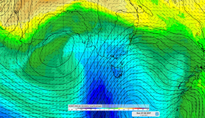
The cold air mass will hit on Sunday. Image: Weatherzone.
The Bureau of Meteorology forecasts rain to fall as snow in the Snowy Mountains above 1700 metres on Saturday and Sunday. Bitterly cold winds and showers will persist elsewhere.
Weatherzone forecaster Anthony Sharwood said Saturday night is when things get serious.
“The second front is much stronger and in the wake of its passage on Saturday night, Sunday maximum temps should struggle their way to 15 in Melbourne, 13 in Hobart and 15 in Canberra,” he said.
“Cold, dry air in the wake of the front should bring Canberra’s first decent frost for the year, with a minimum temp around zero degree Celsius.”
Mr Sharwood said the system looks good for snowfall in Victorian resorts such as Mt Buller, with less significant falls on the NSW ski fields.
Forecasters are also saying the year’s first cold blast is a sign of a seasonal shift as the Southern Ocean cold fronts play a more active role in southern Australia’s weather.
On the other side of the country, parts of north Western Australia will be under the influence of Tropical Cyclone Seroja, which is building up strength in the Indian Ocean and is expected to turn towards land during the weekend or early next week.