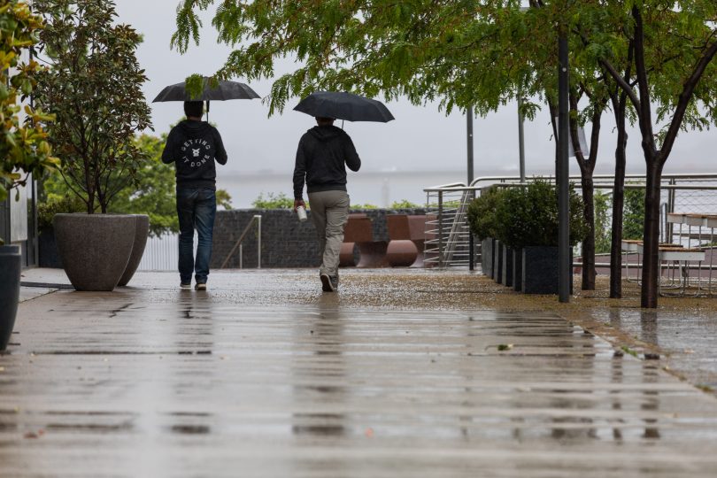
The BOM says more rain is on its way to the capital this weekend. Photo: Michelle Kroll.
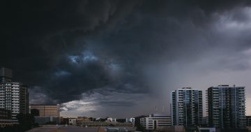
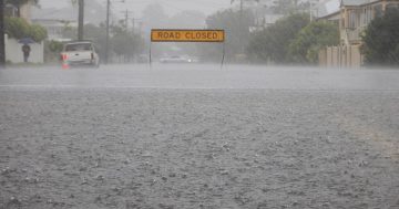
Canberra is set for a drenching, with the potential of severe storms in the region tomorrow (30 April).
The Territory could see anywhere between 10 and 25 millimetres, with heavy localised falls possible.
“This is due to a trough associated with a cold front moving from inland NSW,” Bureau of Meteorology community engagement officer Morgan Pumpa said.
“There is the chance of severe storms, but they’re expected to be short-lived as the system is moving very quickly.”
The northern areas of the ACT and towns further north are most likely to be impacted.
There is also the potential for gusty winds, but they’re not expected to hit urban areas.
“We could see some damaging winds around the alpine peaks,” Ms Pumpa said.
Temperatures will also drop over the weekend, but the weather will begin to clear as the system moves through.
“Sunday will become partly cloudy before we see more settled conditions again for the first part of the week.”
Canberra’s ESA is also keeping a close eye on the forecast, but no warnings are expected at this stage.
“Should there be severe weather which is forecast to impact communities, we will look to send out warnings to the communities in conjunction with the BOM,” a spokesperson said.
The heavy falls aren’t expected to make it over the mountains, with lighter showers forecast for the south coast.
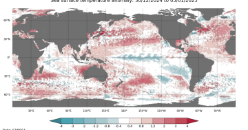
The BOM’s latest seasonal outlook shows rainfall for the rest of autumn and into winter is predicted to be above median for the region, with a high chance of at least 150 millimetres falling between May and July.
Climatologist Professor Janette Lindesay said this is due to a number of climate drivers that surround Australia.
“The La Niña we’ve been experiencing is weakening but is not gone, which is unusual for this time of year,” she said.
The BOM said there is also the potential for a negative Indian Ocean Dipole (IOD), which increases the chances of above-average winter-spring rainfall for large parts of Australia.
“[The IOD is] a feeder of warmer moist air to Australia if we have cooler air off Africa and warm water north of Australia,” Professor Lindesay said.
“You can then get a ‘north-west cloud band’ which has a low-pressure system off our north-west coast, then a band of cloud connects this with a cold front in the south/south-east of Australia … which is happening at the moment.
“These don’t occur all the time, so you have the energy out of the tropics fed down this line of cloud to Tasmania. This means we have warm, moist air coming from the north-west into a rapidly moving cold front, which is why we could see storms tomorrow.”
A negative IOD also increases the likelihood temperatures will be above average, with the BOM’s seasonal outlook predicting a greater than 80 per cent chance that minimum temperatures for winter will be warmer than the median.
While Canberrans may welcome a warmer winter, Professor Lindesay said it’s not all good news.
“It can confuse the plants; they can’t keep up. They’re triggered by day length and temperature,” she said.
“I have a plum tree that’s already flowered, so will it flower in spring? How will this impact bugs and insects? It’s all a bit disrupted.”
It is important to note that model outlooks have low accuracy at this time of year, so caution should be taken when considering IOD outlooks beyond May.
Professor Lindesay said autumn is generally a time when weather predictions are more difficult as the cycle of the seasons transitions.
It has to do with the Earth’s rotations and where the Sun is situated in our skies.
“In summer, the overhead sun is as far south as it’s going to get over the Tropic of Capricorn,” she said.
“This means the warmer air around the tropics expands southwards, pushing cold front systems around the pole.
“But as we transition [to winter], the more tropical band of warmer air is contracting from the Southern Hemisphere, and the air around Antarctica starts expanding, so you start to see the cold fronts move further north and come into play.
“April really is the worst month to try and predict ahead.”