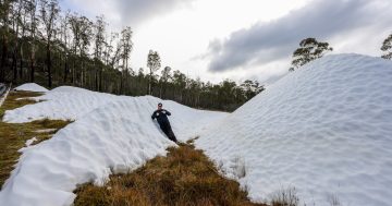
Snow and icy conditions are expected across southern NSW and the ACT this week. Photo: Leon Oberg.
Some of Canberra’s southern suburbs and the Brindabella Ranges will be in the eye of a very strong blast of polar air expected to bring snow flurries on Tuesday night and Wednesday (8 and 9 June).
Forecasts still vary as the complex frontal and low-pressure system moves across Victoria, Tasmania and southern NSW; however, many reliable models are forecasting snowfalls to extend up to the Queensland border for areas above 900 metres.
In the ACT region, where the elevation is 577 metres, the mercury will take a dramatic dip to a forecast maximum of just 8 degrees on Wednesday as the first serious blast of winter arrives. A maximum of 10 deg C on Thursday will feel much colder, though, while 20 to 30 mm of rain is also expected on Wednesday and up to another 20 mm on Thursday.
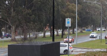
Backed by strong northwesterly winds on Tuesday night and most of Wednesday, any showers that form are expected to fall as snow flurries in Tuggeranong, Woden, Weston Creek, Molonglo Valley, Canberra City, Belconnen and Gungahlin. However, any snow that falls is not likely to settle.
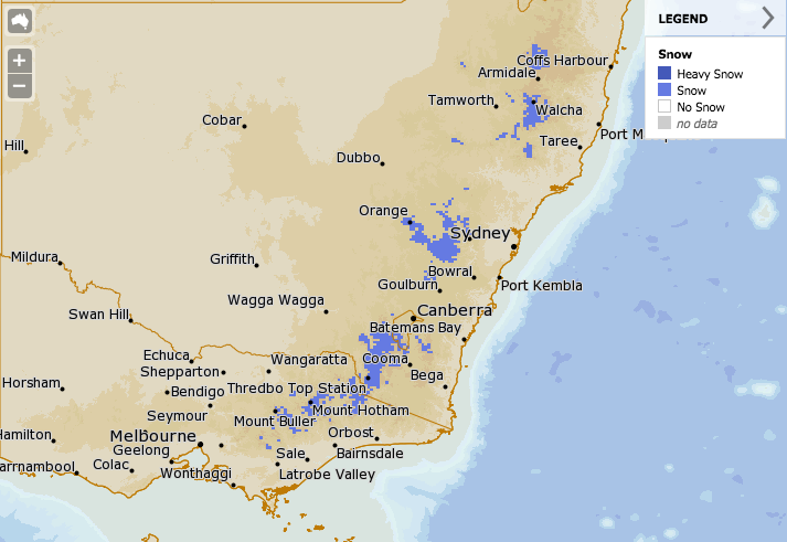
The Bureau of Meteorology’s forecast for snow on Wednesday (9 June). Image: BOM MetEye.
Bureau of Meteorology meteorologist Melody Sturm said on Monday (7 June) they are forecasting strong and gusty north-west winds that could be severe. Behind the cold front are widespread showers, small hail and isolated thunderstorms.
“For NSW, we have a cold front pushing across the state on Tuesday,” Ms Sturm said. “Things start to get really interesting as a complex area of low pressure starts to develop late Tuesday and into Wednesday and begins to intensify as it moves off the coast.
“It’s very much an evolving weather situation, but snow is expected to drop to low levels throughout areas of NSW above 900 metres. Snow should settle on the ground in those areas but shouldn’t last longer than a day.”
On Wednesday, the Central and Northern Tablelands of NSW may be impacted, including Orange, Oberon, the Blue Mountains, Barrington Tops, Armidale, Walcha, Glen Innes and Guyra. Snow may also fall in southern Queensland around the Darling Downs.
There is also a risk of heavy rain and very strong winds in the south-east later in the week, and people in these areas should watch for updates and severe weather warnings, which are expected to be issued. Coastal areas could see flash-flooding and small hail as the low-pressure system forms off the NSW coastline.

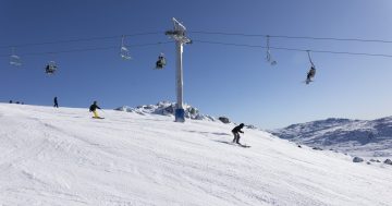
Skiers and snowboarders gather for the opening day at Perisher on Friday. Photo: Perisher Facebook.
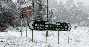
The higher peaks around the ACT are also likely to see heavier snow covering, although rainfall will wash it away fairly quickly.
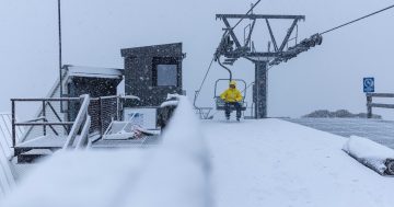
Of course, the ski resorts are not just rubbing their hands to keep them warm, with a very handy covering of snow ahead of the traditional opening of the ski season this long weekend. Perisher jumped the queue last Friday (4 June) by opening a week earlier after recent cold conditions allowed for a 25 cm covering of man-made snow.
Snowatch.com.au forecaster Pete Taylor said 60 to 100 cm of snow is likely across all resorts, although rain could wash some of it away on Thursday.
“The resorts are likely to do very well from this system with a metre of snow being the best-case scenario for Thredbo up top, Perisher, Falls Creek and Hotham,” he said.
“There is a wide range between the minimum and maximum snowfall predictions, and that is due to Thursday’s temps, which will be hovering around -1C to +1C with rain in the south. This is the day to watch as it could damage the cover if temps stay above zero.”
Long-range, Mr Taylor said there are good outlooks for snow in the mountains from 16 to 18 June, with further positive signs for snowfalls on 24 to 26 June.
The weekend should be mostly cloudy with the chance of some light snow up top and showers and drizzle on the lower slopes.
“I’m also liking the looks of a system due around the 30th of June,” he said.