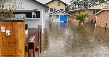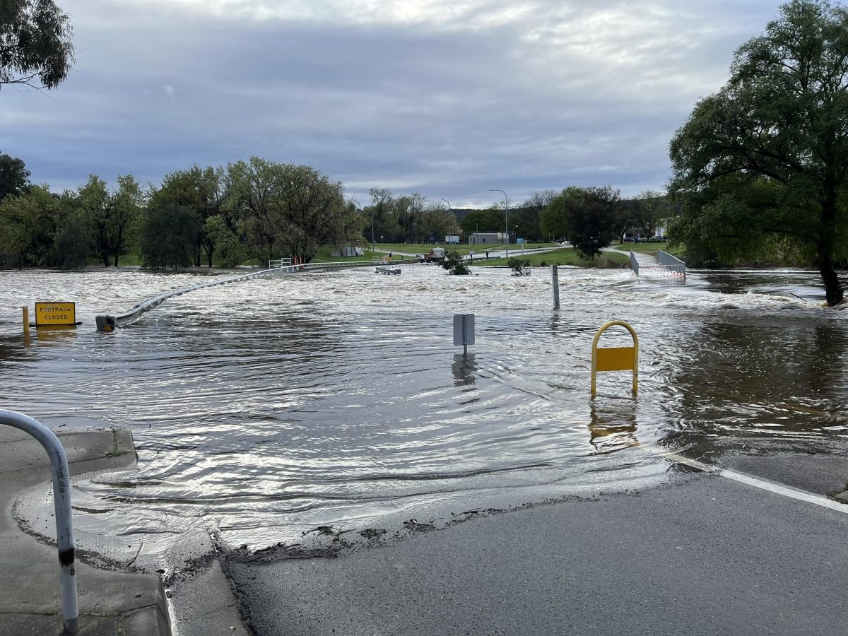
The Queanbeyan River peaked at 4.55 metres on Sunday (9 October) closing the low-level crossing near McDonald’s. Photo: NSW SES Queanbeyan Unit Facebook.
Another week and another round of rain is forecast for Canberra and the Capital region.
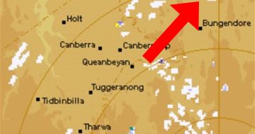
Showers were expected to increase from Thursday (13 October) afternoon and into Friday, with strong winds also a possibility for elevated regions.
Queanbeyan area SES chief Robert Cuneen said they’re watching the forecast intensely.
“Every rain forecast we’re now analysing to death,” he said.
“You’ve always got to touch wood, but if the forecast is accurate for our region, the rain will be spread over a good 24-hour period and if it does that with just 10 to 15 millimetres, that we can cope with.”
Volunteers were slightly caught off guard last week by sudden heavy rainfall overnight, which saw the closure of the Morriset Street low-level bridge.
“These sort of events are the ones causing us headaches now,” Mr Cuneen said.
“The soil is saturated. Any rain we’re receiving is turning into surface water which runs off. If it falls over a longer period, there’s more of a chance for the water to be absorbed and it runs off into the rivers at a slower pace … but if anything comes down in a heavy shower, then it runs into the rivers quite quickly and quite deep.”
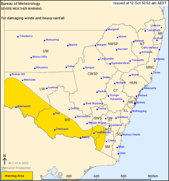
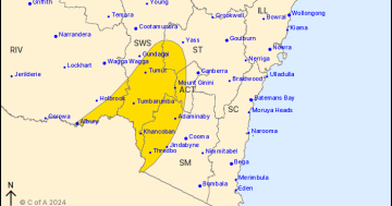
Damaging winds and heavy rain were expected to hit southern and western NSW on Thursday (13 October). Photo: BoM.
A deep low-pressure system south of the Great Australian Bight was forecast to extend a strong cold front across southern NSW on Thursday.
The Bureau of Meteorology warned that this was expected to produce “heavy rainfall” over southern parts of the Lower Western and Riverina districts and onto the western slopes of the Alpine region.
“The additional rainfall this week will further exacerbate the flooding situation across southern NSW and Victoria, with the prime focus shifting to Victoria, northern Tasmania and southern New South Wales, with many moderate to major flood warnings possible depending on exactly where the heaviest falls occur,” a spokesperson said.
“Landslips are possible given sodden soils and the expectation of further rain.
“Residents and communities living on or near any rivers, creeks and streams or in low lying areas, especially in … the Riverina of NSW are advised to stay up to date with the latest forecast and warnings.”
Mr Cuneen said it was still wise to keep an eye on the forecast.
“If what’s predicted just further south at Albury falls on us, then we’ve got real trouble again,” he said.
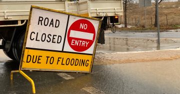
“It won’t take much to close the roads … if you hear heavy rain at night, the chances are there will be crossings closed in the morning.”
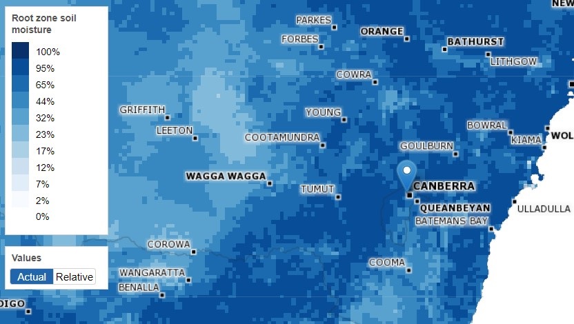
The Australian Landscape Water Balance map showed soil moisture was extremely high across the region. Photo: BoM.
Strong winds averaging 63 km/h with damaging wind gusts of about 110 km/h were possible in Alpine areas above 1500 metres from Thursday afternoon, clearing into Friday morning.
While all ACT sports grounds have been re-opened for training and match play following last week’s rain, time will tell whether they remain accessible over the weekend.
“The dry weather in the last few days has allowed the grounds to drain sufficiently to enable safe use; however, more rainfall is forecast toward the end of this week and may impact the safe use of the grounds across the weekend,” an ACT Government statement said.
“The state of playing surfaces will be monitored closely, and a decision about the weekend will be communicated as soon as possible.”
Coppins Crossing and Naas Road in Canberra were re-opened earlier this week, but several other crossings remained closed.