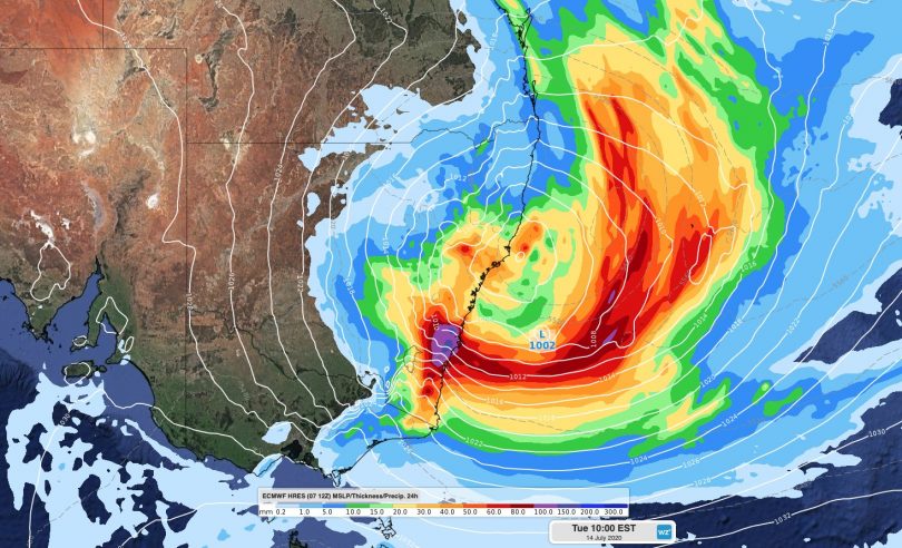
A powerful east-coast low-pressure system will bring damaging winds and a big swell early next week. Image: Weatherzone.
A cold air mass with at least two low-pressure systems embedded will cross the Great Australian Bight over the weekend before forming into an east-coast low on Tuesday next week (14 July). The systems will bring swells of more than six metres and damaging winds to the South Coast, and rain and possible snowfalls to the ACT area and south-east over the weekend.
Forecast models for the east-coast low are still variable, but forecaster Ben Domensino from Weatherzone said a large pool of cold upper-level air will pass over southern and eastern Australia, causing a mix of rain, thunderstorms and snow in multiple states and territories between Friday and Sunday.
“On Monday, this upper-level pool of cold air should reach Australia’s east coast,” Mr Domensino said.
“The interaction of the cold air with relatively warm sea surface temperatures in the Tasman Sea could fuel the development of intense and dangerous weather along parts of Australia’s eastern seaboard early next week.
“As is often the case with these east coast severe weather events, there’s quite a bit of model uncertainty around how this system will evolve and where it’s most significant impacts will occur.”
Mr Domensino said two main forecast models indicate that a low-pressure system could deepen near the central coast of NSW on Monday and Tuesday.
However, the Bureau of Meteorology’s model predicts the system will develop further off the coast and further south. This would significantly change which areas are likely to be impacted by the most intense weather from this system.
“If this scenario eventuates, it would cause heavy rain, strong and potentially damaging winds and dangerous surf along parts of the NSW coast and ranges early next week.
“At this stage, the most intense weather is likely to occur along the NSW coast and adjacent ranges somewhere between the South Coast and Mid North Coast, between Monday and Wednesday.
“However, past events of this nature have shown us that despite the model uncertainty, this has the potential to turn into a high impact severe weather event,” Mr Domensino said.
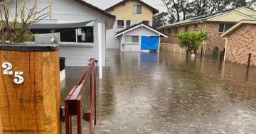
What is certain is that there will be heavy rain, flooding, damaging winds and dangerous surf along the east coast from Tuesday next week.
While no weather warnings have been issued by the Bureau of Meteorology, their forecast indicates heavy rain falling on the South Coast from Monday next week.
On Monday, heavy rain will follow when light winds from the south between 15 to 25 km/h will tend west to southwesterly between 20 to 30 km/h during the afternoon.
There is a 100 per cent chance of rain on Tuesday and Wednesday, extending into Thursday next week.
There will be rough to very rough seas, with a heavy swell.
People on the South Coast are advised to monitor warnings and be cautious when near the ocean next week.