Expect 20-plus days for the rest of the working week. Photo: Michelle Kroll.
Warm sunny weather will arrive right on cue for the start of spring, with a string of 20-plus degree days forecast for the rest of the working week.
After a winter marked by cloud and rain, a few days of blue skies and T-shirt temperatures, at least by lunchtime, will be welcome, especially by those in lockdown getting out for their hour of exercise.
It’s the kind of early spring weather that usually turns Canberrans out in droves, but the lockdown should mean a more muted response to the national capital’s annual unwinding.
The Bureau of Meteorology says a ridge of high pressure is building across NSW and the ACT, dragging heat from central Australia down to southern climes.
The next few days are forecast to reach heady maximums of 22, 23 and 22 degrees, after chilly starts of 3 and 5 degrees, with north-westerly winds increasing to provide a challenge to allergy sufferers.
However, by the weekend, a trough and cold front will move through, bringing showers and distinctly cooler temperatures.
Gardeners will welcome up to 20 mm of rain on Saturday after the drying winds, and the showers may linger on a cool Sunday when the maximum will retreat to 14 degrees.
The Bureau says that by the middle of next week the warmer days may return in a cycle of changeability all too familiar to Canberrans.
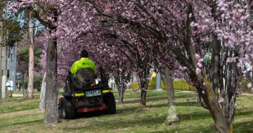
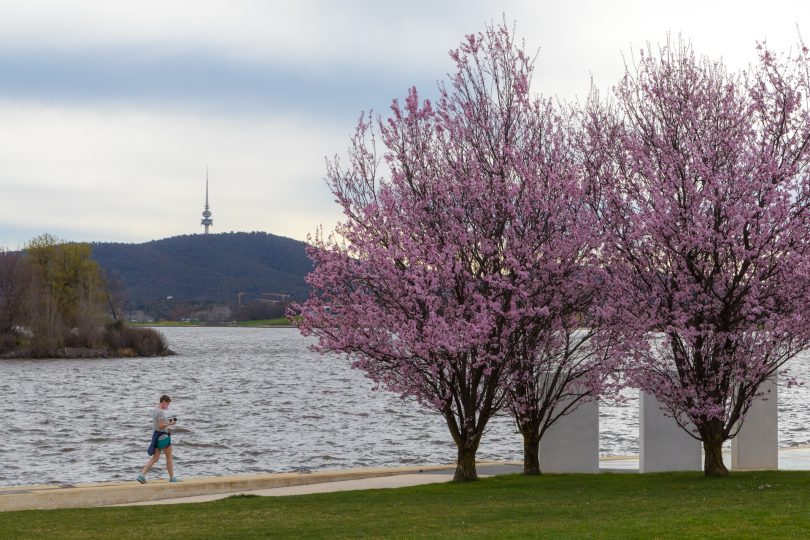
Gardeners are expecting an explosion of life and colour in back yards and on the city’s streetscapes after such a wet winter.
While the main Floriade event has been cancelled, the perfect conditions mean the blooms in Commonwealth Park and across the suburbs will be spectacular.
But it will also mean another busy season for City Services’ mowers who have battled to keep the place tidy in recent times.
The Bureau’s spring outlook is so far positive for a benign bushfire season, with rainfall likely to be above median for the eastern two-thirds of Australia.
Days are expected to be cooler than average for southern Australia, but the nights and morning minimums are tipped to be warmer.
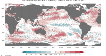
Driving this weather pattern is the negative Indian Ocean Dipole, with large parts of the eastern tropical Indian Ocean warmer than average.
This is forecast to continue into spring, increasing the chance of above-average spring rainfall to southern and eastern Australia.
The cooling of the tropical Pacific over the coming months is also likely contributing to the wetter than median outlooks.
But by December, the IOD is expected to return to neutral.
The El Niño–Southern Oscillation (ENSO) is currently neutral, and only one of seven models surveyed by the Bureau indicate the Pacific Ocean cooling will be sustained enough and cool enough to meet the more benign La Niña criteria in spring or early summer.
While the ACT has enjoyed a wet winter and spring may be mild, the Bureau says Australia’s climate has warmed by around 1.44°C for the 1910–2019 period, and southern Australia has seen a reduction of 10 to 20 per cent in cool-season (April–October) rainfall in recent decades.